Estimated Value: $842,513 - $922,000
3
Beds
2
Baths
1,160
Sq Ft
$763/Sq Ft
Est. Value
About This Home
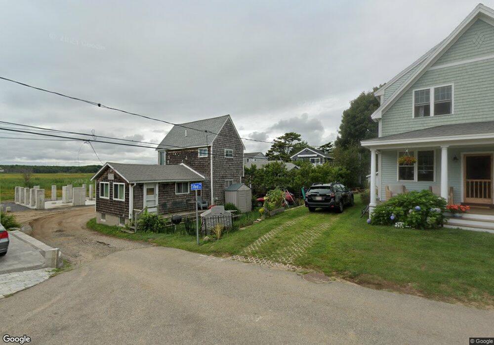
This home is located at 18 Clifford Ln, Wells, ME 04090 and is currently estimated at $885,128, approximately $763 per square foot. 18 Clifford Ln is a home located in York County with nearby schools including Wells Junior High School, Wells Elementary School, and Wells High School.
Ownership History
Date
Name
Owned For
Owner Type
Purchase Details
Closed on
Jun 27, 2014
Sold by
Evangelou George C and Evangelou Maria J
Bought by
Durgin Daniel G and Durgin Sarah A
Current Estimated Value
Home Financials for this Owner
Home Financials are based on the most recent Mortgage that was taken out on this home.
Original Mortgage
$240,000
Outstanding Balance
$181,945
Interest Rate
4.19%
Mortgage Type
New Conventional
Estimated Equity
$703,183
Purchase Details
Closed on
May 12, 2008
Sold by
Evangelou Jesse and Evangelou Antigone
Bought by
Evangelou James A
Create a Home Valuation Report for This Property
The Home Valuation Report is an in-depth analysis detailing your home's value as well as a comparison with similar homes in the area
Home Values in the Area
Average Home Value in this Area
Purchase History
| Date | Buyer | Sale Price | Title Company |
|---|---|---|---|
| Durgin Daniel G | -- | -- | |
| Durgin Daniel G | -- | -- | |
| Evangelou James A | -- | -- | |
| Evangelou James A | -- | -- |
Source: Public Records
Mortgage History
| Date | Status | Borrower | Loan Amount |
|---|---|---|---|
| Open | Durgin Daniel G | $240,000 | |
| Closed | Evangelou James A | $240,000 |
Source: Public Records
Tax History Compared to Growth
Tax History
| Year | Tax Paid | Tax Assessment Tax Assessment Total Assessment is a certain percentage of the fair market value that is determined by local assessors to be the total taxable value of land and additions on the property. | Land | Improvement |
|---|---|---|---|---|
| 2024 | $5,037 | $828,430 | $574,820 | $253,610 |
| 2023 | $4,937 | $828,430 | $574,820 | $253,610 |
| 2022 | $4,168 | $398,500 | $267,010 | $131,490 |
| 2021 | $4,192 | $398,500 | $267,010 | $131,490 |
| 2020 | $4,002 | $381,900 | $267,010 | $114,890 |
| 2019 | $3,979 | $381,900 | $267,010 | $114,890 |
| 2018 | $3,871 | $381,900 | $267,010 | $114,890 |
| 2017 | $3,880 | $381,900 | $267,010 | $114,890 |
| 2016 | $3,842 | $381,900 | $267,010 | $114,890 |
| 2015 | $3,800 | $381,900 | $267,010 | $114,890 |
| 2013 | $3,483 | $381,900 | $267,010 | $114,890 |
Source: Public Records
Map
Nearby Homes
- 813 Ocean Ave
- 835 Ocean Ave
- 403 Webhannet Dr
- 11 Partridge Ln
- 191 Eldridge Rd
- 189 Eldridge Rd
- 404 Ocean Ave Unit 7
- 390 Ocean Ave
- 15 Heather Ln
- 48 Howard Ave
- 26 Gold Ribbon Dr
- 2 Gold Ribbon Dr
- 341 Ocean Ave Unit 1
- 16 Howard Ave
- 63 Grenier Ln Unit 1
- 314 Ocean Ave
- 733 Post Rd Unit 225
- 733 Post Rd Unit 126
- 562 Post Rd
- 15 Blanchard St
- 9 Clifford Ln
- 15 Clifford Ln
- 10 Wesley Ln
- 62 Hillside St
- 12 Clifford Ln
- 66 Hillside St
- 58 Hillside St
- 52 Hillside St
- 65 Hillside St
- 746 Ocean Ave
- 7 Wesley Ln
- 10 Prescott Ln
- 752 Ocean Ave
- 49 Hillside St
- 47 Hillside St
- 22 Prescott Ln
- 40 Hillside St
- 0 Prescott Ln Unit 1524322
- 0 Prescott Ln Unit 3 1524606
- 0 Prescott Ln