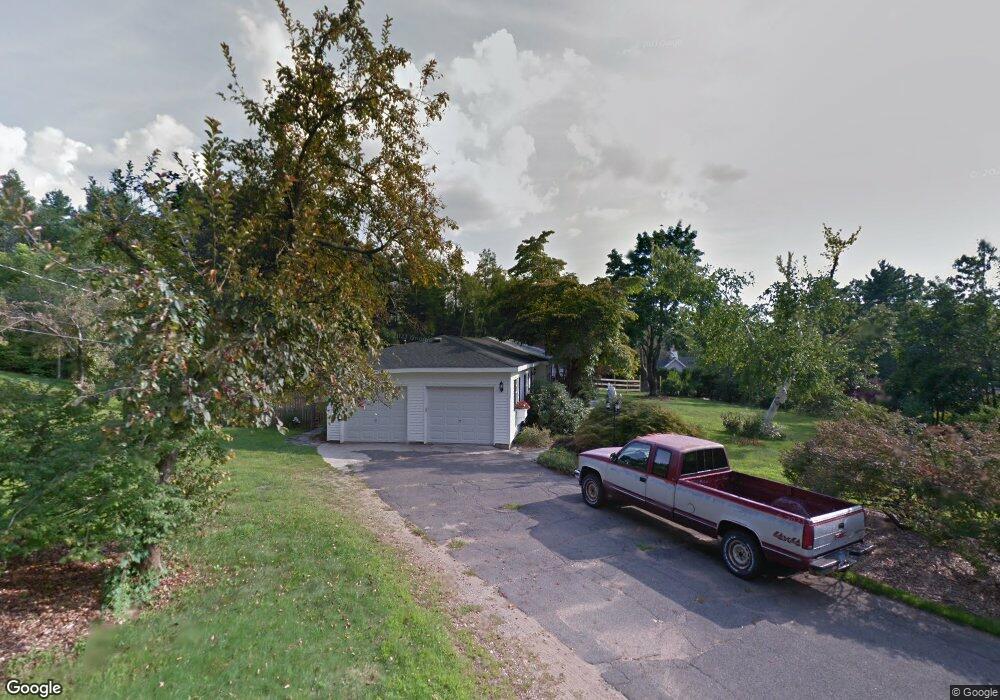
18 Crestview Dr Somers, CT 06071
Estimated Value: $445,000 - $546,545
4
Beds
4
Baths
2,919
Sq Ft
$169/Sq Ft
Est. Value
About This Home
This home is located at 18 Crestview Dr, Somers, CT 06071 and is currently estimated at $492,136, approximately $168 per square foot. 18 Crestview Dr is a home located in Tolland County with nearby schools including Somers Elementary School, Mabelle B. Avery Middle School, and Somers High School.
Ownership History
Date
Name
Owned For
Owner Type
Purchase Details
Closed on
Apr 8, 2025
Sold by
Hawthorne Leland R
Bought by
Cybulski Charles S and Cybulski Melissa D
Current Estimated Value
Home Financials for this Owner
Home Financials are based on the most recent Mortgage that was taken out on this home.
Original Mortgage
$417,100
Outstanding Balance
$415,288
Interest Rate
6.76%
Mortgage Type
Purchase Money Mortgage
Estimated Equity
$76,848
Purchase Details
Closed on
Mar 1, 1995
Sold by
Mack Michael and Mack Janet
Bought by
Hawthorne Leland and Hawthorne Joanne M
Home Financials for this Owner
Home Financials are based on the most recent Mortgage that was taken out on this home.
Original Mortgage
$122,500
Interest Rate
8%
Mortgage Type
Unknown
Create a Home Valuation Report for This Property
The Home Valuation Report is an in-depth analysis detailing your home's value as well as a comparison with similar homes in the area
Home Values in the Area
Average Home Value in this Area
Purchase History
| Date | Buyer | Sale Price | Title Company |
|---|---|---|---|
| Cybulski Charles S | $430,000 | None Available | |
| Hawthorne Leland | $217,500 | -- | |
| Hawthorne Leland | $217,500 | -- |
Source: Public Records
Mortgage History
| Date | Status | Borrower | Loan Amount |
|---|---|---|---|
| Open | Cybulski Charles S | $417,100 | |
| Previous Owner | Hawthorne Leland | $250,000 | |
| Previous Owner | Hawthorne Leland | $122,500 |
Source: Public Records
Tax History
| Year | Tax Paid | Tax Assessment Tax Assessment Total Assessment is a certain percentage of the fair market value that is determined by local assessors to be the total taxable value of land and additions on the property. | Land | Improvement |
|---|---|---|---|---|
| 2025 | $6,818 | $225,700 | $77,600 | $148,100 |
| 2024 | $6,536 | $225,700 | $77,600 | $148,100 |
| 2023 | $6,390 | $225,700 | $77,600 | $148,100 |
| 2022 | $6,220 | $225,700 | $77,600 | $148,100 |
| 2021 | $6,017 | $225,700 | $77,600 | $148,100 |
| 2020 | $6,177 | $225,700 | $77,600 | $148,100 |
| 2019 | $6,448 | $235,600 | $102,700 | $132,900 |
| 2018 | $5,697 | $235,600 | $102,700 | $132,900 |
| 2017 | $6,001 | $235,600 | $102,700 | $132,900 |
| 2016 | $5,706 | $235,600 | $102,700 | $132,900 |
| 2015 | $5,875 | $251,400 | $108,100 | $143,300 |
| 2014 | $5,875 | $251,400 | $108,100 | $143,300 |
Source: Public Records
Map
Nearby Homes
- 142 Turnpike Rd
- 100 Battle St
- 1040 Main St
- 283 Mountain View Rd
- 994 Main St
- 64 Bradfield Dr
- 63 Maple Ridge Dr
- 93 Galbraith Rd
- 969 Main St
- 369 Turnpike Rd
- 64 Somerset Ln
- 18 Hillcrest Dr
- 190 Root Rd
- 12 & 16 Haas Rd
- 125 Chestnut Hill Rd
- 11 King Rd
- 51 Handel Rd
- 12 Petersson Cir
- 20 Old Birch Rd
- 138 Main St
- 24 Crestview Dr
- 12 Crestview Dr
- 23 Crestview Dr
- 13 Crestview Dr
- 4 Crestview Dr
- 30 Crestview Dr
- 39 Turnpike Rd
- 25 Turnpike Rd
- 5 Crestview Dr
- 10 Turnpike
- 19 Turnpike Rd
- 8 Turnpike Rd
- 49 Turnpike Rd
- 66 Turnpike Rd
- 4 Turnpike Rd
- 18 Sky Ridge Dr
- 3 Turnpike Rd
- 7 Turnpike Rd
- 46 Sky Ridge Dr
- 19 Sky Ridge Dr