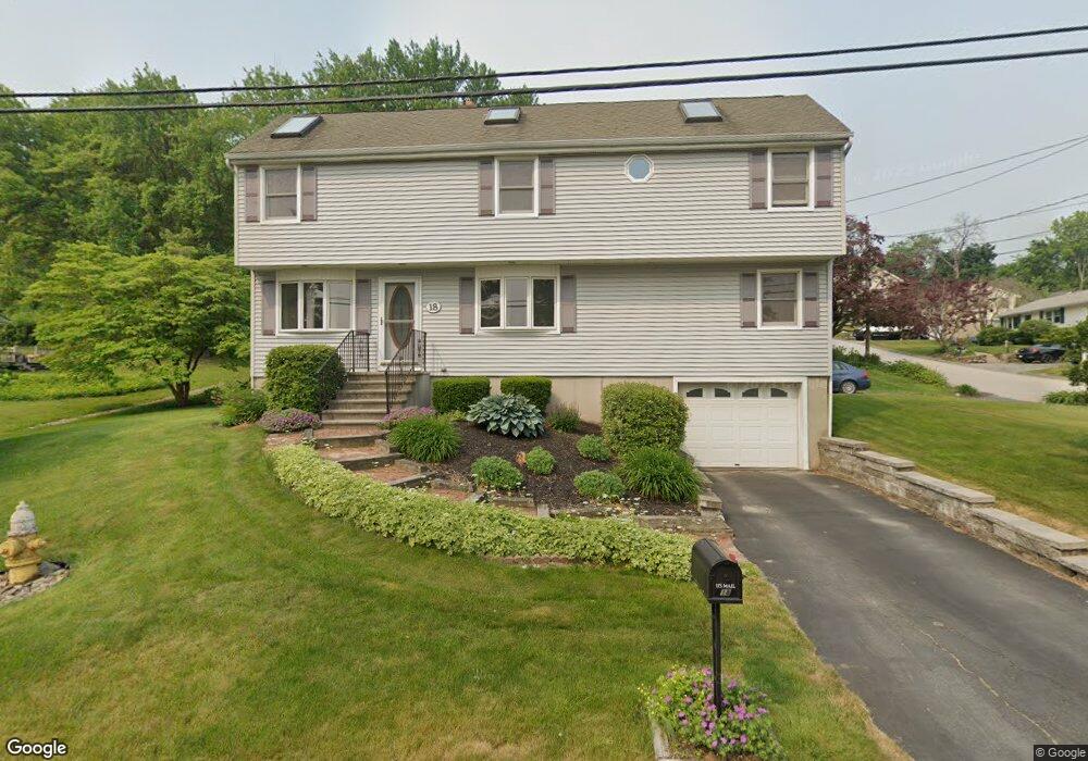
18 Dearborn St Worcester, MA 01604
Broadmeadow Brook NeighborhoodEstimated Value: $483,000 - $517,000
4
Beds
2
Baths
1,830
Sq Ft
$273/Sq Ft
Est. Value
About This Home
This home is located at 18 Dearborn St, Worcester, MA 01604 and is currently estimated at $499,980, approximately $273 per square foot. 18 Dearborn St is a home located in Worcester County with nearby schools including Jacob Hiatt Magnet School, Chandler Magnet, and Rice Square Elementary School.
Ownership History
Date
Name
Owned For
Owner Type
Purchase Details
Closed on
Jun 1, 2015
Sold by
Morocco Joann
Bought by
Morocco Joann and Morocco James A
Current Estimated Value
Create a Home Valuation Report for This Property
The Home Valuation Report is an in-depth analysis detailing your home's value as well as a comparison with similar homes in the area
Home Values in the Area
Average Home Value in this Area
Purchase History
| Date | Buyer | Sale Price | Title Company |
|---|---|---|---|
| Morocco Joann | -- | -- | |
| Morocco Joann | -- | -- |
Source: Public Records
Tax History Compared to Growth
Tax History
| Year | Tax Paid | Tax Assessment Tax Assessment Total Assessment is a certain percentage of the fair market value that is determined by local assessors to be the total taxable value of land and additions on the property. | Land | Improvement |
|---|---|---|---|---|
| 2025 | $5,678 | $430,500 | $117,500 | $313,000 |
| 2024 | $5,556 | $404,100 | $117,500 | $286,600 |
| 2023 | $5,435 | $379,000 | $102,200 | $276,800 |
| 2022 | $5,018 | $329,900 | $81,800 | $248,100 |
| 2021 | $4,905 | $301,300 | $65,400 | $235,900 |
| 2020 | $4,746 | $279,200 | $65,400 | $213,800 |
| 2019 | $4,565 | $253,600 | $58,800 | $194,800 |
| 2018 | $4,533 | $239,700 | $58,800 | $180,900 |
| 2017 | $4,353 | $226,500 | $58,800 | $167,700 |
| 2016 | $4,328 | $210,000 | $42,700 | $167,300 |
| 2015 | $4,215 | $210,000 | $42,700 | $167,300 |
| 2014 | -- | $210,000 | $42,700 | $167,300 |
Source: Public Records
Map
Nearby Homes
- 133 Derby St
- 54 Kenberma Rd
- 8 Beaumont Rd
- 4 Everton Ave
- 26 Derby St
- 10 Rutledge St Unit 3G
- 42 Bridgeport St
- 8 Taunton St
- 62 Allston Ave
- 47 Acton St
- 36,38,38.5 Houghton St
- 247 Pilgrim Ave
- 94 Massasoit Rd
- 91 Standish St
- 10 Lamar Ave
- 23 Woodford St
- 1 N Woodford St
- 6 Holcombe St
- 17 Plantation St
- 573 Grafton St