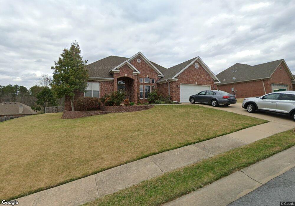
18 Denver St Little Rock, AR 72223
Estimated Value: $335,000 - $372,000
--
Bed
2
Baths
2,090
Sq Ft
$167/Sq Ft
Est. Value
About This Home
This home is located at 18 Denver St, Little Rock, AR 72223 and is currently estimated at $348,214, approximately $166 per square foot. 18 Denver St is a home located in Pulaski County with nearby schools including Baker Interdistrict Elementary School, Joe T. Robinson Middle School, and Joe T. Robinson High School.
Ownership History
Date
Name
Owned For
Owner Type
Purchase Details
Closed on
May 18, 2007
Sold by
Burgess Robin Lee and Burgess Carolyn Case
Bought by
King Matthew W and King Amber C
Current Estimated Value
Home Financials for this Owner
Home Financials are based on the most recent Mortgage that was taken out on this home.
Original Mortgage
$180,000
Outstanding Balance
$109,787
Interest Rate
6.22%
Mortgage Type
Purchase Money Mortgage
Estimated Equity
$238,427
Purchase Details
Closed on
May 24, 2006
Sold by
Burgess Robin Lee
Bought by
Burgess Robin Lee and Burgess Carolyn Case
Purchase Details
Closed on
Sep 23, 2005
Sold by
M & M Development Inc
Bought by
Burgess Robin
Home Financials for this Owner
Home Financials are based on the most recent Mortgage that was taken out on this home.
Original Mortgage
$181,636
Interest Rate
5.76%
Mortgage Type
Fannie Mae Freddie Mac
Purchase Details
Closed on
Feb 18, 2005
Sold by
Capitol Lakes Management Llc
Bought by
M & M Development Inc
Create a Home Valuation Report for This Property
The Home Valuation Report is an in-depth analysis detailing your home's value as well as a comparison with similar homes in the area
Home Values in the Area
Average Home Value in this Area
Purchase History
| Date | Buyer | Sale Price | Title Company |
|---|---|---|---|
| King Matthew W | $240,000 | First National Title Company | |
| Burgess Robin Lee | -- | None Available | |
| Burgess Robin | $228,000 | -- | |
| M & M Development Inc | $40,000 | Lenders Title Co |
Source: Public Records
Mortgage History
| Date | Status | Borrower | Loan Amount |
|---|---|---|---|
| Open | King Matthew W | $180,000 | |
| Previous Owner | Burgess Robin | $181,636 |
Source: Public Records
Tax History Compared to Growth
Tax History
| Year | Tax Paid | Tax Assessment Tax Assessment Total Assessment is a certain percentage of the fair market value that is determined by local assessors to be the total taxable value of land and additions on the property. | Land | Improvement |
|---|---|---|---|---|
| 2025 | $3,471 | $61,014 | $9,600 | $51,414 |
| 2024 | $3,182 | $61,014 | $9,600 | $51,414 |
| 2023 | $3,182 | $61,014 | $9,600 | $51,414 |
| 2022 | $3,224 | $61,014 | $9,600 | $51,414 |
| 2021 | $3,102 | $44,980 | $7,900 | $37,080 |
| 2020 | $2,704 | $44,980 | $7,900 | $37,080 |
| 2019 | $2,704 | $44,980 | $7,900 | $37,080 |
| 2018 | $2,729 | $44,980 | $7,900 | $37,080 |
| 2017 | $2,729 | $44,980 | $7,900 | $37,080 |
| 2016 | $3,039 | $47,260 | $6,800 | $40,460 |
| 2015 | $3,062 | $47,260 | $6,800 | $40,460 |
| 2014 | $3,062 | $47,256 | $6,800 | $40,456 |
Source: Public Records
Map
Nearby Homes
- 15516 Hartford St
- 8 Pennsylvania Ct
- 901 Cape St
- 11 Flatrock Point
- 728 Edgewood Cir
- 16 Driftwood Ln
- 22 Driftwood Ln
- 20 Driftwood Ln
- 102 Edgewood Cir
- 14905 Pride Valley Rd
- 8 Weatherstone Point
- 6 Weatherstone Point
- 27001 Kanis Rd
- 710 Edgewood Cir
- 208 Kanis Ridge Dr
- 16300 Cooper Orbit Rd
- 8 Ledge Rock Cove
- 15 Weatherstone Point
- 301 Kanis Ridge Dr
- 201 Edgewood Cir
- 14 Denver St
- 22 Denver St
- 15519 Hartford St
- 15515 Hartford St
- 15523 Hartford St
- 19 Denver St
- 15 Denver St
- 10 Denver St
- 1305 Lansing St
- 15511 Hartford St
- 4 Frankfort Ct
- 15525 Hartford St
- 1317 Lansing St
- 3 Frankfort Ct
- 2 Bangor Ct
- 6 Denver St
- 1321 Lansing St
- 0 Lansing St Unit 16010194
- 0 Lansing St Unit 17037216
- 15505 Hartford St