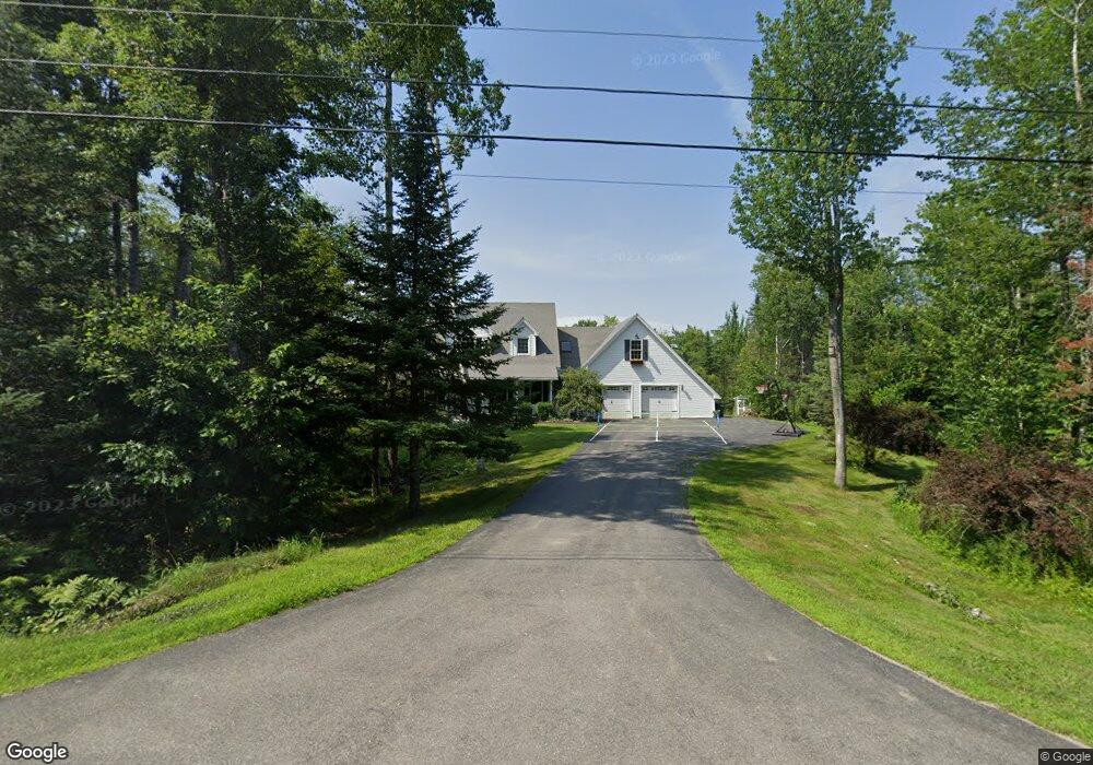
18 Dunston Dr Glenburn, ME 04401
Estimated Value: $448,000 - $558,000
--
Bed
--
Bath
--
Sq Ft
1.81
Acres
About This Home
This home is located at 18 Dunston Dr, Glenburn, ME 04401 and is currently estimated at $492,622. 18 Dunston Dr is a home located in Penobscot County with nearby schools including Glenburn Elementary School, Orono Middle School, and Orono High School.
Ownership History
Date
Name
Owned For
Owner Type
Purchase Details
Closed on
Aug 9, 2019
Sold by
Littlefield Chesley B and Littlefield Judith R
Bought by
Nesin Sandy and Bird Jason N
Current Estimated Value
Home Financials for this Owner
Home Financials are based on the most recent Mortgage that was taken out on this home.
Original Mortgage
$256,000
Outstanding Balance
$224,347
Interest Rate
3.73%
Mortgage Type
New Conventional
Estimated Equity
$268,275
Create a Home Valuation Report for This Property
The Home Valuation Report is an in-depth analysis detailing your home's value as well as a comparison with similar homes in the area
Home Values in the Area
Average Home Value in this Area
Purchase History
| Date | Buyer | Sale Price | Title Company |
|---|---|---|---|
| Nesin Sandy | -- | -- |
Source: Public Records
Mortgage History
| Date | Status | Borrower | Loan Amount |
|---|---|---|---|
| Open | Nesin Sandy | $256,000 |
Source: Public Records
Tax History Compared to Growth
Tax History
| Year | Tax Paid | Tax Assessment Tax Assessment Total Assessment is a certain percentage of the fair market value that is determined by local assessors to be the total taxable value of land and additions on the property. | Land | Improvement |
|---|---|---|---|---|
| 2024 | $5,339 | $386,890 | $49,460 | $337,430 |
| 2023 | $5,378 | $386,890 | $49,460 | $337,430 |
| 2022 | $5,400 | $322,410 | $41,220 | $281,190 |
| 2021 | $5,803 | $322,410 | $41,220 | $281,190 |
| 2020 | $5,868 | $322,410 | $41,220 | $281,190 |
| 2019 | $5,884 | $322,410 | $41,220 | $281,190 |
| 2018 | $5,965 | $322,410 | $41,220 | $281,190 |
| 2017 | $5,440 | $256,600 | $37,000 | $219,600 |
| 2016 | $5,183 | $256,600 | $37,000 | $219,600 |
| 2015 | $5,042 | $256,600 | $37,000 | $219,600 |
| 2014 | $4,773 | $256,600 | $37,000 | $219,600 |
| 2012 | $4,914 | $256,600 | $37,000 | $219,600 |
Source: Public Records
Map
Nearby Homes
- 79 Libbey Ln
- 549 Hudson Rd
- 474 Hudson Rd
- 41 Roundstone Dr
- 348 Lakeview Rd
- 357 Kelley Rd
- 30 Moonbeam Way
- 45 (#16) Moonbeam Way
- 134 Pine Ledge Rd
- 80 (#7) Hornbeam Way
- 175 (#12) Hornbeam Way
- 165 (#10) Hornbeam Way
- 30 (#3) Hornbeam Way
- 25 (#4) Hornbeam Way
- 15 (#2) Hornbeam Way
- 1 (#1) Hornbeam Way
- 145 (#12) Pine Ledge Rd
- 165 (#13) Pine Ledge Rd
- 125 (#10) Pine Ledge Rd
- 95 (#8) Pine Ledge Rd
- 12 Dunston Dr
- 24 Dunston Dr
- 23 Dunston Dr
- 6 Dunston Dr
- 4 Manansis View
- 4 Manansis View
- 13 Dunston Dr
- Lot34 Dunston Dr
- Lot 34 Dunston Dr
- 34 Dunston Dr
- 39 Dunston Dr
- 31 Dunston Dr
- 29 Dunston Dr
- LOT 55 Riverbend Dr
- 6 Sophies Way
- 21 Riverbend Dr
- 12 Manansis View
- Lot 73 Riverbend Dr
- Lot 71 Riverbend Dr
- Lot 69 Riverbend Dr