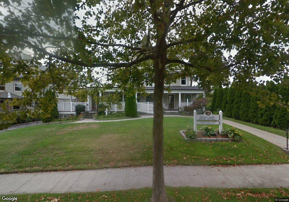
18 Field Point Rd Greenwich, CT 06830
Downtown Greenwich NeighborhoodEstimated Value: $4,805,708
1
Bed
1
Bath
5,265
Sq Ft
$913/Sq Ft
Est. Value
About This Home
This home is located at 18 Field Point Rd, Greenwich, CT 06830 and is currently estimated at $4,805,708, approximately $912 per square foot. 18 Field Point Rd is a home located in Fairfield County with nearby schools including Julian Curtiss School, Central Middle School, and Greenwich High School.
Ownership History
Date
Name
Owned For
Owner Type
Purchase Details
Closed on
Nov 17, 2000
Sold by
Smith Georeg A and Johnson Barbara J
Bought by
R&D Design Group Inc
Current Estimated Value
Home Financials for this Owner
Home Financials are based on the most recent Mortgage that was taken out on this home.
Original Mortgage
$1,400,000
Interest Rate
7.78%
Mortgage Type
Commercial
Create a Home Valuation Report for This Property
The Home Valuation Report is an in-depth analysis detailing your home's value as well as a comparison with similar homes in the area
Home Values in the Area
Average Home Value in this Area
Purchase History
| Date | Buyer | Sale Price | Title Company |
|---|---|---|---|
| R&D Design Group Inc | $2,000,000 | -- |
Source: Public Records
Mortgage History
| Date | Status | Borrower | Loan Amount |
|---|---|---|---|
| Closed | R&D Design Group Inc | $1,400,000 |
Source: Public Records
Tax History Compared to Growth
Tax History
| Year | Tax Paid | Tax Assessment Tax Assessment Total Assessment is a certain percentage of the fair market value that is determined by local assessors to be the total taxable value of land and additions on the property. | Land | Improvement |
|---|---|---|---|---|
| 2025 | $28,900 | $2,338,350 | $1,451,030 | $887,320 |
| 2024 | $27,911 | $2,338,350 | $1,451,030 | $887,320 |
| 2023 | $27,209 | $2,338,350 | $1,451,030 | $887,320 |
| 2022 | $26,961 | $2,338,350 | $1,451,030 | $887,320 |
| 2021 | $28,226 | $2,344,370 | $1,451,030 | $893,340 |
| 2020 | $28,179 | $2,344,370 | $1,451,030 | $893,340 |
| 2019 | $27,482 | $2,263,730 | $1,451,030 | $812,700 |
| 2018 | $26,870 | $2,263,730 | $1,451,030 | $812,700 |
| 2017 | $27,208 | $2,263,730 | $1,451,030 | $812,700 |
| 2016 | $26,778 | $2,263,730 | $1,451,030 | $812,700 |
| 2015 | $22,177 | $1,859,690 | $1,116,850 | $742,840 |
| 2014 | $21,619 | $1,859,690 | $1,116,850 | $742,840 |
Source: Public Records
Map
Nearby Homes
- 6 Benedict Place
- 25 W Elm St Unit 36
- 68 Dearfield Dr
- 15 Dearfield Ln
- 15 Lafayette Ct Unit 4D
- 125 Field Point Rd Unit PH B5
- 4 Lafayette Ct Unit 1C
- 4 Lafayette Ct Unit PH
- 1 Sound View Terrace
- 75 Mason St
- 50 Sound View Dr Unit 4n
- 98 Lewis St
- 57 Prospect St
- 25 Woodland Dr Unit C
- 47 Lafayette Place Unit 6J
- 47 Lafayette Place Unit 6J
- 20 Church St Unit A22
- 115 Lake Ave
- 48 Lexington Ave
- 98 Prospect St
- 18 Field Point Rd
- 18 Field Point Rd
- 18 Field Point Rd
- 18 Field Point Rd Unit 2A
- 18 Field Point Rd Unit 3
- 24 Field Point Rd
- 25 Field Point Rd
- 25 Field Point Rd Unit 3
- 35 Field Point Rd
- 35 Field Point Rd Unit 3rd Floor
- 38 Field Point Rd
- 111 W Putnam Ave Unit 111
- 41 W Elm St
- 41 W Elm St Unit 2W
- 141 W Putnam Ave
- 2 Benedict Place
- 2 Benedict Place Unit 3 A
- 2 Benedict Place Unit 3 B
- 9 Benedict Place Unit Lower Level
- 9 Benedict Place Unit LL