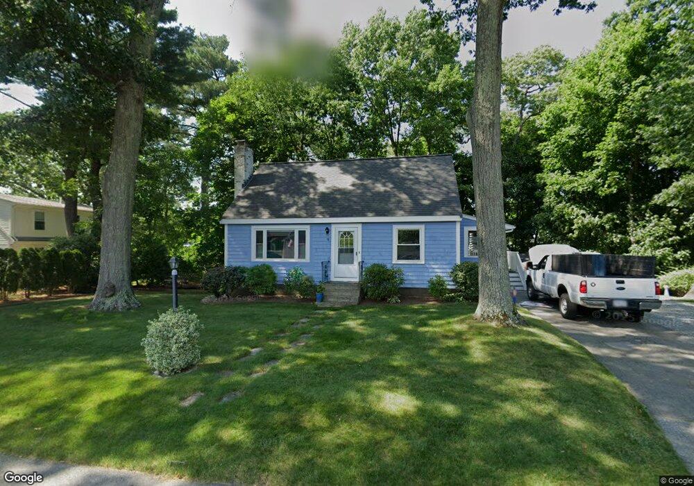
18 Gannett Rd Natick, MA 01760
Estimated Value: $638,000 - $719,153
3
Beds
2
Baths
1,190
Sq Ft
$574/Sq Ft
Est. Value
About This Home
This home is located at 18 Gannett Rd, Natick, MA 01760 and is currently estimated at $683,038, approximately $573 per square foot. 18 Gannett Rd is a home located in Middlesex County with nearby schools including Natick High School, Lilja Elementary School, and Wilson Middle School.
Ownership History
Date
Name
Owned For
Owner Type
Purchase Details
Closed on
Oct 18, 2016
Sold by
Thomson John and Luciano Joseph
Bought by
Thomson John L and Heffernan Elizabeth A
Current Estimated Value
Purchase Details
Closed on
Oct 7, 2009
Sold by
Maung Christopher G
Bought by
Thompson John and Luciano Karen
Home Financials for this Owner
Home Financials are based on the most recent Mortgage that was taken out on this home.
Original Mortgage
$234,000
Interest Rate
5.14%
Mortgage Type
Purchase Money Mortgage
Purchase Details
Closed on
May 21, 1999
Sold by
Maung Myra Est
Bought by
Maung Christopher G
Create a Home Valuation Report for This Property
The Home Valuation Report is an in-depth analysis detailing your home's value as well as a comparison with similar homes in the area
Home Values in the Area
Average Home Value in this Area
Purchase History
| Date | Buyer | Sale Price | Title Company |
|---|---|---|---|
| Thomson John L | -- | -- | |
| Thompson John | $297,000 | -- | |
| Maung Christopher G | $169,000 | -- |
Source: Public Records
Mortgage History
| Date | Status | Borrower | Loan Amount |
|---|---|---|---|
| Previous Owner | Thompson John | $234,000 | |
| Previous Owner | Maung Christopher G | $35,000 |
Source: Public Records
Tax History Compared to Growth
Tax History
| Year | Tax Paid | Tax Assessment Tax Assessment Total Assessment is a certain percentage of the fair market value that is determined by local assessors to be the total taxable value of land and additions on the property. | Land | Improvement |
|---|---|---|---|---|
| 2025 | $7,189 | $601,100 | $411,600 | $189,500 |
| 2024 | $7,062 | $576,000 | $396,200 | $179,800 |
| 2023 | $6,957 | $550,400 | $374,500 | $175,900 |
| 2022 | $6,755 | $506,400 | $342,800 | $163,600 |
| 2021 | $6,295 | $462,500 | $322,300 | $140,200 |
| 2020 | $6,086 | $447,200 | $307,000 | $140,200 |
| 2019 | $7,219 | $447,200 | $307,000 | $140,200 |
| 2018 | $5,164 | $404,900 | $307,000 | $97,900 |
| 2017 | $4,852 | $359,700 | $263,700 | $96,000 |
| 2016 | $4,584 | $337,800 | $242,700 | $95,100 |
| 2015 | $4,562 | $330,100 | $242,700 | $87,400 |
Source: Public Records
Map
Nearby Homes