Estimated Value: $302,000 - $320,000
3
Beds
2
Baths
1,659
Sq Ft
$186/Sq Ft
Est. Value
About This Home
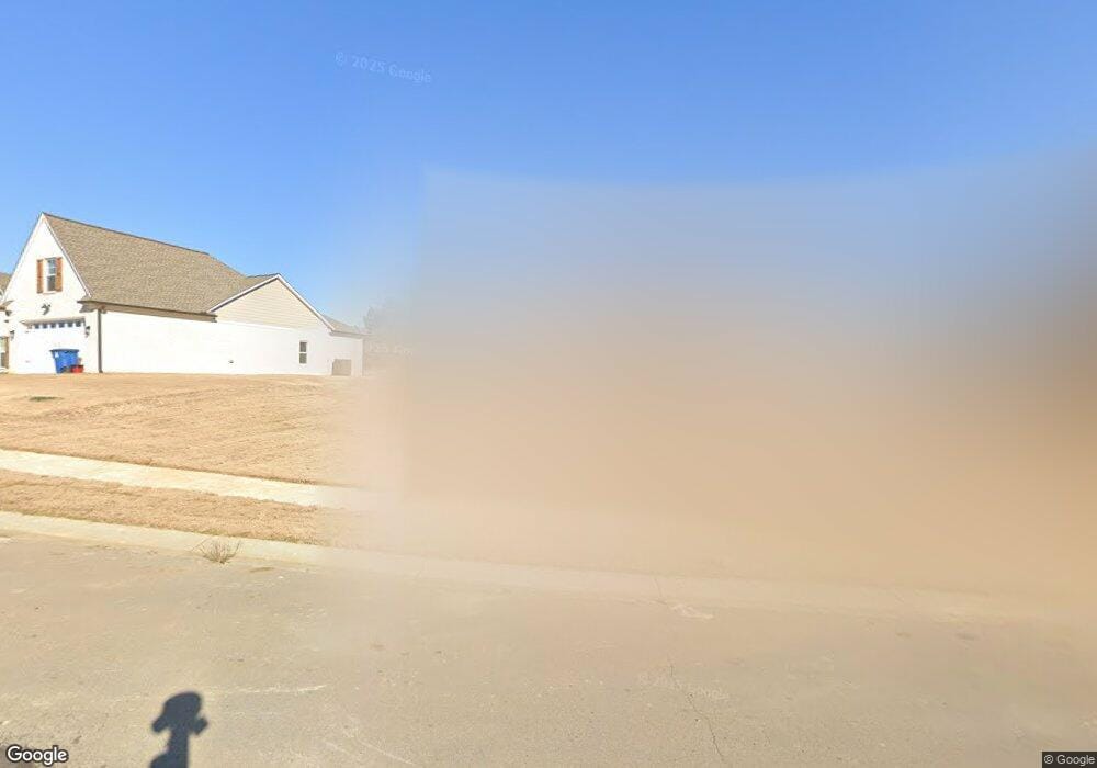
This home is located at 18 Hays Run, Atoka, TN 38004 and is currently estimated at $308,743, approximately $186 per square foot. 18 Hays Run is a home located in Tipton County with nearby schools including Atoka Elementary School, Brighton Middle School, and Brighton High School.
Ownership History
Date
Name
Owned For
Owner Type
Purchase Details
Closed on
May 3, 2019
Sold by
Wentzel Michael O
Bought by
Husted Joseph Michael and Husted Alexandra Rae
Current Estimated Value
Home Financials for this Owner
Home Financials are based on the most recent Mortgage that was taken out on this home.
Original Mortgage
$5,600
Outstanding Balance
$4,903
Interest Rate
4%
Mortgage Type
New Conventional
Estimated Equity
$303,840
Purchase Details
Closed on
Dec 28, 2015
Sold by
Wentzel Michael O
Bought by
Wentzel Michael O
Purchase Details
Closed on
Jan 31, 2006
Sold by
Strong Jon F
Bought by
Wentzel Michael O
Home Financials for this Owner
Home Financials are based on the most recent Mortgage that was taken out on this home.
Original Mortgage
$153,225
Interest Rate
6.14%
Mortgage Type
VA
Purchase Details
Closed on
Aug 16, 2004
Bought by
Strong Jon and Strong Ann
Create a Home Valuation Report for This Property
The Home Valuation Report is an in-depth analysis detailing your home's value as well as a comparison with similar homes in the area
Home Values in the Area
Average Home Value in this Area
Purchase History
| Date | Buyer | Sale Price | Title Company |
|---|---|---|---|
| Husted Joseph Michael | $160,000 | -- | |
| Wentzel Michael O | -- | -- | |
| Wentzel Michael O | $150,000 | -- | |
| Strong Jon | $27,000 | -- |
Source: Public Records
Mortgage History
| Date | Status | Borrower | Loan Amount |
|---|---|---|---|
| Open | Husted Joseph Michael | $5,600 | |
| Open | Husted Joseph Michael | $157,102 | |
| Previous Owner | Strong Jon | $153,225 |
Source: Public Records
Tax History Compared to Growth
Tax History
| Year | Tax Paid | Tax Assessment Tax Assessment Total Assessment is a certain percentage of the fair market value that is determined by local assessors to be the total taxable value of land and additions on the property. | Land | Improvement |
|---|---|---|---|---|
| 2024 | -- | $66,100 | $7,225 | $58,875 |
| 2023 | $1,491 | $66,100 | $7,225 | $58,875 |
| 2022 | $1,419 | $46,225 | $5,325 | $40,900 |
| 2021 | $1,396 | $46,225 | $5,325 | $40,900 |
| 2020 | $1,395 | $46,225 | $5,325 | $40,900 |
| 2019 | $1,447 | $40,300 | $5,325 | $34,975 |
| 2018 | $1,447 | $40,300 | $5,325 | $34,975 |
| 2017 | $1,297 | $40,300 | $5,325 | $34,975 |
| 2016 | $1,297 | $40,300 | $5,325 | $34,975 |
| 2015 | $1,296 | $40,300 | $5,325 | $34,975 |
| 2014 | $1,197 | $40,288 | $0 | $0 |
Source: Public Records
Map
Nearby Homes
- 78 Doe Trail
- 189 Cotton Fall Dr
- 93 Sterling Farm Dr
- 61 Como Ln
- 284 Merino Dr
- 170 Como Ln
- 125 Columbia Way
- 371 Beverly Dr
- 29 Merino Dr
- 236 Como Ln
- 35 Drysdale Cove
- 50 Drysdale Cove
- 75 Marian Dr
- 60 Drysdale Cove
- 102 Trinity Cove
- 33 Ward Ln
- 425 Eureka Trail
- 128 Loch Haven Cove S
- 336 Sterling Ridge Dr
- 104 Lochmeade Dr
- 18 Hayes Run
- 0 Hayes Run Unit 10037847
- 0 Hayes Run Unit 3167091
- 0 Hayes Run Unit 10009527
- 32 Hays Run
- 443 Sterling Farm Dr
- 31 Hays Run
- 52 Hays Run
- 127 Buck Stand Rd
- 151 Buck Stand Rd
- 454 Sterling Farm Dr
- 436 Sterling Farm Dr
- 107 Buck Stand Rd
- 474 Sterling Farm Dr
- 68 Hayes Run
- 67 Hays Run
- 424 Sterling Farm Dr
- 85 Buck Stand Rd
- 498 Sterling Farm Dr
- 34 Deer Skin Cove