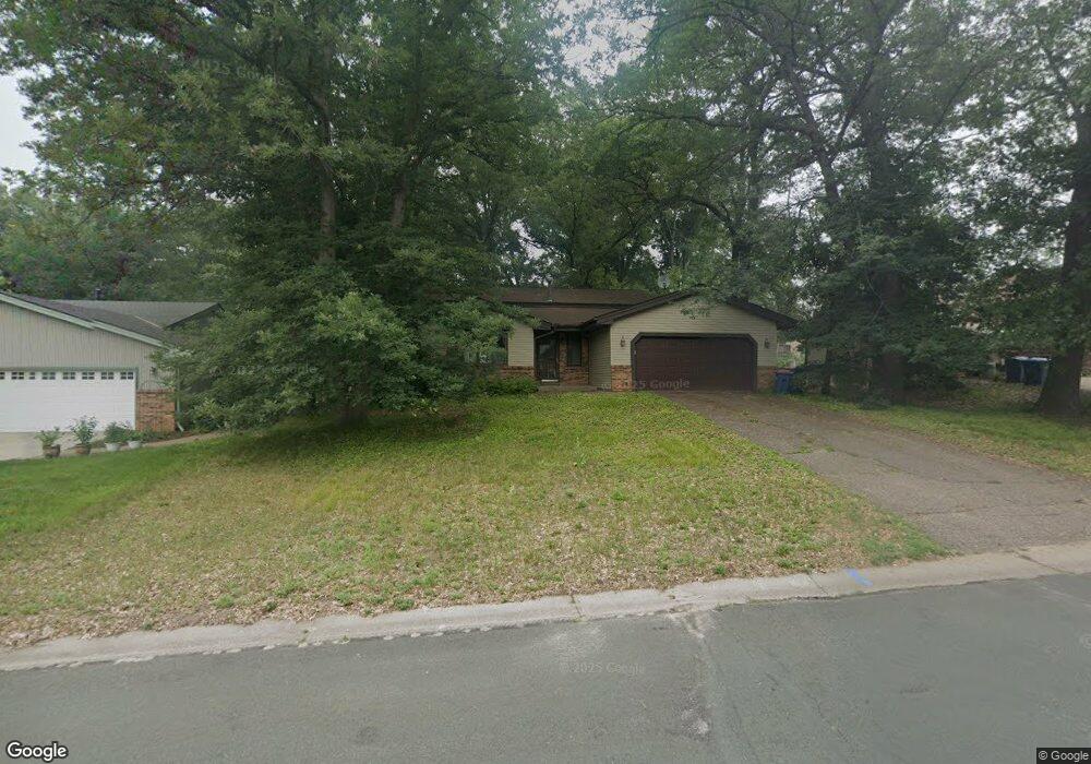
18 Hillcrest Ln Circle Pines, MN 55014
Estimated Value: $401,000 - $456,000
4
Beds
2
Baths
1,247
Sq Ft
$337/Sq Ft
Est. Value
About This Home
This home is located at 18 Hillcrest Ln, Circle Pines, MN 55014 and is currently estimated at $419,905, approximately $336 per square foot. 18 Hillcrest Ln is a home located in Anoka County with nearby schools including Blue Heron Elementary School, Centennial Middle School, and Centennial High School.
Ownership History
Date
Name
Owned For
Owner Type
Purchase Details
Closed on
Dec 28, 2009
Sold by
Davey Dan M and Davey Pamela
Bought by
Brotz Norbert C and Brotz Caryn L
Current Estimated Value
Home Financials for this Owner
Home Financials are based on the most recent Mortgage that was taken out on this home.
Original Mortgage
$203,532
Outstanding Balance
$132,883
Interest Rate
4.84%
Mortgage Type
New Conventional
Estimated Equity
$287,022
Purchase Details
Closed on
Nov 12, 1997
Sold by
Bendix Scott R and Bendix Deborah J
Bought by
Davey Dan and Davey Pamela
Create a Home Valuation Report for This Property
The Home Valuation Report is an in-depth analysis detailing your home's value as well as a comparison with similar homes in the area
Home Values in the Area
Average Home Value in this Area
Purchase History
| Date | Buyer | Sale Price | Title Company |
|---|---|---|---|
| Brotz Norbert C | $217,000 | -- | |
| Davey Dan | $143,600 | -- |
Source: Public Records
Mortgage History
| Date | Status | Borrower | Loan Amount |
|---|---|---|---|
| Open | Brotz Norbert C | $203,532 |
Source: Public Records
Tax History Compared to Growth
Tax History
| Year | Tax Paid | Tax Assessment Tax Assessment Total Assessment is a certain percentage of the fair market value that is determined by local assessors to be the total taxable value of land and additions on the property. | Land | Improvement |
|---|---|---|---|---|
| 2025 | $4,516 | $371,500 | $125,000 | $246,500 |
| 2024 | $4,516 | $365,100 | $115,000 | $250,100 |
| 2023 | $4,207 | $355,400 | $100,000 | $255,400 |
| 2022 | $3,945 | $354,900 | $90,000 | $264,900 |
| 2021 | $3,892 | $291,400 | $76,700 | $214,700 |
| 2020 | $3,862 | $281,500 | $76,700 | $204,800 |
| 2019 | $3,790 | $265,800 | $70,200 | $195,600 |
| 2018 | $3,265 | $247,000 | $0 | $0 |
| 2017 | $2,984 | $234,800 | $0 | $0 |
| 2016 | $3,219 | $214,900 | $0 | $0 |
| 2015 | $3,012 | $214,900 | $69,100 | $145,800 |
| 2014 | -- | $181,100 | $52,100 | $129,000 |
Source: Public Records
Map
Nearby Homes
- 104 South Dr
- 100 South Dr Unit E
- 114 South Dr Unit D
- 3 Golden Oak Dr
- 301 Evergreen Ln
- 230 Aurora Ln
- 343 Heritage Trail
- 324 Heritage Trail
- 306 Heritage Trail
- 6356 Hodgson Rd
- 6924 Lakeview Dr
- 253 Stardust Blvd
- 9104 Lexington Ave N
- Maxwell Plan at The Grove at Flowerfield - Villas Collection
- Palmer Plan at The Grove at Flowerfield - Villas Collection
- Maxwell II Plan at The Grove at Flowerfield - Villas Collection
- Cascade Plan at The Grove at Flowerfield - Villas Collection
- Smithtown Plan at The Grove at Flowerfield - Villas Collection
- 4023 Edgewood Rd NE
- 376 Arrowhead Dr
- 16 Hillcrest Ln
- 20 Hillcrest Ln
- 19 Hillcrest Ln
- 22 Hillcrest Ln
- 14 Hillcrest Ln
- 17 Hillcrest Ln
- 17 Pleasant View Ln
- 21 Hillcrest Ln
- 15 Pleasant View Ln
- 19 Pleasant View Ln
- 15 Hillcrest Ln
- 21 Pleasant View Ln
- 12 Hillcrest Ln
- 23 Hillcrest Ln
- 13 Pleasant View Ln
- 13 Hillcrest Ln
- 10 Hillcrest Ln
- 11 Pleasant View Ln
- 29 Ridge Rd
- 26 Ridge Rd