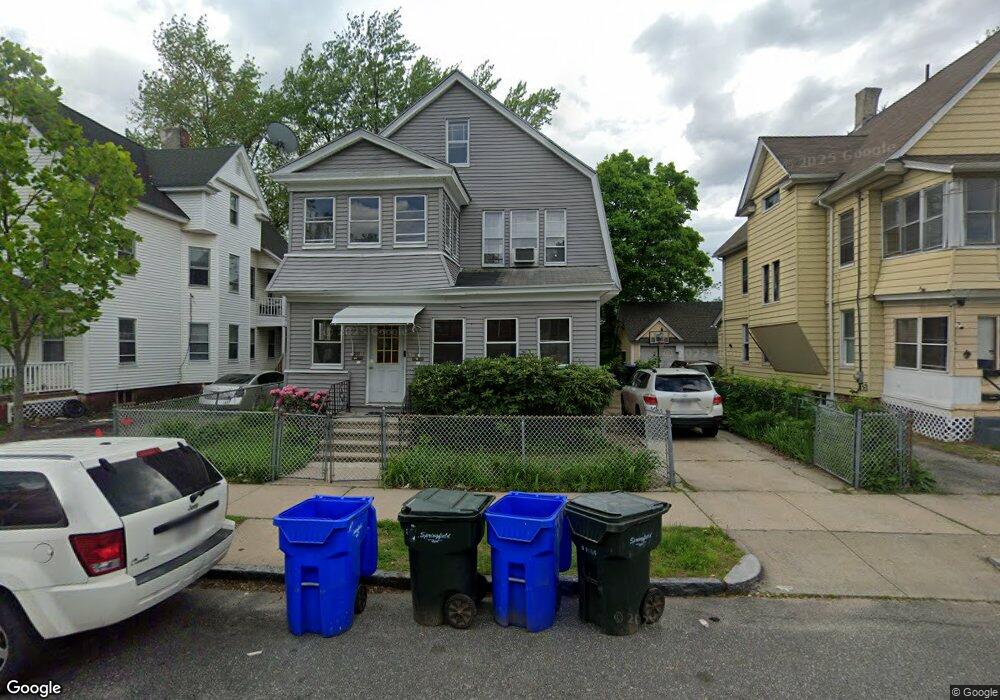
18 Middlesex St Unit 20 Springfield, MA 01109
Upper Hill NeighborhoodEstimated Value: $354,000 - $489,000
6
Beds
2
Baths
2,712
Sq Ft
$147/Sq Ft
Est. Value
About This Home
This home is located at 18 Middlesex St Unit 20, Springfield, MA 01109 and is currently estimated at $398,660, approximately $146 per square foot. 18 Middlesex St Unit 20 is a home located in Hampden County with nearby schools including Homer Street Elementary School, John J Duggan Middle, and Springfield High School of Science and Technology.
Ownership History
Date
Name
Owned For
Owner Type
Purchase Details
Closed on
Mar 17, 2025
Sold by
Weir Delores I
Bought by
Arbow Mohamed M and Arbow Yasin B
Current Estimated Value
Home Financials for this Owner
Home Financials are based on the most recent Mortgage that was taken out on this home.
Original Mortgage
$336,385
Outstanding Balance
$333,720
Interest Rate
6.12%
Mortgage Type
FHA
Estimated Equity
$64,940
Purchase Details
Closed on
Sep 1, 1987
Sold by
Mckenzie Herman N
Bought by
Weir Eric A
Home Financials for this Owner
Home Financials are based on the most recent Mortgage that was taken out on this home.
Original Mortgage
$76,500
Interest Rate
10.24%
Mortgage Type
Purchase Money Mortgage
Create a Home Valuation Report for This Property
The Home Valuation Report is an in-depth analysis detailing your home's value as well as a comparison with similar homes in the area
Home Values in the Area
Average Home Value in this Area
Purchase History
| Date | Buyer | Sale Price | Title Company |
|---|---|---|---|
| Arbow Mohamed M | $348,000 | None Available | |
| Arbow Mohamed M | $348,000 | None Available | |
| Weir Eric A | $85,000 | -- |
Source: Public Records
Mortgage History
| Date | Status | Borrower | Loan Amount |
|---|---|---|---|
| Open | Arbow Mohamed M | $336,385 | |
| Closed | Arbow Mohamed M | $336,385 | |
| Previous Owner | Weir Eric A | $72,500 | |
| Previous Owner | Weir Eric A | $76,500 |
Source: Public Records
Tax History
| Year | Tax Paid | Tax Assessment Tax Assessment Total Assessment is a certain percentage of the fair market value that is determined by local assessors to be the total taxable value of land and additions on the property. | Land | Improvement |
|---|---|---|---|---|
| 2025 | $4,975 | $317,300 | $29,500 | $287,800 |
| 2024 | $4,804 | $299,100 | $29,500 | $269,600 |
| 2023 | $4,564 | $267,700 | $26,800 | $240,900 |
| 2022 | $4,218 | $224,100 | $25,000 | $199,100 |
| 2021 | $4,166 | $220,400 | $17,800 | $202,600 |
| 2020 | $3,656 | $187,200 | $17,800 | $169,400 |
| 2019 | $3,336 | $169,500 | $15,200 | $154,300 |
| 2018 | $3,202 | $162,700 | $15,200 | $147,500 |
| 2017 | $3,006 | $152,900 | $14,200 | $138,700 |
| 2016 | $2,540 | $129,200 | $14,200 | $115,000 |
| 2015 | $2,569 | $130,600 | $14,200 | $116,400 |
Source: Public Records
Map
Nearby Homes
- 31-33 Suffolk St
- 48-50 Dresden St
- 62-64 Bristol St
- 25 Dresden St
- 89 Bristol St
- 111 Marlborough St
- 135-137 Suffolk St
- 124-126 Westford Cir
- 19 Westford Ave
- 21 Westford Cir
- 46 Mapledell St
- 87 Fenwick St
- 65 Montrose St
- 15 Kenyon St
- 867 Roosevelt Ave
- 11 Ina St
- 189 Northampton Ave
- 52-56 Andrew St
- 145 Cambridge St
- 0 NS (24) Alden St
- 18-20 Middlesex St
- 24 Middlesex St
- 14 Middlesex St
- 21 Wellington St
- 30 Middlesex St
- 289 Wilbraham Rd
- 25 Wellington St
- 293 Wilbraham Rd
- 27 Wellington St
- 17-19 Middlesex St
- 17 Middlesex St Unit 19
- 15 Middlesex St
- 23 Middlesex St
- 281 Wilbraham Rd
- 36 Middlesex St
- 35 Wellington St
- 301 Wilbraham Rd
- 31 Middlesex St
- 42 Middlesex St
- 37 Wellington St
Your Personal Tour Guide
Ask me questions while you tour the home.