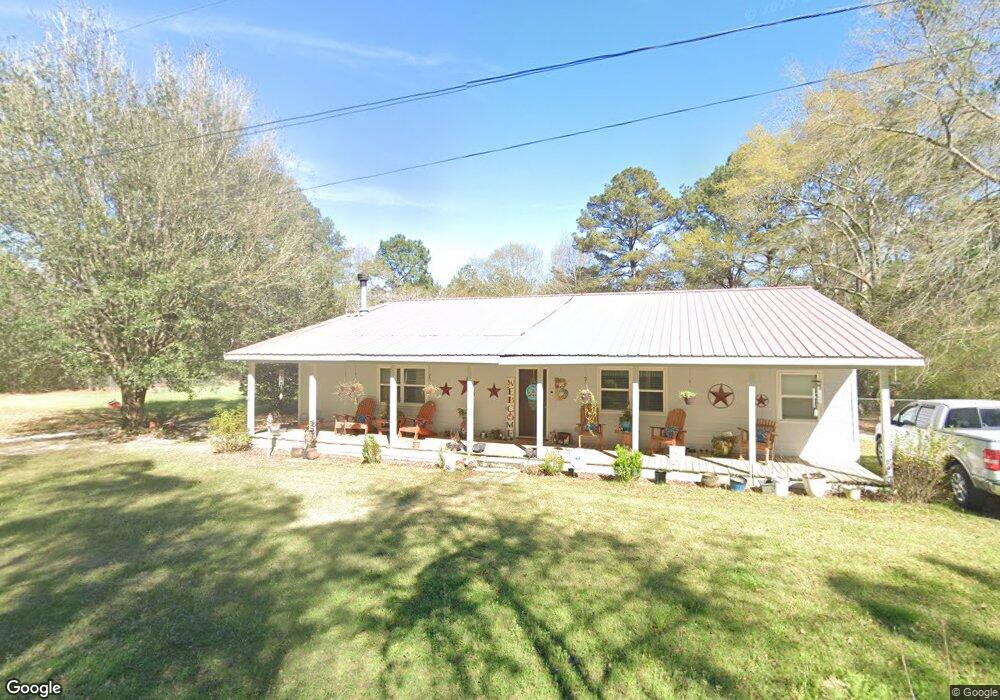
18 Monk Rd Wiggins, MS 39577
Estimated Value: $213,117 - $246,000
3
Beds
2
Baths
2,214
Sq Ft
$103/Sq Ft
Est. Value
About This Home
This home is located at 18 Monk Rd, Wiggins, MS 39577 and is currently estimated at $227,529, approximately $102 per square foot. 18 Monk Rd is a home located in Stone County with nearby schools including Stone Elementary School, Stone Middle School, and Stone High School.
Ownership History
Date
Name
Owned For
Owner Type
Purchase Details
Closed on
Sep 23, 2014
Sold by
Larry W Larry W and Hood Sherry L
Bought by
Brewer James B and Brewer Yvonne L
Current Estimated Value
Home Financials for this Owner
Home Financials are based on the most recent Mortgage that was taken out on this home.
Original Mortgage
$61,999
Interest Rate
4.16%
Mortgage Type
Unknown
Purchase Details
Closed on
Apr 8, 2011
Sold by
Hood Larry W and Hood Larry
Bought by
Hood Larry W and Hood Sherry L
Purchase Details
Closed on
Sep 29, 2010
Sold by
Federal Home Loan Mortgage Corporation
Bought by
Hood Larry W and Hood Sherry L
Create a Home Valuation Report for This Property
The Home Valuation Report is an in-depth analysis detailing your home's value as well as a comparison with similar homes in the area
Home Values in the Area
Average Home Value in this Area
Purchase History
| Date | Buyer | Sale Price | Title Company |
|---|---|---|---|
| Brewer James B | -- | -- | |
| Hood Larry W | -- | -- | |
| Hood Larry W | $64,250 | -- |
Source: Public Records
Mortgage History
| Date | Status | Borrower | Loan Amount |
|---|---|---|---|
| Closed | Brewer James B | $61,999 |
Source: Public Records
Tax History
| Year | Tax Paid | Tax Assessment Tax Assessment Total Assessment is a certain percentage of the fair market value that is determined by local assessors to be the total taxable value of land and additions on the property. | Land | Improvement |
|---|---|---|---|---|
| 2025 | $156 | $10,978 | $0 | $0 |
| 2024 | $169 | $8,686 | $0 | $0 |
| 2023 | $168 | $8,686 | $0 | $0 |
| 2022 | $164 | $8,686 | $0 | $0 |
| 2021 | $150 | $8,686 | $0 | $0 |
| 2020 | $756 | $7,914 | $0 | $0 |
| 2019 | $749 | $7,914 | $0 | $0 |
| 2018 | $750 | $7,915 | $0 | $0 |
| 2017 | $744 | $7,914 | $0 | $0 |
| 2016 | $688 | $7,335 | $0 | $0 |
| 2015 | $690 | $7,335 | $0 | $0 |
| 2014 | $830 | $7,334 | $0 | $0 |
Source: Public Records
Map
Nearby Homes
- 13 C Bond Rd
- 3092 Highway 26
- 3144 Highway 26
- 21 Twin Oaks Ln
- 8 Chisholm Trail
- 501 Pratt Rd
- Nsn Delancey Rd
- 405 Old Highway 49
- 620 Stevon Moore St
- 163 Inda Rd E
- 46 Presley Dr
- 0 N Highway 49 Hwy Unit 4125746
- 441 Park St
- 0 Park St
- 606 Pine Ave E
- 0 S Third St Unit 4126203
- 0 Sweetbay Ln Unit 4120426
- 00 Mississippi 26
- 221 Third St S
- 206 Fifth St N Unit N
Your Personal Tour Guide
Ask me questions while you tour the home.