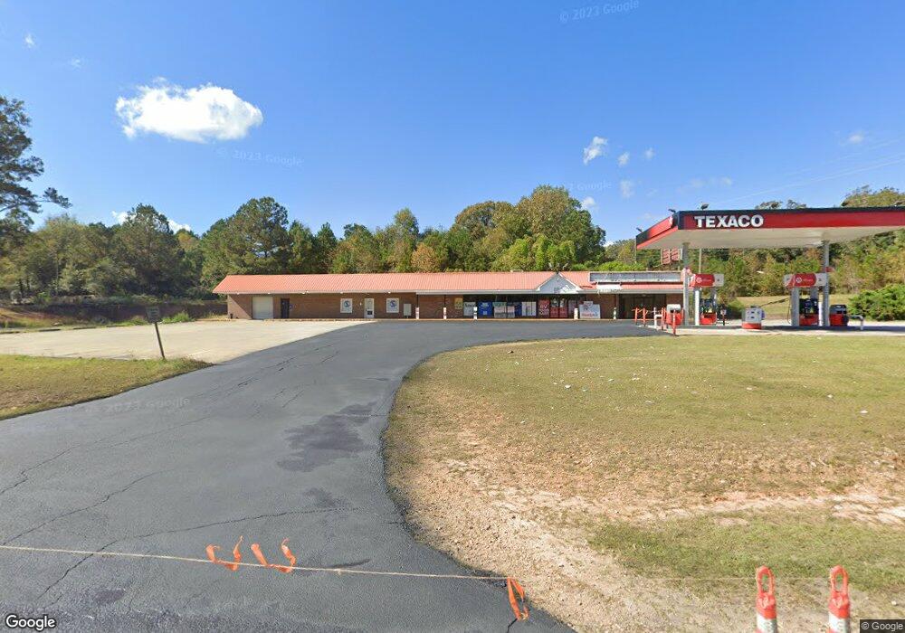
18 New Airport Rd Lagrange, GA 30240
Estimated Value: $2,053,845
--
Bed
3
Baths
6,426
Sq Ft
$320/Sq Ft
Est. Value
About This Home
This home is located at 18 New Airport Rd, Lagrange, GA 30240 and is currently estimated at $2,053,845, approximately $319 per square foot. 18 New Airport Rd is a home located in Troup County with nearby schools including Berta Weathersbee Elementary School, Whitesville Road Elementary School, and Long Cane Elementary School.
Ownership History
Date
Name
Owned For
Owner Type
Purchase Details
Closed on
Jun 1, 2022
Sold by
Mgs Venture Llc
Bought by
Blackwire Holdings Llc
Current Estimated Value
Home Financials for this Owner
Home Financials are based on the most recent Mortgage that was taken out on this home.
Original Mortgage
$1,225,000
Interest Rate
5.27%
Mortgage Type
Mortgage Modification
Purchase Details
Closed on
May 21, 2020
Sold by
C & M Real Estate Inc
Bought by
Mgs Venture Llc
Purchase Details
Closed on
Aug 1, 2001
Sold by
Corley/Mcclendon Drugs Inc
Bought by
C & M Real Estate Inc
Purchase Details
Closed on
Jul 31, 1998
Sold by
B & K Properties
Bought by
Corley/Mcclendon Drugs Inc
Purchase Details
Closed on
Jul 26, 1976
Bought by
B & K Properties
Purchase Details
Closed on
Jun 4, 1976
Purchase Details
Closed on
Jan 1, 1972
Purchase Details
Closed on
Jan 1, 1965
Create a Home Valuation Report for This Property
The Home Valuation Report is an in-depth analysis detailing your home's value as well as a comparison with similar homes in the area
Home Values in the Area
Average Home Value in this Area
Purchase History
| Date | Buyer | Sale Price | Title Company |
|---|---|---|---|
| Blackwire Holdings Llc | $1,750,000 | -- | |
| Mgs Venture Llc | $350,000 | -- | |
| C & M Real Estate Inc | -- | -- | |
| Corley/Mcclendon Drugs Inc | $240,000 | -- | |
| B & K Properties | -- | -- | |
| -- | -- | -- | |
| -- | -- | -- | |
| -- | -- | -- |
Source: Public Records
Mortgage History
| Date | Status | Borrower | Loan Amount |
|---|---|---|---|
| Closed | Blackwire Holdings Llc | $1,225,000 |
Source: Public Records
Tax History Compared to Growth
Tax History
| Year | Tax Paid | Tax Assessment Tax Assessment Total Assessment is a certain percentage of the fair market value that is determined by local assessors to be the total taxable value of land and additions on the property. | Land | Improvement |
|---|---|---|---|---|
| 2024 | $19,418 | $712,000 | $164,000 | $548,000 |
| 2023 | $18,526 | $679,280 | $164,000 | $515,280 |
| 2022 | $8,888 | $318,440 | $65,600 | $252,840 |
| 2021 | $4,222 | $194,320 | $65,600 | $128,720 |
| 2020 | $7,749 | $256,920 | $65,600 | $191,320 |
| 2019 | $5,897 | $195,520 | $65,600 | $129,920 |
| 2018 | $5,871 | $194,680 | $65,600 | $129,080 |
| 2017 | $5,872 | $194,680 | $65,600 | $129,080 |
| 2016 | $6,091 | $201,944 | $65,600 | $136,344 |
| 2015 | $6,101 | $201,944 | $65,600 | $136,344 |
| 2014 | $6,111 | $201,944 | $65,600 | $136,344 |
| 2013 | -- | $201,944 | $65,600 | $136,344 |
Source: Public Records
Map
Nearby Homes
- 0 Unit 10514554
- 141 Avery Dr
- 212 Aster Way
- 101 Crown St Unit LOT 5
- 102 Crown St Unit LOT 1
- The Rhodes Plan at Crown Street Cottages
- The Truitt Plan at Crown Street Cottages
- The Callaway Plan at Crown Street Cottages
- 167 S Kight Dr
- 802 Monroe St
- 205 Grady St
- 608 Wilburn Ave
- 610 Wilburn Ave
- 107 Clark St
- 119 Jones St
- 211 Moores Hill
- 0 Moores Hill
- 202 Parker Ln
- 102 Parker St
- 109 Garfield St
- 2005 West Point Rd
- 46 New Airport Rd
- 52 New Airport Rd
- 2002 W Point Rd
- 1970 West Point Rd
- 27 New Airport Rd
- 41 New Airport Rd
- 53 New Airport Rd
- 74 New Airport Rd
- 2053 West Point Rd
- 65 New Airport Rd
- 9 Terrace Dr
- 84 New Airport Rd
- 42 Terrace Dr
- 29 Terrace Dr
- 20 Sunset Dr
- 92 New Airport Rd
- 8 Sunset Dr
- 3 New Airport Rd
- 41 Terrace Dr