Estimated Value: $637,000 - $827,000
2
Beds
3
Baths
2,063
Sq Ft
$352/Sq Ft
Est. Value
About This Home
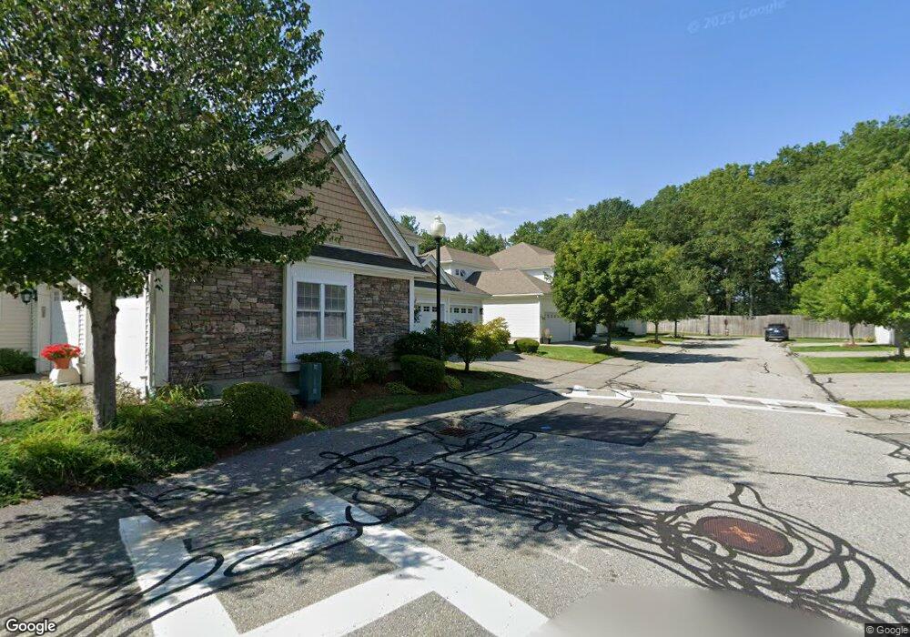
This home is located at 18 Preston Way Unit 55, Acton, MA 01720 and is currently estimated at $725,174, approximately $351 per square foot. 18 Preston Way Unit 55 is a home located in Middlesex County with nearby schools including Acton-Boxborough Regional High School and Oak Meadow Montessori School.
Ownership History
Date
Name
Owned For
Owner Type
Purchase Details
Closed on
Aug 3, 2020
Sold by
Harring Cedric F and Harring Arlette E
Bought by
Fisher Thomas and Howard H E
Current Estimated Value
Home Financials for this Owner
Home Financials are based on the most recent Mortgage that was taken out on this home.
Original Mortgage
$364,000
Outstanding Balance
$322,894
Interest Rate
3%
Mortgage Type
New Conventional
Estimated Equity
$402,280
Purchase Details
Closed on
Nov 23, 2011
Sold by
Nic Realty Llc
Bought by
Harring Cedric F and Harring Arlette E
Home Financials for this Owner
Home Financials are based on the most recent Mortgage that was taken out on this home.
Original Mortgage
$291,000
Interest Rate
4.12%
Mortgage Type
Purchase Money Mortgage
Create a Home Valuation Report for This Property
The Home Valuation Report is an in-depth analysis detailing your home's value as well as a comparison with similar homes in the area
Home Values in the Area
Average Home Value in this Area
Purchase History
| Date | Buyer | Sale Price | Title Company |
|---|---|---|---|
| Fisher Thomas | $520,000 | None Available | |
| Harring Cedric F | $364,225 | -- |
Source: Public Records
Mortgage History
| Date | Status | Borrower | Loan Amount |
|---|---|---|---|
| Open | Fisher Thomas | $364,000 | |
| Previous Owner | Harring Cedric F | $291,000 |
Source: Public Records
Tax History Compared to Growth
Tax History
| Year | Tax Paid | Tax Assessment Tax Assessment Total Assessment is a certain percentage of the fair market value that is determined by local assessors to be the total taxable value of land and additions on the property. | Land | Improvement |
|---|---|---|---|---|
| 2025 | $11,134 | $649,200 | $0 | $649,200 |
| 2024 | $10,180 | $610,700 | $0 | $610,700 |
| 2023 | $9,609 | $547,200 | $0 | $547,200 |
| 2022 | $9,717 | $499,600 | $0 | $499,600 |
| 2021 | $9,579 | $473,500 | $0 | $473,500 |
| 2020 | $8,456 | $439,500 | $0 | $439,500 |
| 2019 | $8,054 | $415,800 | $0 | $415,800 |
| 2018 | $8,291 | $427,800 | $0 | $427,800 |
| 2017 | $6,734 | $353,300 | $0 | $353,300 |
| 2016 | $6,913 | $359,500 | $0 | $359,500 |
| 2015 | $6,561 | $344,400 | $0 | $344,400 |
| 2014 | $6,368 | $327,400 | $0 | $327,400 |
Source: Public Records
Map
Nearby Homes
- 927 Main St
- 875 Acton St
- 17 Northbriar Rd
- 1 Quarry Rd
- 407 Great Rd Unit 9
- 403 Great Rd Unit 5
- 601 Old Stone Brook
- 428 Great Rd Unit 10
- 420 Great Rd Unit B3
- 517 Tumbling Hawk
- 390 Great Rd Unit A2
- 386 Great Rd Unit A8
- 484 Great Rd
- 484 Great Rd
- 237 Brown Bear Crossing Unit 237
- 140 Butternut Hollow Unit 140
- 484 Great Road -3
- 484 Great Road -4
- 484 Great Road -6
- 16 Wampus Ave Unit 32
- 18 Preston Way
- 20 Preston Way
- 22 Preston Way
- 20 Preston Way Unit 20
- 22 Preston Way Unit 53
- 20 Preston Way Unit 54
- 14 Preston Way
- 14 Preston Way Unit 57
- 16 Preston Way
- 21 Preston Way
- 21 Preston Way Unit 21
- 21 Preston Way Unit 52
- 19 Preston Way
- 17 Preston Way
- 17 Preston Way Unit 50
- 10 Preston Way
- 12 Preston Way
- 10 Preston Way Unit 59
- 12 Preston Way Unit 58
- 19 John Francis Ln Unit 19