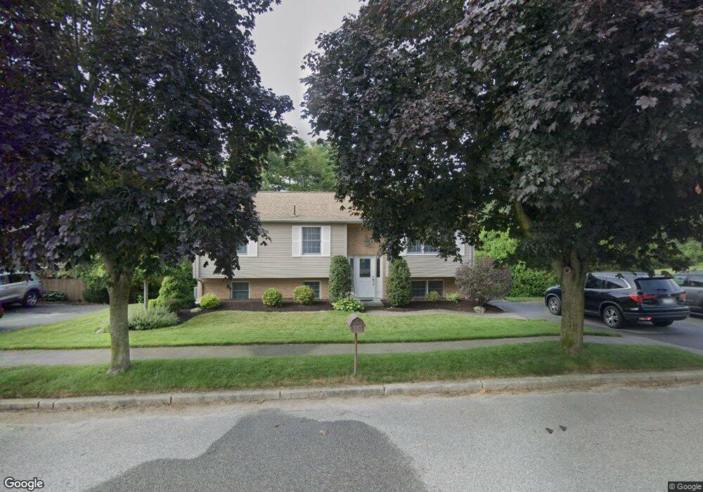
18 Red Barn Ct Cranston, RI 02920
Western Cranston NeighborhoodEstimated Value: $467,704 - $556,000
3
Beds
2
Baths
1,970
Sq Ft
$262/Sq Ft
Est. Value
About This Home
This home is located at 18 Red Barn Ct, Cranston, RI 02920 and is currently estimated at $516,176, approximately $262 per square foot. 18 Red Barn Ct is a home located in Providence County with nearby schools including Glen Hills School, Western Hills Middle School, and Cranston High School West.
Ownership History
Date
Name
Owned For
Owner Type
Purchase Details
Closed on
Sep 30, 2009
Sold by
Howe Dora M and Howe Joseph D
Bought by
Viveiros Bethany and Viveiros Nelson
Current Estimated Value
Home Financials for this Owner
Home Financials are based on the most recent Mortgage that was taken out on this home.
Original Mortgage
$234,671
Interest Rate
5.12%
Mortgage Type
Purchase Money Mortgage
Purchase Details
Closed on
Aug 8, 2001
Sold by
Sousa David M and Sousa Ann
Bought by
Howe Joseph D and Howe Dora
Home Financials for this Owner
Home Financials are based on the most recent Mortgage that was taken out on this home.
Original Mortgage
$157,429
Interest Rate
7.1%
Create a Home Valuation Report for This Property
The Home Valuation Report is an in-depth analysis detailing your home's value as well as a comparison with similar homes in the area
Home Values in the Area
Average Home Value in this Area
Purchase History
| Date | Buyer | Sale Price | Title Company |
|---|---|---|---|
| Viveiros Bethany | $239,000 | -- | |
| Howe Joseph D | $160,000 | -- |
Source: Public Records
Mortgage History
| Date | Status | Borrower | Loan Amount |
|---|---|---|---|
| Open | Howe Joseph D | $90,000 | |
| Open | Howe Joseph D | $181,900 | |
| Closed | Howe Joseph D | $234,671 | |
| Previous Owner | Howe Joseph D | $157,429 |
Source: Public Records
Tax History
| Year | Tax Paid | Tax Assessment Tax Assessment Total Assessment is a certain percentage of the fair market value that is determined by local assessors to be the total taxable value of land and additions on the property. | Land | Improvement |
|---|---|---|---|---|
| 2025 | $5,935 | $427,600 | $110,700 | $316,900 |
| 2024 | $5,820 | $427,600 | $110,700 | $316,900 |
| 2023 | $5,617 | $297,200 | $76,400 | $220,800 |
| 2022 | $5,501 | $297,200 | $76,400 | $220,800 |
| 2021 | $5,350 | $297,200 | $76,400 | $220,800 |
| 2020 | $5,342 | $257,200 | $80,000 | $177,200 |
| 2019 | $5,342 | $257,200 | $80,000 | $177,200 |
| 2018 | $5,219 | $257,200 | $80,000 | $177,200 |
| 2017 | $4,999 | $217,900 | $72,700 | $145,200 |
| 2016 | $4,892 | $217,900 | $72,700 | $145,200 |
| 2015 | $4,892 | $217,900 | $72,700 | $145,200 |
| 2014 | $4,545 | $199,000 | $72,700 | $126,300 |
Source: Public Records
Map
Nearby Homes
- 61 Crossland Rd
- 0 Natick Rd
- 25 Wilson St
- 12 Railroad Row
- 62 Governors Hill Unit 572
- 63 Governors Hill Unit 63
- 744 Providence St
- 14 W Natick Rd
- 8 Lily Ln Unit 8
- 5 High St
- 15 Carrie Ann Dr
- 46 Hornbeam Dr
- 16 Flynn Ave
- 9 Odonnell Ave
- 78 Wilbur Ave
- 52 Jambray Ave
- 1715 Phenix Ave
- 11 College Hill Rd Unit 5B
- 11 College Hill Rd Unit 4A
- 12 W Valley Cir