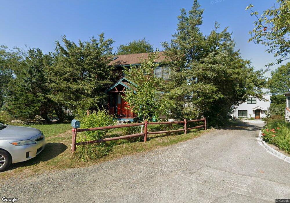
18 Riggs Point Rd Gloucester, MA 01930
Estimated Value: $545,000 - $1,211,000
2
Beds
2
Baths
906
Sq Ft
$1,052/Sq Ft
Est. Value
About This Home
This home is located at 18 Riggs Point Rd, Gloucester, MA 01930 and is currently estimated at $953,177, approximately $1,052 per square foot. 18 Riggs Point Rd is a home located in Essex County with nearby schools including Plum Cove School, Ralph B O'maley Middle School, and Gloucester High School.
Ownership History
Date
Name
Owned For
Owner Type
Purchase Details
Closed on
May 3, 2006
Sold by
Collins E Fraser
Bought by
Brien Michael P
Current Estimated Value
Home Financials for this Owner
Home Financials are based on the most recent Mortgage that was taken out on this home.
Original Mortgage
$560,000
Outstanding Balance
$323,214
Interest Rate
6.34%
Mortgage Type
Purchase Money Mortgage
Estimated Equity
$629,963
Create a Home Valuation Report for This Property
The Home Valuation Report is an in-depth analysis detailing your home's value as well as a comparison with similar homes in the area
Purchase History
| Date | Buyer | Sale Price | Title Company |
|---|---|---|---|
| Brien Michael P | $760,000 | -- |
Source: Public Records
Mortgage History
| Date | Status | Borrower | Loan Amount |
|---|---|---|---|
| Open | Brien Michael P | $560,000 |
Source: Public Records
Tax History
| Year | Tax Paid | Tax Assessment Tax Assessment Total Assessment is a certain percentage of the fair market value that is determined by local assessors to be the total taxable value of land and additions on the property. | Land | Improvement |
|---|---|---|---|---|
| 2025 | $9,328 | $959,700 | $882,900 | $76,800 |
| 2024 | $9,994 | $1,027,100 | $841,000 | $186,100 |
| 2023 | $9,452 | $892,500 | $717,300 | $175,200 |
| 2022 | $9,053 | $771,800 | $623,800 | $148,000 |
| 2021 | $9,430 | $758,000 | $567,300 | $190,700 |
| 2020 | $9,140 | $741,300 | $567,300 | $174,000 |
| 2019 | $8,936 | $704,200 | $540,900 | $163,300 |
| 2018 | $8,676 | $671,000 | $527,700 | $143,300 |
| 2017 | $9,361 | $709,700 | $502,700 | $207,000 |
| 2016 | $8,942 | $657,000 | $480,800 | $176,200 |
| 2015 | $8,747 | $640,800 | $469,900 | $170,900 |
Source: Public Records
Map
Nearby Homes
- 2 Breezy Point Rd
- 672 Washington St
- 3 Deacon Farm Ln
- 13 Honeysuckle Rd
- 31 Echo Ave
- 226 Atlantic St
- 178 Atlantic St
- 167 Atlantic St
- 13 Mystic Ave
- 8 Mystic Ave
- 7 Colburn St
- 6 Monroe Ct
- 98 Maplewood Ave
- 9 Cleveland Place
- 40 Sargent St
- 19 Trask St Unit 2
- 15 Harvard St
- 33 Maplewood Ave Unit 310
- 113 Pleasant St
- 145 Essex Ave Unit 402
- 16 Riggs Point Rd
- 22 Riggs Point Rd
- 24 Riggs Point Road Winter
- 24 Riggs Point Road Winter Unit WINTER
- 90 Riggs Point Rd
- 14 Riggs Point Rd
- 24 Riggs Point Rd
- 24 Riggs Point Rd Unit WINTER
- 20 Riggs Point Rd
- 12 Riggs Point Rd
- 15 Riggs Point Rd
- 28 Riggs Point Rd
- 26 Riggs Point Rd
- 50 Vine St
- 10 Riggs Point Rd
- 47 Vine St
- 17 Riggs Point Rd
- 48 Vine St
- 19 Riggs Point Rd
- 8 Riggs Point Rd
Your Personal Tour Guide
Ask me questions while you tour the home.