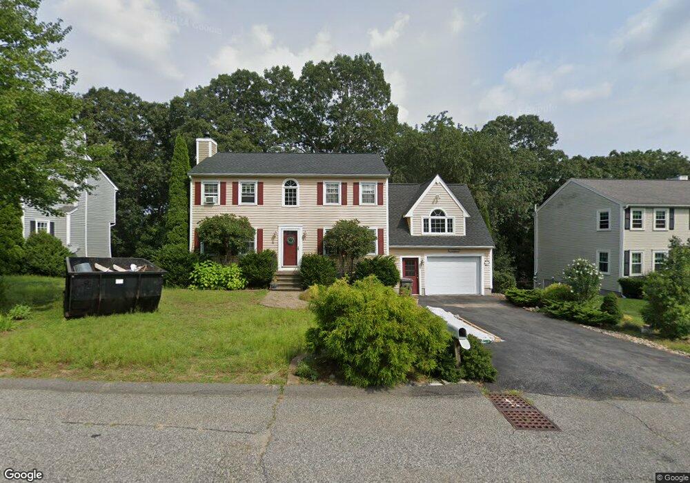
18 Rock St Framingham, MA 01702
Estimated Value: $691,805 - $744,000
3
Beds
2
Baths
1,796
Sq Ft
$396/Sq Ft
Est. Value
About This Home
This home is located at 18 Rock St, Framingham, MA 01702 and is currently estimated at $711,201, approximately $395 per square foot. 18 Rock St is a home located in Middlesex County with nearby schools including Framingham High School, Pincushion Hill Montessori School, and Saint Bridget School.
Ownership History
Date
Name
Owned For
Owner Type
Purchase Details
Closed on
Apr 20, 2016
Sold by
Parra Karen J
Bought by
Karen J Parra Ret and Parra
Current Estimated Value
Purchase Details
Closed on
Dec 30, 1993
Sold by
High Rock Acres Rt and Bartolini Bruce
Bought by
Brown Karen J
Home Financials for this Owner
Home Financials are based on the most recent Mortgage that was taken out on this home.
Original Mortgage
$151,900
Interest Rate
7%
Mortgage Type
Purchase Money Mortgage
Create a Home Valuation Report for This Property
The Home Valuation Report is an in-depth analysis detailing your home's value as well as a comparison with similar homes in the area
Home Values in the Area
Average Home Value in this Area
Purchase History
| Date | Buyer | Sale Price | Title Company |
|---|---|---|---|
| Karen J Parra Ret | -- | -- | |
| Karen J Parra Ret | -- | -- | |
| Brown Karen J | $159,900 | -- | |
| Brown Karen J | $159,900 | -- |
Source: Public Records
Mortgage History
| Date | Status | Borrower | Loan Amount |
|---|---|---|---|
| Previous Owner | Brown Karen J | $151,900 | |
| Previous Owner | Brown Karen J | $130,000 |
Source: Public Records
Tax History
| Year | Tax Paid | Tax Assessment Tax Assessment Total Assessment is a certain percentage of the fair market value that is determined by local assessors to be the total taxable value of land and additions on the property. | Land | Improvement |
|---|---|---|---|---|
| 2025 | $7,797 | $653,000 | $259,800 | $393,200 |
| 2024 | $7,643 | $613,400 | $232,000 | $381,400 |
| 2023 | $7,349 | $561,400 | $207,000 | $354,400 |
| 2022 | $6,970 | $507,300 | $187,900 | $319,400 |
| 2021 | $6,775 | $482,200 | $180,600 | $301,600 |
| 2020 | $6,871 | $458,700 | $164,100 | $294,600 |
| 2019 | $6,889 | $447,900 | $164,100 | $283,800 |
| 2018 | $6,867 | $420,800 | $158,000 | $262,800 |
| 2017 | $6,768 | $405,000 | $153,400 | $251,600 |
| 2016 | $6,827 | $392,800 | $153,400 | $239,400 |
| 2015 | $6,784 | $380,700 | $153,600 | $227,100 |
Source: Public Records
Map
Nearby Homes
- 15 Bellmore Rd
- 45 Daytona Ave
- 116 Waverly St
- 768 Waverley St
- 10 Rhubena St
- 51 Crest Rd
- 131 Mellen St Unit 3B
- 12 & 14 Waverly St
- 20 Mulhall Dr
- 327 Singletary Ln
- 69 Gilbert St
- 15 Bates Rd
- 24 Bates Rd
- 437 America Blvd Unit 437
- 25 Eames St
- 77 Arlington St
- 27 Gordon St Unit 305
- 29 Gordon St Unit 107
- 120 Franklin St
- 92 Alexander St
Your Personal Tour Guide
Ask me questions while you tour the home.