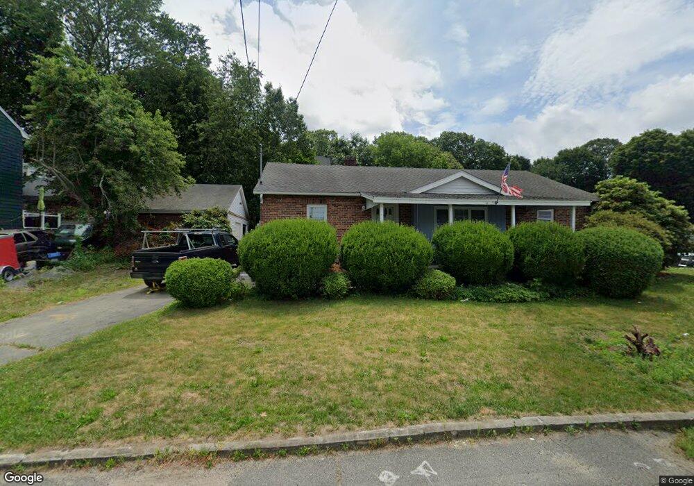
18 School St Saugus, MA 01906
Cliftondale NeighborhoodEstimated Value: $701,000 - $793,000
4
Beds
2
Baths
1,739
Sq Ft
$425/Sq Ft
Est. Value
About This Home
This home is located at 18 School St, Saugus, MA 01906 and is currently estimated at $738,956, approximately $424 per square foot. 18 School St is a home with nearby schools including Saugus High School, Pioneer Charter School Of Science II, and Sacred Heart School.
Ownership History
Date
Name
Owned For
Owner Type
Purchase Details
Closed on
Apr 7, 2005
Sold by
Grieco Charles K and Grieco Lou Ann
Bought by
20 School St Rlty Llc
Current Estimated Value
Purchase Details
Closed on
Apr 25, 2002
Sold by
Murphy Patricia M and White Fritz C
Bought by
Grieco Charles K and Grieco Lou Ann
Purchase Details
Closed on
Oct 18, 2000
Sold by
Hogan James J and Golden Lorraine J
Bought by
Murphy Patricia M
Home Financials for this Owner
Home Financials are based on the most recent Mortgage that was taken out on this home.
Original Mortgage
$175,000
Interest Rate
7.88%
Mortgage Type
Commercial
Create a Home Valuation Report for This Property
The Home Valuation Report is an in-depth analysis detailing your home's value as well as a comparison with similar homes in the area
Home Values in the Area
Average Home Value in this Area
Purchase History
| Date | Buyer | Sale Price | Title Company |
|---|---|---|---|
| 20 School St Rlty Llc | -- | -- | |
| Grieco Charles K | $362,000 | -- | |
| Murphy Patricia M | $166,000 | -- |
Source: Public Records
Mortgage History
| Date | Status | Borrower | Loan Amount |
|---|---|---|---|
| Previous Owner | Murphy Patricia M | $322,000 | |
| Previous Owner | Murphy Patricia M | $175,000 |
Source: Public Records
Tax History
| Year | Tax Paid | Tax Assessment Tax Assessment Total Assessment is a certain percentage of the fair market value that is determined by local assessors to be the total taxable value of land and additions on the property. | Land | Improvement |
|---|---|---|---|---|
| 2025 | $6,851 | $641,500 | $341,900 | $299,600 |
| 2024 | $6,671 | $626,400 | $332,700 | $293,700 |
| 2023 | $6,463 | $574,000 | $291,100 | $282,900 |
| 2022 | $6,280 | $522,900 | $270,800 | $252,100 |
| 2021 | $5,882 | $476,700 | $224,600 | $252,100 |
| 2020 | $5,438 | $456,200 | $213,500 | $242,700 |
| 2019 | $5,329 | $437,500 | $203,300 | $234,200 |
| 2018 | $4,861 | $419,800 | $194,100 | $225,700 |
| 2017 | $4,445 | $368,900 | $184,800 | $184,100 |
| 2016 | $4,164 | $341,300 | $175,500 | $165,800 |
| 2015 | $3,908 | $325,100 | $167,200 | $157,900 |
| 2014 | $3,897 | $335,700 | $167,200 | $168,500 |
Source: Public Records
Map
Nearby Homes
- 31 Mountain Ave
- 4 Foss Ave
- 20 Maple St
- 141 Essex St Unit D6
- 141 Essex St Unit B4
- 7 Adams Ave
- 32-34 Mount Vernon St
- 25 Auburn St
- 6 Saugus Ave Unit A
- 2 Ashford St
- 36 Jasper St
- 57 Vine St
- 28 Naples Ave
- 43 Taylor St
- 25 Piedmont Ave
- 187 Hamilton St
- 34 Summer St
- 0 Hampton St
- 4 Oneil Way
- 133 Salem St Unit 414
Your Personal Tour Guide
Ask me questions while you tour the home.