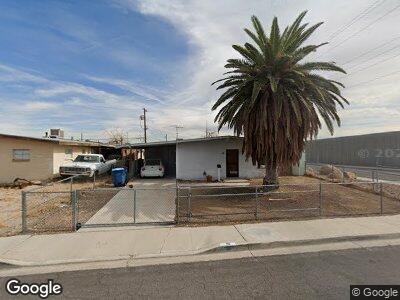
18 Stanford St Las Vegas, NV 89107
Michael Way NeighborhoodEstimated Value: $266,000 - $321,000
3
Beds
2
Baths
1,095
Sq Ft
$278/Sq Ft
Est. Value
About This Home
This home is located at 18 Stanford St, Las Vegas, NV 89107 and is currently estimated at $303,957, approximately $277 per square foot. 18 Stanford St is a home located in Clark County with nearby schools including J.T. McWlliams Elementary School, Robert O Gibson Middle School, and Western High School.
Ownership History
Date
Name
Owned For
Owner Type
Purchase Details
Closed on
Jan 5, 2001
Sold by
Cooke Douglas J and Cooke Patricia L
Bought by
Tapp Nancy
Current Estimated Value
Home Financials for this Owner
Home Financials are based on the most recent Mortgage that was taken out on this home.
Original Mortgage
$83,230
Interest Rate
7.65%
Mortgage Type
FHA
Purchase Details
Closed on
Jul 5, 2000
Sold by
Cooke Patricia
Bought by
Cooke Douglas J and Cooke Patricia L
Purchase Details
Closed on
Mar 8, 2000
Sold by
Martin Russ
Bought by
Martin Dale and Perkins Diana
Create a Home Valuation Report for This Property
The Home Valuation Report is an in-depth analysis detailing your home's value as well as a comparison with similar homes in the area
Home Values in the Area
Average Home Value in this Area
Purchase History
| Date | Buyer | Sale Price | Title Company |
|---|---|---|---|
| Tapp Nancy | $84,000 | Land Title | |
| Martin Dale | -- | Land Title | |
| Perkins Diana | -- | Land Title | |
| Cooke Douglas J | -- | -- | |
| Martin Dale | -- | -- | |
| Martin Dale | -- | National Title Company |
Source: Public Records
Mortgage History
| Date | Status | Borrower | Loan Amount |
|---|---|---|---|
| Open | Tapp Nancy | $101,925 | |
| Closed | Tapp Nancy | $101,925 | |
| Closed | Tapp Nancy | $106,500 | |
| Closed | Tapp Nancy | $83,230 | |
| Closed | Tapp Nancy | $2,520 |
Source: Public Records
Tax History Compared to Growth
Tax History
| Year | Tax Paid | Tax Assessment Tax Assessment Total Assessment is a certain percentage of the fair market value that is determined by local assessors to be the total taxable value of land and additions on the property. | Land | Improvement |
|---|---|---|---|---|
| 2025 | $585 | $40,800 | $25,200 | $15,600 |
| 2024 | $568 | $40,800 | $25,200 | $15,600 |
| 2023 | $568 | $39,986 | $25,900 | $14,086 |
| 2022 | $552 | $33,660 | $21,000 | $12,660 |
| 2021 | $536 | $29,945 | $18,200 | $11,745 |
| 2020 | $517 | $26,472 | $15,050 | $11,422 |
| 2019 | $511 | $26,068 | $15,050 | $11,018 |
| 2018 | $488 | $20,838 | $10,500 | $10,338 |
| 2017 | $657 | $20,042 | $9,800 | $10,242 |
| 2016 | $458 | $16,928 | $7,000 | $9,928 |
| 2015 | $456 | $14,879 | $5,250 | $9,629 |
| 2014 | $442 | $13,310 | $3,780 | $9,530 |
Source: Public Records
Map
Nearby Homes
- 5005 Harmony Ave
- 124 Countrywood Cir
- 5220 Mission Carmel Ln Unit 101
- 5220 Mission Carmel Ln Unit 103
- 5220 Mission Carmel Ln Unit 107
- 5109 Sugarfoot Ave
- 220 Mission Catalina Ln Unit 207
- 220 Mission Catalina Ln Unit 202
- 125 Firecreek Cir
- 424 Stanford St
- 230 Mission Catalina Ln Unit 204
- 5261 Mission Carmel Ln Unit 202
- 221 Mission Catalina Ln Unit 104
- 221 Mission Catalina Ln Unit 202
- 221 Mission Catalina Ln Unit 105
- 5129 Sugarfoot Ave
- 516 Donner St
- 220 Mission Newport Ln Unit 201
- 220 Mission Newport Ln Unit 106
- 5332 Desert Blossom Rd
- 18 Stanford St
- 4931 Nebraska Ave
- 17 Princeton St
- 4923 Nebraska Ave
- 4930 Nebraska Ave
- 17 Stanford St
- 5001 Nebraska Ave
- 4922 Nebraska Ave
- 5000 Nebraska Ave
- 105 Princeton St
- 105 Stanford St
- 108 Stanford St
- 18 Princeton St
- 18 Princeton St
- 4913 Nebraska Ave
- 18 N Minnesota St
- 5013 Nebraska Ave
- 109 Princeton St
- 4912 Nebraska Ave
- 5012 Nebraska Ave