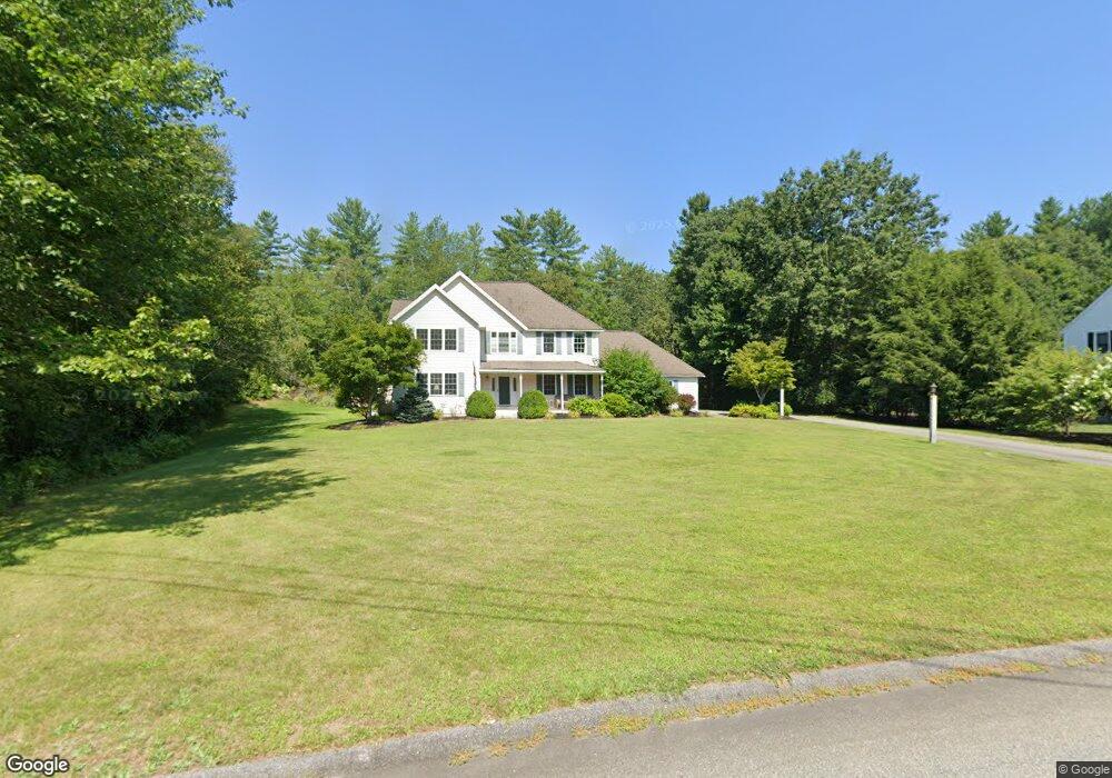
18 Swallow Dr Hollis, NH 03049
Hollis NeighborhoodEstimated Value: $702,000 - $1,030,000
4
Beds
3
Baths
2,726
Sq Ft
$316/Sq Ft
Est. Value
About This Home
This home is located at 18 Swallow Dr, Hollis, NH 03049 and is currently estimated at $861,513, approximately $316 per square foot. 18 Swallow Dr is a home with nearby schools including Hollis Primary School, Hollis Upper Elementary School, and Hollis-Brookline Middle School.
Ownership History
Date
Name
Owned For
Owner Type
Purchase Details
Closed on
May 17, 2021
Sold by
Law Scott B and Law Abbie O
Bought by
Scott & Abbie Law Ret
Current Estimated Value
Purchase Details
Closed on
Aug 7, 2000
Sold by
Glendale Homes Inc
Bought by
Law Scott B and Law Abbie O
Home Financials for this Owner
Home Financials are based on the most recent Mortgage that was taken out on this home.
Original Mortgage
$171,000
Interest Rate
8.1%
Create a Home Valuation Report for This Property
The Home Valuation Report is an in-depth analysis detailing your home's value as well as a comparison with similar homes in the area
Home Values in the Area
Average Home Value in this Area
Purchase History
| Date | Buyer | Sale Price | Title Company |
|---|---|---|---|
| Scott & Abbie Law Ret | -- | None Available | |
| Law Scott B | $321,100 | -- |
Source: Public Records
Mortgage History
| Date | Status | Borrower | Loan Amount |
|---|---|---|---|
| Previous Owner | Law Scott B | $138,056 | |
| Previous Owner | Law Scott B | $153,000 | |
| Previous Owner | Law Scott B | $171,000 |
Source: Public Records
Tax History Compared to Growth
Tax History
| Year | Tax Paid | Tax Assessment Tax Assessment Total Assessment is a certain percentage of the fair market value that is determined by local assessors to be the total taxable value of land and additions on the property. | Land | Improvement |
|---|---|---|---|---|
| 2024 | $12,845 | $724,500 | $267,000 | $457,500 |
| 2023 | $12,070 | $724,500 | $267,000 | $457,500 |
| 2022 | $16,352 | $724,500 | $267,000 | $457,500 |
| 2021 | $10,444 | $460,100 | $171,100 | $289,000 |
| 2020 | $10,593 | $457,000 | $171,100 | $285,900 |
| 2019 | $10,557 | $457,000 | $171,100 | $285,900 |
| 2018 | $9,552 | $457,000 | $171,100 | $285,900 |
| 2017 | $9,610 | $415,100 | $146,500 | $268,600 |
| 2016 | $9,726 | $415,100 | $146,500 | $268,600 |
| 2015 | $9,556 | $415,100 | $146,500 | $268,600 |
| 2014 | $9,601 | $415,100 | $146,500 | $268,600 |
| 2013 | $9,397 | $411,800 | $146,500 | $265,300 |
Source: Public Records
Map
Nearby Homes
- 77 Mooar Hill Rd
- 75 Deerwood Dr Unit B
- 5 Dumaine Ave Unit B
- 5 Dumaine Ave Unit N
- 3 Roedean Dr Unit C-207
- 201 Millwright Dr
- 4-13 Woodmont Dr
- 199 Pine Hill Rd
- 36 Hampton Dr
- 26 Andover Down Unit 276
- 5 Chatfield Dr Unit U18
- 40-40A Pine Hill Rd
- 10 Drouin Way
- 3 Cranleigh Mews Unit U297
- 25 Eastern Ave
- 102 Silver Lake Rd
- 334 Broad St
- 118 Broad St
- 2 Broadcrest Ln
- 15 Four Winds Rd