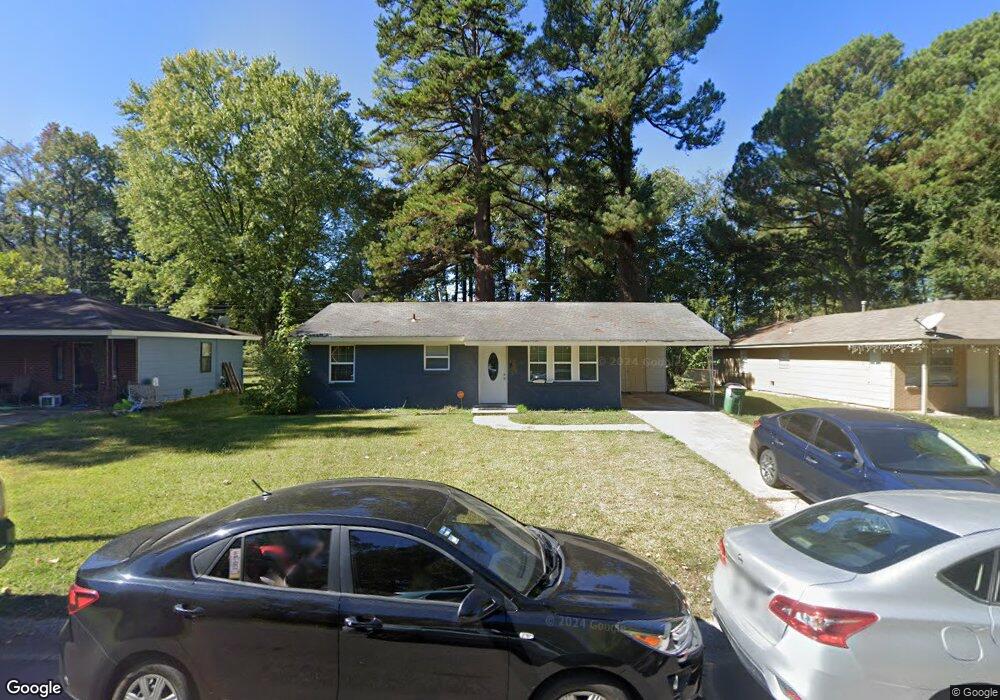
18 Yorkton Dr Little Rock, AR 72209
Chicot West NeighborhoodEstimated Value: $125,196 - $144,000
4
Beds
2
Baths
1,608
Sq Ft
$84/Sq Ft
Est. Value
About This Home
This home is located at 18 Yorkton Dr, Little Rock, AR 72209 and is currently estimated at $134,299, approximately $83 per square foot. 18 Yorkton Dr is a home located in Pulaski County with nearby schools including Mabelvale Elementary School, Mabelvale Middle School, and Little Rock Southwest High School.
Ownership History
Date
Name
Owned For
Owner Type
Purchase Details
Closed on
Mar 29, 2018
Sold by
Coleman Vines And Associates Llc
Bought by
Swlr Properties Llc
Current Estimated Value
Purchase Details
Closed on
Mar 8, 2006
Sold by
Hud
Bought by
Coleman Vines & Associates Llc
Home Financials for this Owner
Home Financials are based on the most recent Mortgage that was taken out on this home.
Original Mortgage
$61,600
Interest Rate
6.09%
Mortgage Type
Purchase Money Mortgage
Purchase Details
Closed on
Jul 29, 2005
Sold by
Midfirst Bank
Bought by
Hud
Create a Home Valuation Report for This Property
The Home Valuation Report is an in-depth analysis detailing your home's value as well as a comparison with similar homes in the area
Home Values in the Area
Average Home Value in this Area
Purchase History
| Date | Buyer | Sale Price | Title Company |
|---|---|---|---|
| Swlr Properties Llc | $24,500 | Commerce Title & Closing Ser | |
| Coleman Vines & Associates Llc | -- | Three Rivers Title Svcs Inc | |
| Hud | -- | -- |
Source: Public Records
Mortgage History
| Date | Status | Borrower | Loan Amount |
|---|---|---|---|
| Previous Owner | Coleman Vines & Associates Llc | $61,600 |
Source: Public Records
Tax History Compared to Growth
Tax History
| Year | Tax Paid | Tax Assessment Tax Assessment Total Assessment is a certain percentage of the fair market value that is determined by local assessors to be the total taxable value of land and additions on the property. | Land | Improvement |
|---|---|---|---|---|
| 2025 | $1,234 | $17,622 | $1,000 | $16,622 |
| 2024 | $1,218 | $17,622 | $1,000 | $16,622 |
| 2023 | $1,218 | $17,622 | $1,000 | $16,622 |
| 2022 | $1,117 | $17,622 | $1,000 | $16,622 |
| 2021 | $1,022 | $14,500 | $800 | $13,700 |
| 2020 | $1,015 | $14,500 | $800 | $13,700 |
| 2019 | $1,015 | $14,500 | $800 | $13,700 |
| 2018 | $1,015 | $14,500 | $800 | $13,700 |
| 2017 | $969 | $14,500 | $800 | $13,700 |
| 2016 | $881 | $12,580 | $1,920 | $10,660 |
| 2015 | $882 | $12,580 | $1,920 | $10,660 |
| 2014 | $882 | $12,580 | $1,920 | $10,660 |
Source: Public Records
Map
Nearby Homes
- 9108 Tedburn Cir
- 9119 Tedburn Cir
- 9115 Merrivale Dr
- 9520 Wilderness Rd
- 14301 Mann Rd
- 10325 Interstate 30 Unit I-30
- 16 Terrace Place
- 9619 Southwest Dr
- 8523 Mabelvale Pike
- 8715 Winston Dr
- 7920 Burnelle Dr
- 8712 Herrick Ln
- 6917 Baseline Rd
- 10200 Whispering Pine Dr
- 7710 Bradley Dr
- 0000 Mabelvale Pike
- 3 Renee Cove
- 9824 Chicot Rd
- 10404 Milkyway Dr
- 7808 Mcdaniel Dr