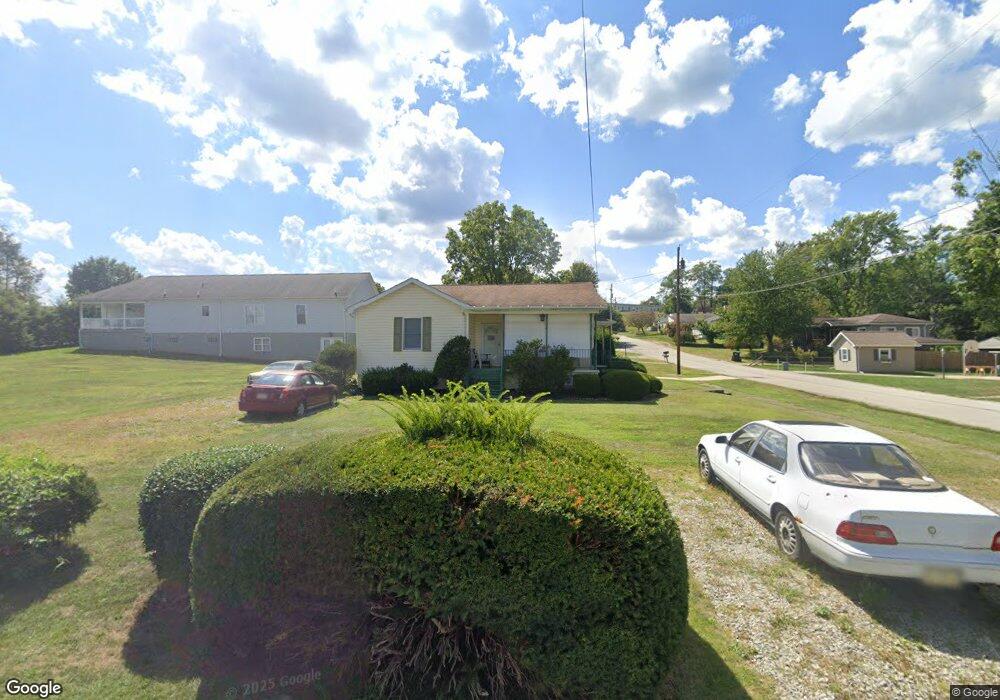
180 Brinker St Latrobe, PA 15650
Estimated Value: $59,669 - $211,000
2
Beds
1
Bath
--
Sq Ft
9,627
Sq Ft Lot
About This Home
This home is located at 180 Brinker St, Latrobe, PA 15650 and is currently estimated at $143,917. 180 Brinker St is a home located in Westmoreland County with nearby schools including Grandview Elementary, Derry Area Middle School, and Derry Area Senior High School.
Ownership History
Date
Name
Owned For
Owner Type
Purchase Details
Closed on
Sep 12, 2022
Sold by
Hill Jr Michael J
Bought by
Rosalie Jane Bell Of The Township Of Hempfiel
Current Estimated Value
Home Financials for this Owner
Home Financials are based on the most recent Mortgage that was taken out on this home.
Original Mortgage
$70,000
Outstanding Balance
$66,861
Interest Rate
5.22%
Mortgage Type
New Conventional
Estimated Equity
$77,056
Purchase Details
Closed on
Dec 20, 2010
Sold by
Hacker Raymond J and Hacker Raymond J
Bought by
Hill Michael J
Home Financials for this Owner
Home Financials are based on the most recent Mortgage that was taken out on this home.
Original Mortgage
$86,708
Interest Rate
4.37%
Mortgage Type
FHA
Purchase Details
Closed on
Jun 1, 2002
Sold by
Hacker John R
Bought by
Hacker Raymond J and Hacker Andrea M
Create a Home Valuation Report for This Property
The Home Valuation Report is an in-depth analysis detailing your home's value as well as a comparison with similar homes in the area
Home Values in the Area
Average Home Value in this Area
Purchase History
| Date | Buyer | Sale Price | Title Company |
|---|---|---|---|
| Rosalie Jane Bell Of The Township Of Hempfiel | $100,000 | -- | |
| Hill Michael J | $89,000 | None Available | |
| Hacker Raymond J | -- | -- |
Source: Public Records
Mortgage History
| Date | Status | Borrower | Loan Amount |
|---|---|---|---|
| Open | Rosalie Jane Bell Of The Township Of Hempfiel | $70,000 | |
| Closed | Hill Michael J | $86,708 |
Source: Public Records
Tax History Compared to Growth
Tax History
| Year | Tax Paid | Tax Assessment Tax Assessment Total Assessment is a certain percentage of the fair market value that is determined by local assessors to be the total taxable value of land and additions on the property. | Land | Improvement |
|---|---|---|---|---|
| 2025 | $1,612 | $12,970 | $2,300 | $10,670 |
| 2024 | $1,612 | $12,970 | $2,300 | $10,670 |
| 2023 | $1,521 | $12,970 | $2,300 | $10,670 |
| 2022 | $1,508 | $12,970 | $2,300 | $10,670 |
| 2021 | $1,508 | $12,970 | $2,300 | $10,670 |
| 2020 | $1,482 | $12,970 | $2,300 | $10,670 |
| 2019 | $1,450 | $12,970 | $2,300 | $10,670 |
| 2018 | $1,385 | $12,970 | $2,300 | $10,670 |
| 2017 | $1,349 | $12,970 | $2,300 | $10,670 |
| 2016 | $1,290 | $12,970 | $2,300 | $10,670 |
| 2015 | $1,290 | $12,970 | $2,300 | $10,670 |
| 2014 | $1,290 | $12,970 | $2,300 | $10,670 |
Source: Public Records
Map
Nearby Homes
- 332 Richmond St
- 1306 Spring St
- 1116 Saint Clair St
- 2101 Walnut Dr
- 1908 Walnut Dr
- 1 Bankie Dr
- 934 Wood St
- 108 Pandora Rd
- 704 Abbott St
- 408 Highview St
- 2023 Sylvan Ave
- 721 Lehmer St
- 1715 Sloan Ave
- 1710 Raymond Ave
- 701 Fairmont St
- 1748 Dailey Ave
- 1505 Raymond Ave
- 498 Sunview Cir
- 1607 Ligonier St
- 209 Gertrude St