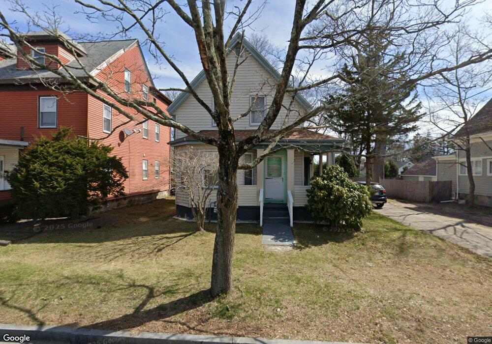
180 Copeland St Brockton, MA 02301
Campello NeighborhoodEstimated Value: $451,188 - $494,000
3
Beds
1
Bath
1,148
Sq Ft
$412/Sq Ft
Est. Value
About This Home
This home is located at 180 Copeland St, Brockton, MA 02301 and is currently estimated at $473,297, approximately $412 per square foot. 180 Copeland St is a home located in Plymouth County with nearby schools including John F. Kennedy Elementary School, Davis K-8 School, and South Middle School.
Ownership History
Date
Name
Owned For
Owner Type
Purchase Details
Closed on
Aug 31, 2001
Sold by
Brugliera Michael A and Moyes Ian M
Bought by
Fleuriot Barnave and Chapron Ginette A
Current Estimated Value
Purchase Details
Closed on
Jun 27, 1988
Sold by
Brugliera Ernest M
Bought by
Brugliera Michael A
Create a Home Valuation Report for This Property
The Home Valuation Report is an in-depth analysis detailing your home's value as well as a comparison with similar homes in the area
Home Values in the Area
Average Home Value in this Area
Purchase History
| Date | Buyer | Sale Price | Title Company |
|---|---|---|---|
| Fleuriot Barnave | $172,500 | -- | |
| Brugliera Michael A | $33,000 | -- |
Source: Public Records
Mortgage History
| Date | Status | Borrower | Loan Amount |
|---|---|---|---|
| Open | Brugliera Michael A | $215,000 | |
| Closed | Brugliera Michael A | $204,000 | |
| Closed | Brugliera Michael A | $15,000 | |
| Closed | Brugliera Michael A | $170,000 |
Source: Public Records
Tax History Compared to Growth
Tax History
| Year | Tax Paid | Tax Assessment Tax Assessment Total Assessment is a certain percentage of the fair market value that is determined by local assessors to be the total taxable value of land and additions on the property. | Land | Improvement |
|---|---|---|---|---|
| 2025 | $4,532 | $374,200 | $136,400 | $237,800 |
| 2024 | $4,292 | $357,100 | $136,400 | $220,700 |
| 2023 | $4,460 | $343,600 | $102,000 | $241,600 |
| 2022 | $3,942 | $282,200 | $92,600 | $189,600 |
| 2021 | $3,744 | $258,200 | $76,500 | $181,700 |
| 2020 | $3,556 | $234,700 | $72,100 | $162,600 |
| 2019 | $3,459 | $222,600 | $69,800 | $152,800 |
| 2018 | $6,730 | $194,200 | $69,800 | $124,400 |
| 2017 | $3,101 | $192,600 | $69,800 | $122,800 |
| 2016 | $2,640 | $152,100 | $67,600 | $84,500 |
| 2015 | $2,432 | $134,000 | $67,600 | $66,400 |
| 2014 | $2,477 | $136,600 | $67,600 | $69,000 |
Source: Public Records
Map
Nearby Homes
- 47 Southworth St
- 115 Market St
- 35 Longworth Ave Unit 17
- 358 Copeland St
- 15 Longworth Ave Unit 231
- 65 Tremont St
- 137 Channing Ave
- 977 Warren Ave
- 223 Clinton St Unit 10
- 223 Clinton St Unit 3
- 13 Finny's Way
- 176 Ettrick St
- 936 Warren Ave
- 15 Fieldstone Dr
- 163 S Leyden St
- 153 Bouve Ave
- 37 Menlo Ave
- 56 Cottage Grove Ave
- 1036 Ash St
- 103 Clinton St
- 182 Copeland St
- 172 Copeland St
- 56 Cushing Ave
- 186 Copeland St
- 54 Cushing Ave
- 157 Brookside Ave
- 160 Copeland St
- 192 Copeland St
- 167 Copeland St
- 46 Cushing Ave
- 187 Copeland St
- 181 Copeland St
- 55 Cushing Ave
- 55 Cushing Ave Unit 1
- 153 Brookside Ave
- 154 Copeland St
- 47 Cushing Ave
- 191 Copeland St
- 42 Cushing Ave
- 163 Copeland St