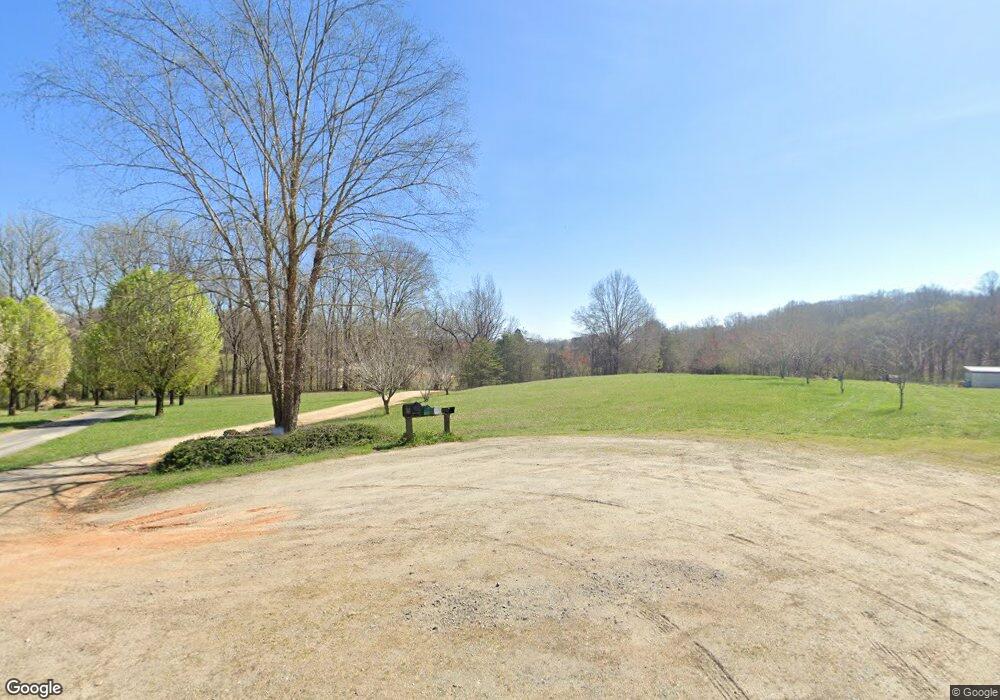
180 Hanford Rd Troutman, NC 28166
Estimated Value: $331,000 - $417,000
4
Beds
2
Baths
2,044
Sq Ft
$181/Sq Ft
Est. Value
About This Home
This home is located at 180 Hanford Rd, Troutman, NC 28166 and is currently estimated at $370,744, approximately $181 per square foot. 180 Hanford Rd is a home located in Iredell County with nearby schools including Shepherd Elementary School, Troutman Middle School, and South Iredell High School.
Ownership History
Date
Name
Owned For
Owner Type
Purchase Details
Closed on
Jul 1, 2010
Sold by
Ellis Melissa Anne
Bought by
Brettin Scott D and Ellis Melissa Anne
Current Estimated Value
Purchase Details
Closed on
Jun 29, 2004
Sold by
Deutsche Bank National Trust Co
Bought by
Ellis Melissa Anne
Purchase Details
Closed on
Sep 29, 2003
Sold by
Harris Herbert and Harris Carollyn M
Bought by
Deutsche Bank National Trust Co and Indymac Bank Fsb
Purchase Details
Closed on
May 1, 1996
Create a Home Valuation Report for This Property
The Home Valuation Report is an in-depth analysis detailing your home's value as well as a comparison with similar homes in the area
Home Values in the Area
Average Home Value in this Area
Purchase History
| Date | Buyer | Sale Price | Title Company |
|---|---|---|---|
| Brettin Scott D | -- | None Available | |
| Ellis Melissa Anne | -- | -- | |
| Deutsche Bank National Trust Co | $90,270 | -- | |
| -- | -- | -- |
Source: Public Records
Tax History Compared to Growth
Tax History
| Year | Tax Paid | Tax Assessment Tax Assessment Total Assessment is a certain percentage of the fair market value that is determined by local assessors to be the total taxable value of land and additions on the property. | Land | Improvement |
|---|---|---|---|---|
| 2024 | $1,394 | $226,110 | $18,180 | $207,930 |
| 2023 | $1,394 | $226,110 | $18,180 | $207,930 |
| 2022 | $1,157 | $174,820 | $13,640 | $161,180 |
| 2021 | $1,153 | $174,820 | $13,640 | $161,180 |
| 2020 | $1,153 | $174,820 | $13,640 | $161,180 |
| 2019 | $1,136 | $174,820 | $13,640 | $161,180 |
| 2018 | $992 | $157,290 | $12,880 | $144,410 |
| 2017 | $992 | $157,290 | $12,880 | $144,410 |
| 2016 | $920 | $145,250 | $12,880 | $132,370 |
| 2015 | $848 | $133,210 | $12,880 | $120,330 |
| 2014 | $830 | $140,150 | $12,880 | $127,270 |
Source: Public Records
Map
Nearby Homes
- 200 Weatherstone Ranch Trail
- 154 Winford Rd
- 279 Winford Rd
- 286 Winford Rd
- 294 Winford Rd
- 515 Brawley Rd
- 232 Sugar Hill Rd
- 212 Sugar Hill Rd
- Wagner Plan at Wheatfield Estates
- Declan Plan at Wheatfield Estates
- Huntley Plan at Wheatfield Estates
- Riley Plan at Wheatfield Estates
- Lenox Plan at Wheatfield Estates
- Herald Plan at Wheatfield Estates
- Vale Plan at Wheatfield Estates
- Jasper Plan at Wheatfield Estates
- Wakefield Plan at Wheatfield Estates
- Charlotte Plan at Wheatfield Estates
- Kipling Plan at Wheatfield Estates
- Bayside Plan at Wheatfield Estates
- 176 Hanford Rd
- 165 Rebekah Ln
- 172 Hanford Rd
- 174 Hanford Rd
- 170 Hanford Rd
- 161 Rebekah Ln
- 157 Rebekah Ln
- 144 Hanford Rd
- 154 Passing Wind Dr
- 143 Rebekah Ln
- 125 Rebekah Ln
- 159 Davis Trail Ln
- 131 Hanford Rd
- 150 Passing Wind Dr
- 153 Davis Trail Ln
- 109 Rebekah Ln
- 137 Davis Trail Ln
- 110 Hanford Rd
- 104 Single Oak Dr
- 00 Weathers Creek Rd
