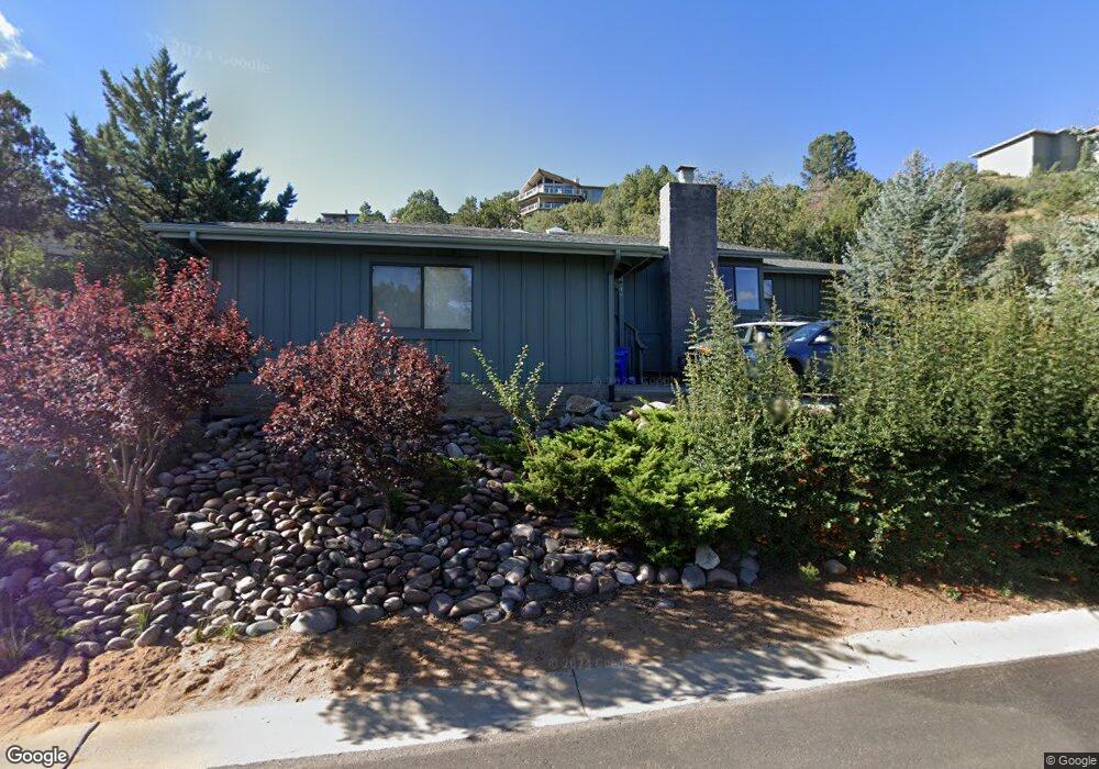
180 High Chaparral Unit 8 Prescott, AZ 86303
Hidden Valley Ranch NeighborhoodEstimated Value: $537,410 - $617,000
3
Beds
2
Baths
1,886
Sq Ft
$316/Sq Ft
Est. Value
About This Home
This home is located at 180 High Chaparral Unit 8, Prescott, AZ 86303 and is currently estimated at $596,353, approximately $316 per square foot. 180 High Chaparral Unit 8 is a home located in Yavapai County with nearby schools including Lincoln Elementary School, Granite Mountain Middle School, and Prescott Mile High Middle School.
Ownership History
Date
Name
Owned For
Owner Type
Purchase Details
Closed on
Dec 30, 2020
Sold by
Marton Linda L and 2013 Linda L
Bought by
Lefkowitz Marc
Current Estimated Value
Home Financials for this Owner
Home Financials are based on the most recent Mortgage that was taken out on this home.
Original Mortgage
$351,000
Outstanding Balance
$313,214
Interest Rate
2.7%
Mortgage Type
New Conventional
Estimated Equity
$283,139
Purchase Details
Closed on
Dec 23, 2013
Sold by
Buxton Sally
Bought by
Marton Linda L
Purchase Details
Closed on
Sep 7, 2012
Sold by
Buxton Sally
Bought by
Buxton Sally
Home Financials for this Owner
Home Financials are based on the most recent Mortgage that was taken out on this home.
Original Mortgage
$272,200
Interest Rate
3.5%
Mortgage Type
New Conventional
Purchase Details
Closed on
Nov 5, 2009
Sold by
Buxton Sally
Bought by
Buxton Sally
Purchase Details
Closed on
Mar 8, 2007
Sold by
Donaldson Robert G and Donaldson Carol S
Bought by
Buxton Sally
Home Financials for this Owner
Home Financials are based on the most recent Mortgage that was taken out on this home.
Original Mortgage
$279,750
Interest Rate
6.2%
Mortgage Type
New Conventional
Purchase Details
Closed on
Apr 5, 2006
Sold by
Donaldson Robert G and Donaldson Carol Sue
Bought by
Donaldson Robert G and Donaldson Carol S
Purchase Details
Closed on
Nov 14, 2003
Sold by
Mcnamara Kathleen
Bought by
Donaldson Robert G and Donaldson Carol Sue
Home Financials for this Owner
Home Financials are based on the most recent Mortgage that was taken out on this home.
Original Mortgage
$145,000
Interest Rate
5.37%
Mortgage Type
New Conventional
Purchase Details
Closed on
Jul 25, 2000
Sold by
Wardell Richard R and Wardell Betty Lou
Bought by
Smith Harold L and Mcnamara Kathleen
Home Financials for this Owner
Home Financials are based on the most recent Mortgage that was taken out on this home.
Original Mortgage
$150,000
Interest Rate
8.15%
Mortgage Type
Seller Take Back
Purchase Details
Closed on
Jan 27, 1997
Sold by
Benson Richard L and Benson June F
Bought by
Wardell Richard R and Wardell Betty Lou
Home Financials for this Owner
Home Financials are based on the most recent Mortgage that was taken out on this home.
Original Mortgage
$115,000
Interest Rate
7.62%
Mortgage Type
New Conventional
Purchase Details
Closed on
Jan 4, 1996
Sold by
Benson Richard L and Benson June F
Bought by
Benson Richard L and Benson June F
Create a Home Valuation Report for This Property
The Home Valuation Report is an in-depth analysis detailing your home's value as well as a comparison with similar homes in the area
Home Values in the Area
Average Home Value in this Area
Purchase History
| Date | Buyer | Sale Price | Title Company |
|---|---|---|---|
| Lefkowitz Marc | $390,000 | Lawyers Title | |
| Marton Linda L | $298,000 | Lawyers Title Yavapai-Coconi | |
| Buxton Sally | -- | Security Title Agency | |
| Buxton Sally | -- | Security Title Agency | |
| Buxton Sally | -- | None Available | |
| Buxton Sally | $373,000 | First American Title Ins Co | |
| Donaldson Robert G | -- | None Available | |
| Donaldson Robert G | $245,800 | Yavapai Title Agency | |
| Smith Harold L | $195,000 | Transnation Title Insurance | |
| Wardell Richard R | $190,000 | First American Title Ins | |
| Benson Richard L | -- | -- |
Source: Public Records
Mortgage History
| Date | Status | Borrower | Loan Amount |
|---|---|---|---|
| Open | Lefkowitz Marc | $351,000 | |
| Previous Owner | Buxton Sally | $272,200 | |
| Previous Owner | Buxton Sally | $279,750 | |
| Previous Owner | Donaldson Robert G | $145,000 | |
| Previous Owner | Smith Harold L | $150,000 | |
| Previous Owner | Wardell Richard R | $115,000 |
Source: Public Records
Tax History Compared to Growth
Tax History
| Year | Tax Paid | Tax Assessment Tax Assessment Total Assessment is a certain percentage of the fair market value that is determined by local assessors to be the total taxable value of land and additions on the property. | Land | Improvement |
|---|---|---|---|---|
| 2026 | $1,384 | $40,139 | -- | -- |
| 2024 | $1,336 | $40,206 | -- | -- |
| 2023 | $1,355 | $33,557 | $0 | $0 |
| 2022 | $1,336 | $28,527 | $5,460 | $23,067 |
| 2021 | $1,434 | $27,946 | $4,747 | $23,199 |
| 2020 | $1,703 | $0 | $0 | $0 |
| 2019 | $1,681 | $0 | $0 | $0 |
| 2018 | $1,622 | $0 | $0 | $0 |
| 2017 | $1,547 | $0 | $0 | $0 |
| 2016 | $1,557 | $0 | $0 | $0 |
| 2015 | -- | $0 | $0 | $0 |
| 2014 | -- | $0 | $0 | $0 |
Source: Public Records
Map
Nearby Homes
- 925 Northwood Loop Unit 130
- 925 Northwood Loop
- 245 High Chaparral
- 305 High Chaparral Loop
- 1140 Gambel Oak Trail
- 110 High Chaparral
- 1165 Gambel Oak Trail
- 1145 Northwood Loop
- 605 Haisley Rd
- 700 Haisley Rd
- 430 High Chaparral Loop
- 845 S Granite St
- 749 S Montezuma St
- 245 Summit Pointe Dr
- 210 Partridge Ln
- 355 Long Branch W
- 285 Crestwood E
- 164 Summit Pointe Dr
- 1120 Tanglewood Rd
- 829 Alpha Ln Unit 13
- 180 High Chaparral
- 170 High Chaparral
- 190 High Chaparral
- 160 High Chaparral
- 185 High Chaparral
- 195 High Chaparral
- 200 High Chaparral
- 175 High Chaparral
- 165 High Chaparral
- 250 Long Branch E
- 205 High Chaparral
- 240 Long Branch E
- 155 High Chaparral
- 220 Long Branch E
- 230 Long Branch E
- 150 High Chaparral
- 150 High Chaparral Unit 8
- 875 Northwood Loop
- 885 Northwood Loop
- 260 Long Branch E