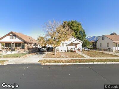
180 W 700 N Spanish Fork, UT 84660
Estimated Value: $374,000 - $409,226
3
Beds
2
Baths
1,576
Sq Ft
$246/Sq Ft
Est. Value
About This Home
This home is located at 180 W 700 N, Spanish Fork, UT 84660 and is currently estimated at $387,557, approximately $245 per square foot. 180 W 700 N is a home located in Utah County with nearby schools including Brockbank Elementary School, Spanish Fork Jr High School, and Spanish Fork High School.
Ownership History
Date
Name
Owned For
Owner Type
Purchase Details
Closed on
May 7, 2015
Sold by
Armistead Joseph A
Bought by
Armistead Joseph A and Armistead Erin K
Current Estimated Value
Home Financials for this Owner
Home Financials are based on the most recent Mortgage that was taken out on this home.
Original Mortgage
$138,871
Outstanding Balance
$109,239
Interest Rate
3.63%
Mortgage Type
VA
Estimated Equity
$274,433
Purchase Details
Closed on
Jul 23, 2014
Sold by
Gilner Gerald L
Bought by
Armistead Joseph A
Home Financials for this Owner
Home Financials are based on the most recent Mortgage that was taken out on this home.
Original Mortgage
$139,900
Interest Rate
4.12%
Mortgage Type
VA
Purchase Details
Closed on
Jul 16, 2008
Sold by
Gilner Gerald L
Bought by
Gilner Gerald L
Purchase Details
Closed on
Oct 7, 2005
Sold by
Mccausland Calvin W and Skinner Marlene M
Bought by
Gilner Gerald L
Home Financials for this Owner
Home Financials are based on the most recent Mortgage that was taken out on this home.
Original Mortgage
$99,200
Interest Rate
5.63%
Mortgage Type
Fannie Mae Freddie Mac
Purchase Details
Closed on
Jul 17, 1996
Sold by
Mccausland William A and Ardena Mccausland N
Bought by
Mccausland William A and Mccausland Ardena S
Create a Home Valuation Report for This Property
The Home Valuation Report is an in-depth analysis detailing your home's value as well as a comparison with similar homes in the area
Home Values in the Area
Average Home Value in this Area
Purchase History
| Date | Buyer | Sale Price | Title Company |
|---|---|---|---|
| Armistead Joseph A | -- | Highland Title | |
| Armistead Joseph A | -- | Cottonwood Title Ins Agency | |
| Gilner Gerald L | -- | None Available | |
| Gilner Gerald L | -- | Title West Title Company | |
| Mccausland William A | -- | -- |
Source: Public Records
Mortgage History
| Date | Status | Borrower | Loan Amount |
|---|---|---|---|
| Open | Armitstead Joseph A | $50,000 | |
| Open | Armistead Joseph A | $138,871 | |
| Closed | Armistead Joseph A | $139,900 | |
| Previous Owner | Gilner Gerald L | $99,200 |
Source: Public Records
Tax History Compared to Growth
Tax History
| Year | Tax Paid | Tax Assessment Tax Assessment Total Assessment is a certain percentage of the fair market value that is determined by local assessors to be the total taxable value of land and additions on the property. | Land | Improvement |
|---|---|---|---|---|
| 2024 | $1,798 | $184,690 | $0 | $0 |
| 2023 | $1,839 | $185,570 | $0 | $0 |
| 2022 | $1,839 | $186,120 | $0 | $0 |
| 2021 | $1,574 | $254,900 | $84,200 | $170,700 |
| 2020 | $1,231 | $224,000 | $70,200 | $153,800 |
| 2019 | $1,231 | $203,900 | $70,200 | $133,700 |
| 2018 | $1,165 | $186,500 | $70,200 | $116,300 |
| 2017 | $1,019 | $87,670 | $0 | $0 |
| 2016 | $0 | $76,120 | $0 | $0 |
| 2015 | -- | $70,015 | $0 | $0 |
| 2014 | $827 | $69,630 | $0 | $0 |
Source: Public Records
Map
Nearby Homes
- 691 N 300 W
- 687 N Main St
- 145 W 500 N
- 900 N 200 St W
- 55 E 700 N
- 727 N Mitchell Dr
- 380 N 100 W
- 1640 N 300 W
- 390 N 100 E
- 279 N 200 W
- 230 E 800 N
- 294 W 200 N
- 284 E 800 N Unit 142
- 288 E 800 N Unit 144
- 330 E 700 N
- 134 N 300 W
- 314 E 1000 N
- 1815 N 630 St W Unit 67
- 1841 N 630 St W Unit 71
- 1828 N 630 St W Unit 100