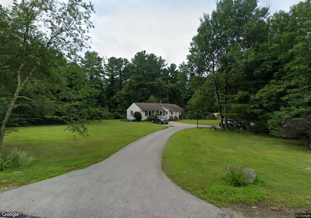
180 West St Douglas, MA 01516
Estimated Value: $461,000 - $551,000
2
Beds
1
Bath
1,328
Sq Ft
$383/Sq Ft
Est. Value
About This Home
This home is located at 180 West St, Douglas, MA 01516 and is currently estimated at $508,355, approximately $382 per square foot. 180 West St is a home located in Worcester County with nearby schools including Douglas Primary School, Douglas Middle School, and Douglas High School.
Ownership History
Date
Name
Owned For
Owner Type
Purchase Details
Closed on
Nov 7, 2014
Sold by
Demery Steven M
Bought by
Richards Jeffrey L and Richards Jennifer
Current Estimated Value
Home Financials for this Owner
Home Financials are based on the most recent Mortgage that was taken out on this home.
Original Mortgage
$219,780
Outstanding Balance
$172,890
Interest Rate
4.75%
Mortgage Type
FHA
Estimated Equity
$335,465
Purchase Details
Closed on
Jun 23, 2008
Sold by
Crockett Beverley E and Mackay Eugene B
Bought by
Demery Steven M
Home Financials for this Owner
Home Financials are based on the most recent Mortgage that was taken out on this home.
Original Mortgage
$216,601
Interest Rate
6.1%
Mortgage Type
Purchase Money Mortgage
Purchase Details
Closed on
Jan 30, 2004
Sold by
Crockett Beverly E
Bought by
Bombara John and Bombara Marietta
Create a Home Valuation Report for This Property
The Home Valuation Report is an in-depth analysis detailing your home's value as well as a comparison with similar homes in the area
Home Values in the Area
Average Home Value in this Area
Purchase History
| Date | Buyer | Sale Price | Title Company |
|---|---|---|---|
| Richards Jeffrey L | $226,000 | -- | |
| Demery Steven M | $220,000 | -- | |
| Bombara John | $125,000 | -- |
Source: Public Records
Mortgage History
| Date | Status | Borrower | Loan Amount |
|---|---|---|---|
| Open | Richards Jeffrey L | $219,780 | |
| Previous Owner | Demery Steven M | $216,601 |
Source: Public Records
Tax History Compared to Growth
Tax History
| Year | Tax Paid | Tax Assessment Tax Assessment Total Assessment is a certain percentage of the fair market value that is determined by local assessors to be the total taxable value of land and additions on the property. | Land | Improvement |
|---|---|---|---|---|
| 2025 | $54 | $412,600 | $99,200 | $313,400 |
| 2024 | $5,343 | $395,200 | $90,200 | $305,000 |
| 2023 | $5,253 | $365,800 | $90,200 | $275,600 |
| 2022 | $5,150 | $315,200 | $83,400 | $231,800 |
| 2021 | $5,043 | $301,600 | $79,400 | $222,200 |
| 2020 | $4,904 | $290,500 | $79,400 | $211,100 |
| 2019 | $4,608 | $268,900 | $79,400 | $189,500 |
| 2018 | $4,201 | $261,400 | $79,400 | $182,000 |
| 2017 | $4,120 | $246,400 | $82,600 | $163,800 |
| 2016 | $4,013 | $238,600 | $82,600 | $156,000 |
| 2015 | $3,927 | $238,600 | $82,600 | $156,000 |
Source: Public Records
Map
Nearby Homes
- 223 West St
- 45 Douglas Hill Way
- 108 Mumford St
- 18 Mumford Rd
- 4 1st St
- 8A Whitins Rd
- 8 Whitins Rd Unit A
- 9 Church St
- 3 Ledge St
- 3 S East Main St
- Lot 27 Cedar St
- 19 Laurel Glades
- 0 Yew St White Ct (Lot 1) Unit 73304928
- 24 Cote Ln
- 189 Main St
- 13 Eagle Dr
- 10 Eagle Dr
- 5 B St
- 34R Tucker Ln
- 0 Yew St Unit 73304926
- 19 Conservation Dr
- 181 West St
- 176 West St
- 173 West St
- 48 1/2 E Charlton Rd
- 170 West St
- 2 Conservation Dr
- 7 Conservation Dr
- 169 West St
- 6 Conservation Dr
- 163 West St
- 13 Conservation Dr
- 164 West St
- 10 Conservation Dr
- 26 Conservation Dr
- 199 West St
- 14 Conservation Dr
- 17 Conservation Dr
- 18 Conservation Dr
- 2 Cross St