Estimated Value: $248,000 - $291,000
3
Beds
1
Bath
1,008
Sq Ft
$261/Sq Ft
Est. Value
About This Home
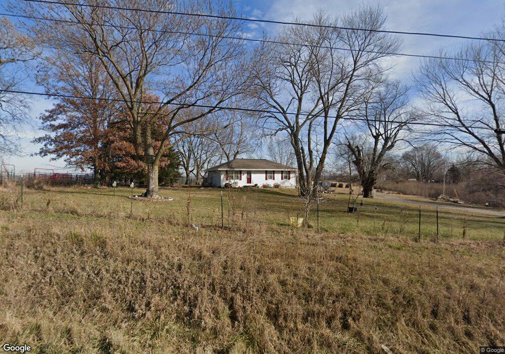
This home is located at 18005 State Route 33, Holt, MO 64048 and is currently estimated at $263,445, approximately $261 per square foot. 18005 State Route 33 is a home located in Clay County with nearby schools including Kearney Junior High School, Kearney High School, and Northern Hills Christian Academy.
Ownership History
Date
Name
Owned For
Owner Type
Purchase Details
Closed on
May 31, 2013
Sold by
Mallon David and Wilson Rachael
Bought by
Wilson Rachael
Current Estimated Value
Home Financials for this Owner
Home Financials are based on the most recent Mortgage that was taken out on this home.
Original Mortgage
$84,270
Outstanding Balance
$59,971
Interest Rate
3.5%
Mortgage Type
FHA
Estimated Equity
$203,474
Purchase Details
Closed on
Aug 24, 2009
Sold by
Secretary Of Housing & Urban Development
Bought by
Wilson Rachael
Home Financials for this Owner
Home Financials are based on the most recent Mortgage that was taken out on this home.
Original Mortgage
$81,400
Interest Rate
5.16%
Mortgage Type
FHA
Purchase Details
Closed on
Jul 21, 2003
Sold by
Clayton Douglas Milton and Clayton Rochelle
Bought by
Jones Ronald A and Jones Cynthia R
Home Financials for this Owner
Home Financials are based on the most recent Mortgage that was taken out on this home.
Original Mortgage
$98,455
Interest Rate
5.15%
Mortgage Type
FHA
Create a Home Valuation Report for This Property
The Home Valuation Report is an in-depth analysis detailing your home's value as well as a comparison with similar homes in the area
Home Values in the Area
Average Home Value in this Area
Purchase History
| Date | Buyer | Sale Price | Title Company |
|---|---|---|---|
| Wilson Rachael | -- | Clear Title Group | |
| Wilson Rachael | -- | First American Title Ins Co | |
| Jones Ronald A | -- | First Title Inc |
Source: Public Records
Mortgage History
| Date | Status | Borrower | Loan Amount |
|---|---|---|---|
| Open | Wilson Rachael | $84,270 | |
| Closed | Wilson Rachael | $81,400 | |
| Previous Owner | Jones Ronald A | $98,455 |
Source: Public Records
Tax History Compared to Growth
Tax History
| Year | Tax Paid | Tax Assessment Tax Assessment Total Assessment is a certain percentage of the fair market value that is determined by local assessors to be the total taxable value of land and additions on the property. | Land | Improvement |
|---|---|---|---|---|
| 2025 | $1,843 | $31,520 | -- | -- |
| 2024 | $1,843 | $27,440 | -- | -- |
| 2023 | $1,759 | $27,440 | $0 | $0 |
| 2022 | $1,373 | $20,980 | $0 | $0 |
| 2021 | $1,374 | $20,976 | $4,427 | $16,549 |
| 2020 | $1,380 | $19,510 | $0 | $0 |
| 2019 | $1,384 | $19,513 | $4,427 | $15,086 |
| 2018 | $1,381 | $18,910 | $0 | $0 |
| 2017 | $1,373 | $18,910 | $4,430 | $14,480 |
| 2016 | $1,373 | $18,910 | $4,430 | $14,480 |
| 2015 | $1,336 | $18,910 | $4,430 | $14,480 |
| 2014 | $1,288 | $18,150 | $4,430 | $13,720 |
Source: Public Records
Map
Nearby Homes
- 17017 NE 180th St
- 16806 NE 180th St
- 0 Lot 5 Arnold Park Lot N A Unit HMS2572371
- 0 Lot 3 Arnold Park Lot N A Unit HMS2572330
- 15806 NE 176th St
- 15404 NE 181st St
- Tract 2 Nation Rd
- TBD NE 188th St
- 16605 Cc Hwy
- Tbd Northeast 188th St
- TBD 188th Street N A
- 0 N Jefferson St Mo-33 Hwy Unit HMS2578203
- 14401 NE 188th St
- 19412 Shanks Rd
- 650 Cleveland St
- 16411 NE 162nd St
- 606 Water St
- 610 Waters St
- 18317 Plattsburg Rd
- 608 Woodson St
- 17016 NE 180th St
- 17220 NE 180th St
- 17008 NE 180th St
- 17009 NE 180th St
- 18100 State Route 33
- 17405 NE 180th St
- 17920 NE 180th St
- 16818 NE 180th St
- 16819 NE 180th St
- 17824 Thompson Rd
- 17812 State Route 33
- 17809 State Route 33
- 16809 NE 180th St
- 18215 State Route 33
- 17808 Thompson Rd
- 17923 Thompson Rd
- 16620 NE 180th St
- 17720 State Route 33
- 17811 Loop Rd
- 17903 Thompson Rd