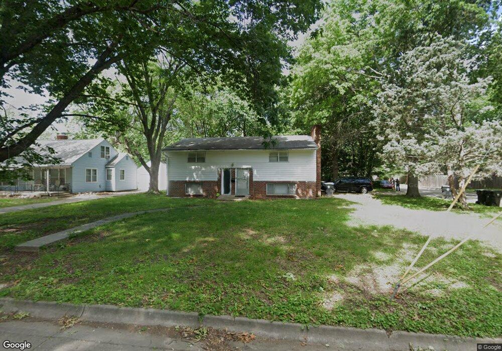
1801 SW High Ave Topeka, KS 66604
Central Topeka NeighborhoodEstimated Value: $144,000 - $198,000
4
Beds
2
Baths
912
Sq Ft
$180/Sq Ft
Est. Value
About This Home
This home is located at 1801 SW High Ave, Topeka, KS 66604 and is currently estimated at $164,404, approximately $180 per square foot. 1801 SW High Ave is a home located in Shawnee County with nearby schools including Buckeye Elementary School, Rosenwald Elementary School, and Martin Park Elementary School.
Ownership History
Date
Name
Owned For
Owner Type
Purchase Details
Closed on
Apr 29, 2025
Sold by
Lowry Glenna J and Lowry Stephen R
Bought by
Mariner Faamanuiaga T and Mariner Mary E
Current Estimated Value
Home Financials for this Owner
Home Financials are based on the most recent Mortgage that was taken out on this home.
Original Mortgage
$390,000
Outstanding Balance
$387,925
Interest Rate
6.67%
Mortgage Type
New Conventional
Estimated Equity
-$223,521
Purchase Details
Closed on
Aug 3, 2011
Sold by
Lowry Stephen R and Lowry Glenna J
Bought by
Lowry Stephen R and Lowry Glenna J
Home Financials for this Owner
Home Financials are based on the most recent Mortgage that was taken out on this home.
Original Mortgage
$408,000
Interest Rate
4.52%
Mortgage Type
Stand Alone Refi Refinance Of Original Loan
Create a Home Valuation Report for This Property
The Home Valuation Report is an in-depth analysis detailing your home's value as well as a comparison with similar homes in the area
Home Values in the Area
Average Home Value in this Area
Purchase History
| Date | Buyer | Sale Price | Title Company |
|---|---|---|---|
| Mariner Faamanuiaga T | -- | Lawyers Title Of Topeka | |
| Lowry Stephen R | -- | First American Title |
Source: Public Records
Mortgage History
| Date | Status | Borrower | Loan Amount |
|---|---|---|---|
| Open | Mariner Faamanuiaga T | $390,000 | |
| Previous Owner | Lowry Stephen R | $408,000 |
Source: Public Records
Tax History Compared to Growth
Tax History
| Year | Tax Paid | Tax Assessment Tax Assessment Total Assessment is a certain percentage of the fair market value that is determined by local assessors to be the total taxable value of land and additions on the property. | Land | Improvement |
|---|---|---|---|---|
| 2025 | $2,210 | $16,477 | -- | -- |
| 2023 | $2,210 | $14,951 | $0 | $0 |
| 2022 | $1,918 | $13,001 | $0 | $0 |
| 2021 | $1,764 | $11,305 | $0 | $0 |
| 2020 | $1,659 | $10,766 | $0 | $0 |
| 2019 | $1,635 | $10,555 | $0 | $0 |
| 2018 | $1,588 | $10,248 | $0 | $0 |
| 2017 | $1,559 | $10,046 | $0 | $0 |
| 2014 | $1,575 | $10,046 | $0 | $0 |
Source: Public Records
Map
Nearby Homes
- 1610 SW Plass Ave
- 1503 SW MacVicar Ave
- 1355 SW Medford Ave
- 1432 SW MacVicar Ave
- 1520 SW Oakley Ave
- 1421 SW Jewell Ave
- 3100 SW Canterbury Ln
- 1527 SW Mulvane St
- 1717 SW 15th St
- 2012 SW Westwood Dr
- 1501-1599 SW 17th St
- 2330 SW Wayne Ave
- 2400 SW 24th St
- 1327 SW College Ave
- 1500 SW Mulvane St
- 1647 SW 21st St
- 2516 SW Huntoon St
- 1531 SW 15th St
- 2812 SW Huntoon St
- 1556 SW 23rd St
- 1809 SW High Ave
- 2525 SW 18th St
- 1745 SW High Ave
- 1815 SW High Ave
- 1810 SW Medford Ave
- 1800 SW Medford Ave
- 1800 SW High Ave
- 1804 SW High Ave
- 1746 SW Medford Ave
- 1818 SW Medford Ave
- 1731 SW High Ave
- 1810 SW High Ave
- 1819 SW High Ave
- 1734 SW High Ave
- 1816 SW High Ave
- 1738 SW Medford Ave
- 1730 SW High Ave
- 1822 SW High Ave
- 1826 SW Medford Ave
- 1829 SW High Ave