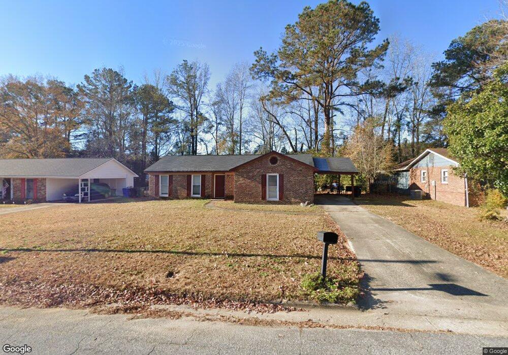
1802 Bunker Hill Rd Columbus, GA 31907
Eastern Columbus NeighborhoodEstimated Value: $138,000 - $152,000
3
Beds
3
Baths
1,267
Sq Ft
$113/Sq Ft
Est. Value
About This Home
This home is located at 1802 Bunker Hill Rd, Columbus, GA 31907 and is currently estimated at $143,201, approximately $113 per square foot. 1802 Bunker Hill Rd is a home located in Muscogee County with nearby schools including Dawson Elementary School, East Columbus Magnet Academy, and Spencer High School.
Ownership History
Date
Name
Owned For
Owner Type
Purchase Details
Closed on
Apr 11, 2025
Sold by
Mckee Keneshia M
Bought by
Kmi Homes Llc
Current Estimated Value
Home Financials for this Owner
Home Financials are based on the most recent Mortgage that was taken out on this home.
Original Mortgage
$93,100
Outstanding Balance
$92,686
Interest Rate
6.64%
Mortgage Type
New Conventional
Estimated Equity
$50,515
Create a Home Valuation Report for This Property
The Home Valuation Report is an in-depth analysis detailing your home's value as well as a comparison with similar homes in the area
Home Values in the Area
Average Home Value in this Area
Purchase History
| Date | Buyer | Sale Price | Title Company |
|---|---|---|---|
| Kmi Homes Llc | -- | None Listed On Document |
Source: Public Records
Mortgage History
| Date | Status | Borrower | Loan Amount |
|---|---|---|---|
| Open | Kmi Homes Llc | $93,100 |
Source: Public Records
Tax History Compared to Growth
Tax History
| Year | Tax Paid | Tax Assessment Tax Assessment Total Assessment is a certain percentage of the fair market value that is determined by local assessors to be the total taxable value of land and additions on the property. | Land | Improvement |
|---|---|---|---|---|
| 2025 | $1,632 | $41,696 | $12,396 | $29,300 |
| 2024 | $163 | $41,696 | $12,396 | $29,300 |
| 2023 | $1,642 | $41,696 | $12,396 | $29,300 |
| 2022 | $1,321 | $32,356 | $12,396 | $19,960 |
| 2021 | $1,247 | $30,548 | $12,396 | $18,152 |
| 2020 | $1,248 | $30,548 | $12,396 | $18,152 |
| 2019 | $1,252 | $30,548 | $12,396 | $18,152 |
| 2018 | $1,252 | $30,548 | $12,396 | $18,152 |
| 2017 | $1,256 | $30,548 | $12,396 | $18,152 |
| 2016 | $1,373 | $33,290 | $5,871 | $27,419 |
| 2015 | $1,375 | $33,290 | $5,871 | $27,419 |
| 2014 | $1,377 | $33,290 | $5,871 | $27,419 |
| 2013 | -- | $33,290 | $5,871 | $27,419 |
Source: Public Records
Map
Nearby Homes
- 5613 Quebec Dr
- 5644 Quebec Dr
- 5310 Stoney Point Rd
- 5664 St Marys Rd
- 1340 Bunker Ridge Ln
- 5728 Lexington Dr
- 1238 Brandywine Dr
- 1513 Alamo Dr
- 1210 Bunker Hill Rd
- 5336 Gettysburg Way
- 4462 Walking Stick Way
- 5219 Argonne Dr
- 5109 Lexington Ln
- 5090 Lexington Ln
- 4408 Walking Stick Way
- 849 Bunker Hill Rd
- 780 Honey Do Ct
- 4939 Aaron Dr
- 1025 Belmar St
- 1225 Rowell St
- 1808 Bunker Hill Rd
- 1756 Bunker Hill Rd
- 5541 Saratoga Dr
- 1814 Bunker Hill Rd
- 5545 Saratoga Dr
- 1750 Bunker Hill Rd
- 5549 Saratoga Dr
- 1805 Bunker Hill Rd
- 5537 Saratoga Dr
- 5602 Germantown Rd
- 1820 Bunker Hill Rd
- 1811 Bunker Hill Rd
- 1742 Bunker Hill Rd
- 5553 Saratoga Dr
- 1817 Bunker Hill Rd
- 5533 Saratoga Dr
- 1741 Bunker Hill Rd
- 1327 Trenton Ct
- 1828 Bunker Hill Rd
- 5557 Saratoga Dr