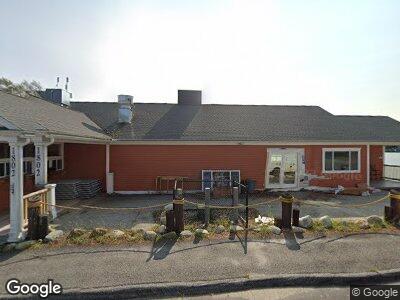
1802 Lewiston Rd Litchfield, ME 04350
Estimated Value: $434,262 - $460,000
--
Bed
--
Bath
1,742
Sq Ft
$254/Sq Ft
Est. Value
About This Home
This home is located at 1802 Lewiston Rd, Litchfield, ME 04350 and is currently estimated at $442,316, approximately $253 per square foot. 1802 Lewiston Rd is a home located in Kennebec County with nearby schools including Libby-Tozier School, Sabattus Primary School, and Carrie Ricker School.
Ownership History
Date
Name
Owned For
Owner Type
Purchase Details
Closed on
Aug 17, 2023
Sold by
Kuzzins Cove Llc
Bought by
Wood Brian and Wood Jennifer
Current Estimated Value
Purchase Details
Closed on
Oct 13, 2009
Sold by
Gary L Marsella Ent Inc
Bought by
Kuzzins Cove Llc
Create a Home Valuation Report for This Property
The Home Valuation Report is an in-depth analysis detailing your home's value as well as a comparison with similar homes in the area
Home Values in the Area
Average Home Value in this Area
Purchase History
| Date | Buyer | Sale Price | Title Company |
|---|---|---|---|
| Wood Brian | $400,000 | None Available | |
| Kuzzins Cove Llc | -- | -- |
Source: Public Records
Mortgage History
| Date | Status | Borrower | Loan Amount |
|---|---|---|---|
| Open | Wood Brian D | $250,000 |
Source: Public Records
Tax History Compared to Growth
Tax History
| Year | Tax Paid | Tax Assessment Tax Assessment Total Assessment is a certain percentage of the fair market value that is determined by local assessors to be the total taxable value of land and additions on the property. | Land | Improvement |
|---|---|---|---|---|
| 2024 | $4,691 | $329,200 | $149,200 | $180,000 |
| 2023 | $4,444 | $329,200 | $149,200 | $180,000 |
| 2022 | $6,494 | $413,100 | $124,400 | $288,700 |
| 2021 | $5,837 | $413,100 | $124,400 | $288,700 |
| 2020 | $5,866 | $413,100 | $124,400 | $288,700 |
| 2019 | $5,783 | $413,100 | $124,400 | $288,700 |
| 2018 | $3,979 | $246,362 | $87,600 | $158,762 |
| 2017 | $3,983 | $246,629 | $87,600 | $159,029 |
| 2016 | $2,585 | $160,057 | $75,600 | $84,457 |
| 2015 | $2,147 | $138,070 | $75,600 | $62,470 |
| 2014 | $1,561 | $109,571 | $75,600 | $33,971 |
| 2013 | $1,350 | $109,737 | $75,600 | $34,137 |
Source: Public Records
Map
Nearby Homes
- 69 Scott Dr
- 0 Rd Unit 1590643
- 0 Route 9-126 Litchfield Dr Unit 1604469
- 20 Lucien Ln
- 75 Grant Rd
- 47 Fickett Dr
- 86-A Kenway Dr
- 12 Cattail Ln
- 51 Forest Ln
- Lot 13A Ridley Ln
- 1363 Hallowell Rd
- 57 Nutting Ln
- 485 Peacepipe Dr Unit B
- 106 Frost Dr
- 2793 Hallowell Rd
- 64 Ferrin Rd
- 1-70 Maine 197
- 2 Warren Rd
- 1161 Hallowell Litchfield Rd
- 533 Route 135
- 1802 Lewiston Rd
- 1809 Lewiston Rd
- 5 Lintonia Dr
- 5 Lintonia Dr Unit 5
- 21 Lintonia Dr Unit 11
- 18 Lintonia Dr Unit 17
- 19 Lintonia Dr Unit 10
- 7 Lintonia Dr Unit 7
- 1791 Lewiston Rd
- 0 Maine 126
- 1813A Lewiston
- 1813B Lewiston Unit B
- 1813A Lewiston Unit A
- 1813 Lewiston Rd Unit A
- 1813 Lewiston Rd
- 1813 Lewiston Rd Unit 22
- 1813 Lewiston Rd Unit 21
- 1787 Lewiston Rd
- 11 Lintonia Dr
- 15 Lintonia Dr Unit 8