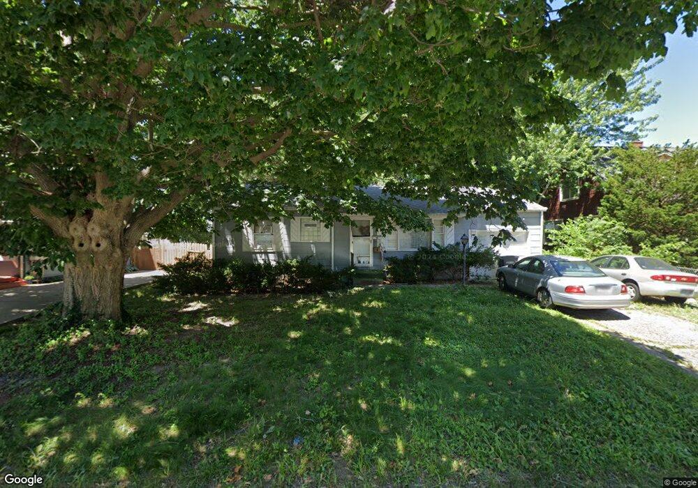
1802 S Dodgion Ave Independence, MO 64055
Hanthorn NeighborhoodEstimated payment $598/month
Highlights
- Ranch Style House
- 1 Car Attached Garage
- Cooling Available
- No HOA
About This Home
This home is located at 1802 S Dodgion Ave, Independence, MO 64055 and is currently priced at $90,000, approximately $61 per square foot. This property was built in 1954. 1802 S Dodgion Ave is a home located in Jackson County with nearby schools including Bridger Middle School, Pioneer Ridge Middle School, and Truman High School.
Listing Agent
Realty Professionals Heartland Brokerage Phone: 816-377-7118 License #2016026017 Listed on: 10/22/2025
Home Details
Home Type
- Single Family
Est. Annual Taxes
- $1,464
Year Built
- Built in 1954
Parking
- 1 Car Attached Garage
- Front Facing Garage
Home Design
- 1,475 Sq Ft Home
- Ranch Style House
- Composition Roof
- Metal Siding
Bedrooms and Bathrooms
- 3 Bedrooms
- 1 Full Bathroom
Additional Features
- 6,918 Sq Ft Lot
- Cooling Available
- Unfinished Basement
Community Details
- No Home Owners Association
- Andes Roberts Addition Subdivision
Listing and Financial Details
- Assessor Parcel Number 26-810-05-25-00-0-00-000
- $0 special tax assessment
Map
Home Values in the Area
Average Home Value in this Area
Tax History
| Year | Tax Paid | Tax Assessment Tax Assessment Total Assessment is a certain percentage of the fair market value that is determined by local assessors to be the total taxable value of land and additions on the property. | Land | Improvement |
|---|---|---|---|---|
| 2025 | $1,464 | $21,609 | $3,534 | $18,075 |
| 2024 | $1,430 | $21,128 | $1,986 | $19,142 |
| 2023 | $1,430 | $21,128 | $1,182 | $19,946 |
| 2022 | $1,207 | $16,340 | $3,058 | $13,282 |
| 2021 | $1,206 | $16,340 | $3,058 | $13,282 |
| 2020 | $1,247 | $16,412 | $3,058 | $13,354 |
| 2019 | $1,227 | $16,412 | $3,058 | $13,354 |
| 2018 | $1,119 | $14,284 | $2,662 | $11,622 |
| 2017 | $1,119 | $14,284 | $2,662 | $11,622 |
| 2016 | $1,053 | $13,307 | $1,761 | $11,546 |
| 2014 | $1,000 | $12,920 | $1,710 | $11,210 |
Property History
| Date | Event | Price | List to Sale | Price per Sq Ft |
|---|---|---|---|---|
| 10/23/2025 10/23/25 | Pending | -- | -- | -- |
| 10/22/2025 10/22/25 | For Sale | $90,000 | -- | $61 / Sq Ft |
Purchase History
| Date | Type | Sale Price | Title Company |
|---|---|---|---|
| Interfamily Deed Transfer | -- | -- |
Mortgage History
| Date | Status | Loan Amount | Loan Type |
|---|---|---|---|
| Closed | $64,800 | Purchase Money Mortgage |
Source: Heartland MLS
MLS Number: 2583369
APN: 26-810-05-25-00-0-00-000
Disclaimer: Certain information contained herein is derived from information provided by parties other than Homes.com. All information provided is deemed reliable, but is not guaranteed to be accurate and should be independently verified.
![]() Based on information submitted to the MLS GRID as of [see last changed date above]. All data is obtained from various sources and may not have been verified by broker or MLS GRID. Supplied Open House Information is subject to change without notice. All information should be independently reviewed and verified for accuracy. Properties may or may not be listed by the office/agent presenting the information. Some IDX listings have been excluded from this website. Prices displayed on all Sold listings are the Last Known Listing Price and may not be the actual selling price.
Based on information submitted to the MLS GRID as of [see last changed date above]. All data is obtained from various sources and may not have been verified by broker or MLS GRID. Supplied Open House Information is subject to change without notice. All information should be independently reviewed and verified for accuracy. Properties may or may not be listed by the office/agent presenting the information. Some IDX listings have been excluded from this website. Prices displayed on all Sold listings are the Last Known Listing Price and may not be the actual selling price.
Listing Information presented by local MLS brokerage: TEN-X, INC., local REALTOR®- Arlene Richardson - (888)952-6393
The Digital Millennium Copyright Act of 1998, 17 U.S.C. § 512 (the “DMCA”) provides recourse for copyright owners who believe that material appearing on the Internet infringes their rights under U.S. copyright law. If you believe in good faith that any content or material made available in connection with our website or services infringes your copyright, you (or your agent) may send us a notice requesting that the content or material be removed, or access to it blocked.
Notices must be sent in writing by email to DMCAnotice@MLSGrid.com.
The DMCA requires that your notice of alleged copyright infringement include the following information:
(1) description of the copyrighted work that is the subject of claimed infringement;
(2) description of the alleged infringing content and information sufficient to permit us to locate the content;
(3) contact information for you, including your address, telephone number and email address;
(4) a statement by you that you have a good faith belief that the content in the manner complained of is not authorized by the copyright owner, or its agent, or by the operation of any law;
(5) a statement by you, signed under penalty of perjury, that the information in the notification is accurate and that you have the authority to enforce the copyrights that are claimed to be infringed; and
(6) a physical or electronic signature of the copyright owner or a person authorized to act on the copyright owner’s behalf. Failure to include all of the above information may result in the delay of the processing of your complaint.
- 1400 S Dodgion Ave
- 311 E Hansen Ct Unit 73
- 1815 & 1719 S Osage St
- 604 Rankin Rd
- 2008 S Osage St
- 301 E Partridge Ave Unit K
- 303 E Partridge #G Ave Unit G
- 337 E Partridge Ave
- 421 E Angus St
- 700 E Gudgell Ave
- 1424 S Liberty St
- 800 E Manor Rd
- 801 E Manor Rd
- 735 E Devon St
- 1340 S Emery Ave
- 804 E Gudgell Ave
- 301 E Fair St
- 17211 E 32nd St S
- 1312 S Emery St
- 1410 S Logan Ave
