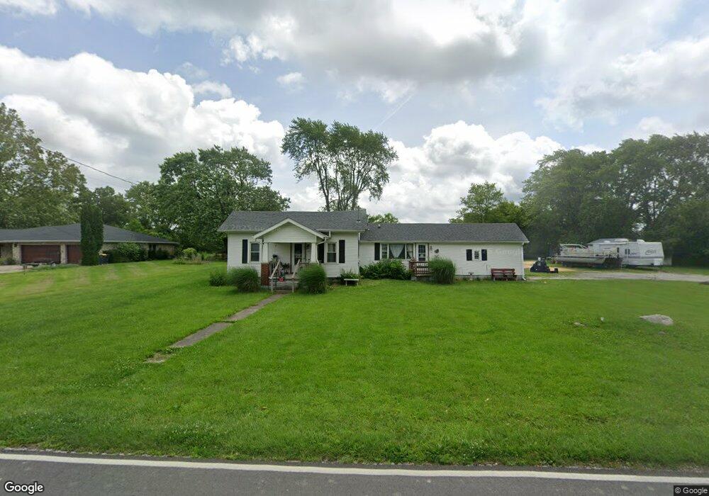
1802 Shepherd Rd Anderson, IN 46012
Estimated Value: $181,920 - $214,000
3
Beds
2
Baths
1,470
Sq Ft
$135/Sq Ft
Est. Value
About This Home
This home is located at 1802 Shepherd Rd, Anderson, IN 46012 and is currently estimated at $197,980, approximately $134 per square foot. 1802 Shepherd Rd is a home located in Madison County with nearby schools including Eastside Elementary School, Highland Middle School, and Anderson High School.
Ownership History
Date
Name
Owned For
Owner Type
Purchase Details
Closed on
Mar 27, 2008
Sold by
Bailey Mark A
Bought by
Andco Realty Llc
Current Estimated Value
Home Financials for this Owner
Home Financials are based on the most recent Mortgage that was taken out on this home.
Original Mortgage
$57,750
Interest Rate
6.09%
Mortgage Type
New Conventional
Purchase Details
Closed on
Aug 29, 2007
Sold by
Wells Fargo Bank Na
Bought by
Andco Realty Llc
Purchase Details
Closed on
Jul 13, 2007
Sold by
Cooper William and Cooper William C
Bought by
Wells Fargo Bank Na
Purchase Details
Closed on
Oct 11, 2005
Sold by
Wood Khristy L
Bought by
Cooper William C and Cooper Suzanne L
Create a Home Valuation Report for This Property
The Home Valuation Report is an in-depth analysis detailing your home's value as well as a comparison with similar homes in the area
Home Values in the Area
Average Home Value in this Area
Purchase History
| Date | Buyer | Sale Price | Title Company |
|---|---|---|---|
| Andco Realty Llc | -- | -- | |
| Bailey Mark A | -- | -- | |
| Andco Realty Llc | -- | -- | |
| Wells Fargo Bank Na | -- | -- | |
| Cooper William C | -- | -- |
Source: Public Records
Mortgage History
| Date | Status | Borrower | Loan Amount |
|---|---|---|---|
| Closed | Bailey Mark A | $57,750 |
Source: Public Records
Tax History Compared to Growth
Tax History
| Year | Tax Paid | Tax Assessment Tax Assessment Total Assessment is a certain percentage of the fair market value that is determined by local assessors to be the total taxable value of land and additions on the property. | Land | Improvement |
|---|---|---|---|---|
| 2024 | $1,680 | $75,600 | $21,500 | $54,100 |
| 2023 | $1,568 | $69,600 | $20,500 | $49,100 |
| 2022 | $1,570 | $69,700 | $19,700 | $50,000 |
| 2021 | $1,471 | $64,900 | $19,500 | $45,400 |
| 2020 | $1,412 | $62,000 | $18,600 | $43,400 |
| 2019 | $1,386 | $60,800 | $18,600 | $42,200 |
| 2018 | $1,329 | $57,100 | $18,600 | $38,500 |
| 2017 | $1,145 | $56,700 | $18,600 | $38,100 |
| 2016 | $1,145 | $56,700 | $18,600 | $38,100 |
| 2014 | $1,540 | $77,000 | $14,000 | $63,000 |
| 2013 | $1,540 | $77,000 | $14,000 | $63,000 |
Source: Public Records
Map
Nearby Homes
- 2703 Marsha Dr
- 2227 Tartan Rd
- 2127 N Cr 300 E Rd
- 2334 Impala Dr
- 1004 Shepherd Rd
- 2208 E Cross St
- 2316 Lake Dr
- 2409 Melody Ln
- 1523 Northcrest Dr
- 0 E Cross St
- 0 E Cross St Unit LotWP001 24471664
- 926 E Post Rd
- 239 N Coventry Dr
- 0 Janet Ct
- 124 N Mustin Dr
- 1309 Ranike Dr
- 2438 E 200 N
- 1015 Ranike Dr
- 809 Deerfield Rd
- 701 Westgate Dr
- 1810 Shepherd Rd
- 1741 Shepherd Rd
- 1712 Shepherd Rd
- 1811 Shepherd Rd
- 2815 Marsha Dr
- 2820 Tamra Ln
- 1826 Shepherd Rd
- 2814 Marsha Dr
- 2814 Tamra Ln
- 2809 Marsha Dr
- 2808 Marsha Dr
- 2808 Tamra Ln
- 2803 Marsha Dr
- 1625 Shepherd Rd
- 2802 Marsha Dr
- 1910 Shepherd Rd
- 2815 Tamra Ln
- 2727 Marsha Dr
- 2809 Tamra Ln
- 2726 Tamra Ln