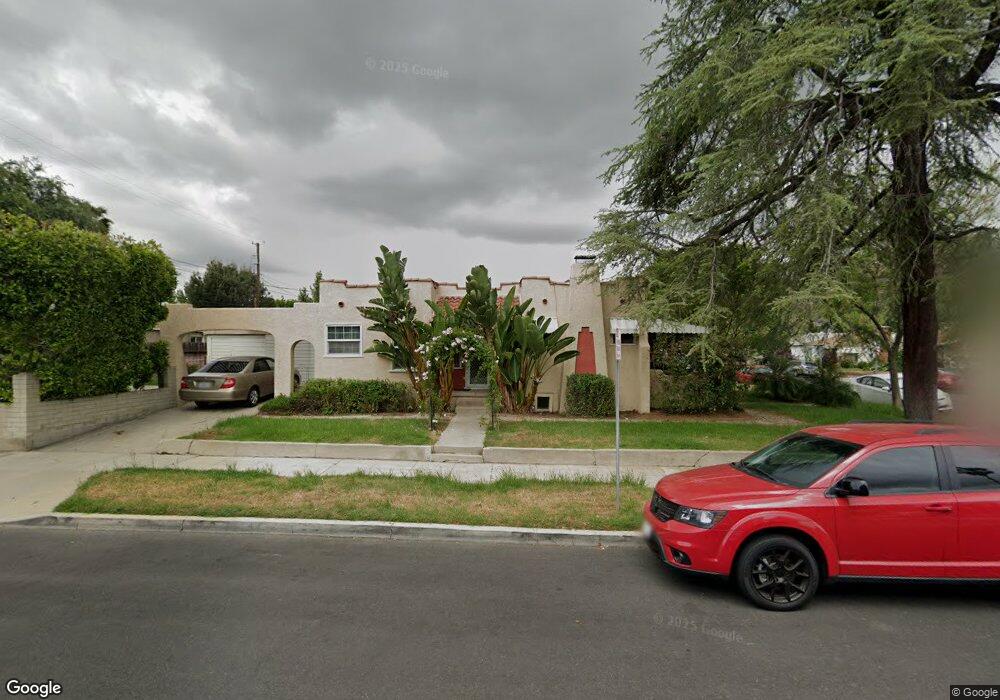
1803 Landis St Burbank, CA 91504
Hillside District NeighborhoodEstimated Value: $831,776 - $1,123,000
2
Beds
1
Bath
968
Sq Ft
$1,014/Sq Ft
Est. Value
About This Home
This home is located at 1803 Landis St, Burbank, CA 91504 and is currently estimated at $981,944, approximately $1,014 per square foot. 1803 Landis St is a home located in Los Angeles County with nearby schools including George Washington Elementary, Luther Burbank Middle School, and Burbank High School.
Ownership History
Date
Name
Owned For
Owner Type
Purchase Details
Closed on
Oct 16, 1995
Sold by
Weakly Tracy Ellen and Mollenkopf Tracy Ellen
Bought by
Sadler Christine
Current Estimated Value
Home Financials for this Owner
Home Financials are based on the most recent Mortgage that was taken out on this home.
Original Mortgage
$81,875
Outstanding Balance
$573
Interest Rate
7.58%
Mortgage Type
Seller Take Back
Estimated Equity
$981,371
Create a Home Valuation Report for This Property
The Home Valuation Report is an in-depth analysis detailing your home's value as well as a comparison with similar homes in the area
Home Values in the Area
Average Home Value in this Area
Purchase History
| Date | Buyer | Sale Price | Title Company |
|---|---|---|---|
| Sadler Christine | $83,000 | Guardian Title Company |
Source: Public Records
Mortgage History
| Date | Status | Borrower | Loan Amount |
|---|---|---|---|
| Open | Sadler Christine | $81,875 |
Source: Public Records
Tax History Compared to Growth
Tax History
| Year | Tax Paid | Tax Assessment Tax Assessment Total Assessment is a certain percentage of the fair market value that is determined by local assessors to be the total taxable value of land and additions on the property. | Land | Improvement |
|---|---|---|---|---|
| 2025 | $2,800 | $244,174 | $159,468 | $84,706 |
| 2024 | $2,800 | $239,388 | $156,342 | $83,046 |
| 2023 | $2,772 | $234,695 | $153,277 | $81,418 |
| 2022 | $2,647 | $230,094 | $150,272 | $79,822 |
| 2021 | $2,633 | $225,583 | $147,326 | $78,257 |
| 2019 | $2,529 | $218,894 | $142,957 | $75,937 |
| 2018 | $2,479 | $214,603 | $140,154 | $74,449 |
| 2016 | $2,348 | $206,271 | $134,712 | $71,559 |
| 2015 | $2,301 | $203,174 | $132,689 | $70,485 |
| 2014 | $2,303 | $199,195 | $130,090 | $69,105 |
Source: Public Records
Map
Nearby Homes
- 1702 Landis St
- 1622 Keeler St
- 2014 Peyton Ave
- 1809 Peyton Ave Unit 313
- 1923 Grismer Ave
- 1814 Grismer Ave
- 1608 Grismer Ave
- 2030 N Brighton St
- 2227 N Lamer St
- 2215 N Brighton St
- 2141 W Pacific Ave
- 520 Irving Dr
- 1320 N Beachwood Dr
- 2310 Washington Cir
- 2420 N Keystone St
- 441 University Ave
- 2250 N Frederic St
- 230 Bethany Rd Unit 117
- 230 Bethany Rd Unit 133
- 2505 N Keystone St
- 1817 Landis St Unit 1817
- 1807 Landis St
- 1811 Landis St
- 1723 Landis St
- 1723 Landis St Unit 204
- 1723 Landis St Unit 202
- 1723 Landis St Unit 201
- 1915 Morgan Ave
- 1815 Landis St
- 1719 Landis St
- 1810 Jackson St
- 1819 Landis St
- 1819 Landis St Unit 1
- 1819 Landis St Unit 2
- 1819 Landis St
- 1802 Landis St
- 1806 Landis St
- 1715 Landis St
- 1814 Jackson St
- 1810 Landis St