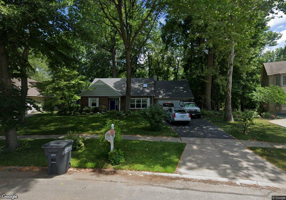
1804 Bobolink Ln Toledo, OH 43615
Reynolds Corners NeighborhoodEstimated Value: $240,000 - $298,242
4
Beds
3
Baths
2,161
Sq Ft
$124/Sq Ft
Est. Value
About This Home
This home is located at 1804 Bobolink Ln, Toledo, OH 43615 and is currently estimated at $267,061, approximately $123 per square foot. 1804 Bobolink Ln is a home located in Lucas County with nearby schools including Hawkins Elementary School, Rogers High School, and St. Benedict Catholic School.
Ownership History
Date
Name
Owned For
Owner Type
Purchase Details
Closed on
Jul 16, 2001
Sold by
Munger William D and Munger Patricia P
Bought by
Jimenez Mark and Haines Mary E
Current Estimated Value
Home Financials for this Owner
Home Financials are based on the most recent Mortgage that was taken out on this home.
Original Mortgage
$154,350
Interest Rate
7.22%
Create a Home Valuation Report for This Property
The Home Valuation Report is an in-depth analysis detailing your home's value as well as a comparison with similar homes in the area
Home Values in the Area
Average Home Value in this Area
Purchase History
| Date | Buyer | Sale Price | Title Company |
|---|---|---|---|
| Jimenez Mark | $162,500 | Northwest Title Agency Of Oh |
Source: Public Records
Mortgage History
| Date | Status | Borrower | Loan Amount |
|---|---|---|---|
| Closed | Jimenez Mark | $154,350 |
Source: Public Records
Tax History Compared to Growth
Tax History
| Year | Tax Paid | Tax Assessment Tax Assessment Total Assessment is a certain percentage of the fair market value that is determined by local assessors to be the total taxable value of land and additions on the property. | Land | Improvement |
|---|---|---|---|---|
| 2024 | $2,642 | $87,570 | $10,605 | $76,965 |
| 2023 | $3,990 | $62,615 | $8,120 | $54,495 |
| 2022 | $3,981 | $62,615 | $8,120 | $54,495 |
| 2021 | $4,079 | $62,615 | $8,120 | $54,495 |
| 2020 | $3,895 | $52,780 | $7,035 | $45,745 |
| 2019 | $3,803 | $52,780 | $7,035 | $45,745 |
| 2018 | $3,635 | $52,780 | $7,035 | $45,745 |
| 2017 | $3,501 | $45,885 | $8,015 | $37,870 |
| 2016 | $3,503 | $131,100 | $22,900 | $108,200 |
| 2015 | $3,469 | $131,100 | $22,900 | $108,200 |
| 2014 | $2,886 | $45,890 | $8,020 | $37,870 |
| 2013 | $2,886 | $45,890 | $8,020 | $37,870 |
Source: Public Records
Map
Nearby Homes
- 5051 Wissman Rd
- 2026 Pautucket Rd
- 5041 Ancil Rd
- 4709 W Bancroft St
- 4705 W Bancroft St
- 5057 Brandon Rd
- 801 Hilltop Ln
- 5331 Fleet Rd
- 710 Hilltop Ln
- 5029 Kellogg Rd
- 4515 W Bancroft St
- 4519 W Bancroft St
- 1101 Sawyer Rd
- 4236 S Terrace View St
- 2009 Garden Ln
- 1925 Olimphia Rd
- 4860 Airport Hwy
- 2222 Talmadge Rd
- 4057 Hillandale Rd
- 2130 Richards Rd
- 1812 Bobolink Ln
- 1756 Bobolink Ln
- 1820 Bobolink Ln
- 1748 Bobolink Ln
- 1809 Bobolink Ln
- 1819 Bobolink Ln
- 1828 Bobolink Ln
- 1741 Eileen Rd
- 1735 Eileen Rd
- 1829 Bobolink Ln
- 1761 Willowhill Ln
- 1729 Eileen Rd
- 1760 Willowhill Ln
- 1805 Eileen Rd
- 1836 Bobolink Ln
- 1721 Eileen Rd
- 1816 Willowhill Ln
- 1803 Eileen Rd
- 1809 Eileen Rd
- 1709 Eileen Rd