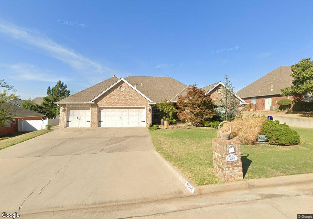
1804 Henson Ct Shawnee, OK 74804
Estimated Value: $323,945 - $357,000
4
Beds
3
Baths
2,425
Sq Ft
$140/Sq Ft
Est. Value
About This Home
This home is located at 1804 Henson Ct, Shawnee, OK 74804 and is currently estimated at $339,236, approximately $139 per square foot. 1804 Henson Ct is a home located in Pottawatomie County.
Ownership History
Date
Name
Owned For
Owner Type
Purchase Details
Closed on
Sep 11, 2000
Sold by
Thompson Michael and Thompson Sandra
Bought by
Wortham Ld and Wortham Roberta
Current Estimated Value
Purchase Details
Closed on
Sep 7, 1996
Sold by
Behren Dan and Behren Debra
Bought by
Thompson Michael
Purchase Details
Closed on
Apr 28, 1995
Sold by
Brown Greg and Brown Christine
Bought by
Vonbehren Dan and Vonbehren Debra
Purchase Details
Closed on
Oct 4, 1994
Sold by
Brown Tom and Brown Carole
Bought by
Brown Greg
Create a Home Valuation Report for This Property
The Home Valuation Report is an in-depth analysis detailing your home's value as well as a comparison with similar homes in the area
Home Values in the Area
Average Home Value in this Area
Purchase History
| Date | Buyer | Sale Price | Title Company |
|---|---|---|---|
| Wortham Ld | $182,000 | -- | |
| Thompson Michael | $174,500 | -- | |
| Vonbehren Dan | $176,500 | -- | |
| Brown Greg | -- | -- |
Source: Public Records
Tax History Compared to Growth
Tax History
| Year | Tax Paid | Tax Assessment Tax Assessment Total Assessment is a certain percentage of the fair market value that is determined by local assessors to be the total taxable value of land and additions on the property. | Land | Improvement |
|---|---|---|---|---|
| 2024 | $1,939 | $22,051 | $3,840 | $18,211 |
| 2023 | $1,939 | $21,409 | $3,840 | $17,569 |
| 2022 | $1,903 | $21,409 | $3,840 | $17,569 |
| 2021 | $1,920 | $21,409 | $3,840 | $17,569 |
| 2020 | $1,940 | $21,653 | $3,840 | $17,813 |
| 2019 | $2,008 | $22,142 | $3,840 | $18,302 |
| 2018 | $2,022 | $22,165 | $3,834 | $18,331 |
| 2017 | $1,944 | $21,519 | $3,643 | $17,876 |
| 2016 | $1,905 | $20,893 | $3,500 | $17,393 |
| 2015 | $1,631 | $20,285 | $3,414 | $16,871 |
| 2014 | $1,581 | $19,693 | $3,600 | $16,093 |
Source: Public Records
Map
Nearby Homes
- 1406 E Bradley St
- 31 E Oak Hill
- 9 Dustin Cir
- 1836 N Bryan Ave
- 23 Crown Point
- 1404 Charles Dr
- 17 Beckley St
- 1208 E Rose Dr
- 40 Northridge Rd
- 1219 E Monroe Dr
- 2 Sequoyah Blvd
- 1301 E Independence St
- 1206 Monroe Dr
- 2024 Lantana Cir
- 57 Serenada Ln
- 1210 E Independence St
- 2 Lancet Cir
- 27 N Rice Ave
- 6 Lancet Ct
- 1410 Laverne Ave
- 1802 Henson Ct
- 1806 Henson Ct
- 1913 Carleton Ln
- 1805 Henson Ct
- 1800 Henson Ct
- 1807 Henson Ct
- 1808 Henson Ct
- 1803 Henson Ct
- 1500 E Bradley St
- 1801 Henson Ct
- 1809 Henson Ct
- 1810 Henson Ct
- 1811 Henson Ct
- 5006 Chauncey Ln
- 1700 E Bradley St
- 1711 Autumn Ln
- 5001 Chauncey Ln
- 5005 Chauncey Ln
- 5009 Chauncey Ln
- 1710 Autumn Ln