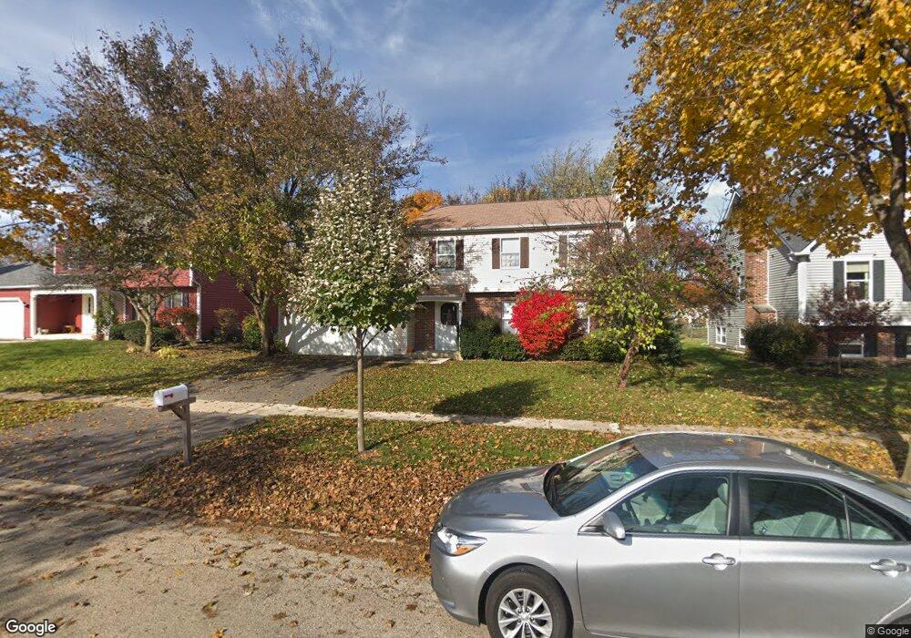
1804 Larson Ave Unit 5 Saint Charles, IL 60174
Southeast Saint Charles NeighborhoodEstimated Value: $414,000 - $426,000
3
Beds
2
Baths
1,500
Sq Ft
$280/Sq Ft
Est. Value
About This Home
This home is located at 1804 Larson Ave Unit 5, Saint Charles, IL 60174 and is currently estimated at $419,786, approximately $279 per square foot. 1804 Larson Ave Unit 5 is a home located in Kane County with nearby schools including Munhall Elementary School, Wredling Middle School, and St Charles East High School.
Ownership History
Date
Name
Owned For
Owner Type
Purchase Details
Closed on
Jun 13, 2025
Sold by
Dunaway Lisa
Bought by
Lisa A Dunaway Trust and Dunaway
Current Estimated Value
Purchase Details
Closed on
Jun 15, 1998
Sold by
Tomas Timothy S
Bought by
Dunaway Paul and Dunaway Lisa
Home Financials for this Owner
Home Financials are based on the most recent Mortgage that was taken out on this home.
Original Mortgage
$150,000
Interest Rate
7.22%
Create a Home Valuation Report for This Property
The Home Valuation Report is an in-depth analysis detailing your home's value as well as a comparison with similar homes in the area
Home Values in the Area
Average Home Value in this Area
Purchase History
| Date | Buyer | Sale Price | Title Company |
|---|---|---|---|
| Lisa A Dunaway Trust | -- | None Listed On Document | |
| Dunaway Paul | $176,000 | Chicago Title Insurance Co |
Source: Public Records
Mortgage History
| Date | Status | Borrower | Loan Amount |
|---|---|---|---|
| Previous Owner | Dunaway Paul | $150,000 |
Source: Public Records
Tax History Compared to Growth
Tax History
| Year | Tax Paid | Tax Assessment Tax Assessment Total Assessment is a certain percentage of the fair market value that is determined by local assessors to be the total taxable value of land and additions on the property. | Land | Improvement |
|---|---|---|---|---|
| 2024 | $8,719 | $117,453 | $33,516 | $83,937 |
| 2023 | $8,413 | $105,122 | $29,997 | $75,125 |
| 2022 | $7,949 | $98,451 | $33,203 | $65,248 |
| 2021 | $7,654 | $93,843 | $31,649 | $62,194 |
| 2020 | $7,579 | $92,093 | $31,059 | $61,034 |
| 2019 | $7,450 | $90,270 | $30,444 | $59,826 |
| 2018 | $7,055 | $85,060 | $29,286 | $55,774 |
| 2017 | $6,774 | $80,846 | $28,284 | $52,562 |
| 2016 | $7,126 | $78,007 | $27,291 | $50,716 |
| 2015 | -- | $74,999 | $26,997 | $48,002 |
| 2014 | -- | $71,965 | $26,997 | $44,968 |
| 2013 | -- | $75,390 | $27,267 | $48,123 |
Source: Public Records
Map
Nearby Homes
- 1718 Jeanette Ave
- 1609 Forrest Blvd
- 1529 Rita Ave
- 1718 Patricia Ln Unit 4
- 1540 Independence Ave
- 1724 Patricia Ln
- 9 Temple Garden Ct
- 1533 Banbury Ave
- 1439 Walnut Hill Ave
- 662 Nichole Ln
- 680 Chandler Ave
- 1590 Adams Ave
- 1572 Dempsey Dr
- 904 Geneva Dr
- 1226 Lencioni Ct
- 1719 S 4th Place
- 888 Geneva Dr
- 1517 Dempsey Dr
- 1501 Dempsey Dr
- 503 Cora Ln
- 1806 Larson Ave
- 1802 Larson Ave Unit 5
- 1803 Ronzheimer Ave
- 1801 Ronzheimer Ave
- 1805 Ronzheimer Ave
- 1810 Larson Ave
- 1803 Larson Ave
- 1805 Larson Ave Unit 5
- 1807 Ronzheimer Ave
- 1801 Larson Ave
- 1807 Larson Ave
- 1812 Larson Ave
- 1809 Ronzheimer Ave Unit 7
- 1809 Larson Ave
- 1715 Ronzheimer Ave
- 1806 Rita Ave
- 1802 Ronzheimer Ave
- 1804 Rita Ave Unit 5
- 1804 Ronzheimer Ave
- 1814 Larson Ave