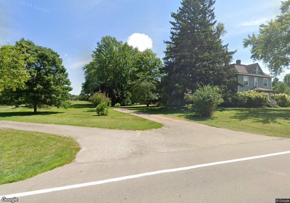
1804 N State Route 741 Franklin, OH 45005
Turtlecreek Township NeighborhoodEstimated Value: $467,000 - $589,598
4
Beds
3
Baths
1,937
Sq Ft
$264/Sq Ft
Est. Value
About This Home
This home is located at 1804 N State Route 741, Franklin, OH 45005 and is currently estimated at $511,650, approximately $264 per square foot. 1804 N State Route 741 is a home located in Warren County with nearby schools including Bowman Primary School, Berry Intermediate School, and Donovan Elementary School.
Ownership History
Date
Name
Owned For
Owner Type
Purchase Details
Closed on
Jun 12, 2020
Sold by
Killin Michael
Bought by
Davis Russell Alan and Davis Veronica Ann
Current Estimated Value
Home Financials for this Owner
Home Financials are based on the most recent Mortgage that was taken out on this home.
Original Mortgage
$168,000
Outstanding Balance
$148,919
Interest Rate
3.2%
Mortgage Type
Unknown
Estimated Equity
$362,731
Purchase Details
Closed on
May 20, 2011
Sold by
Killin Tina
Bought by
Killin Michael
Purchase Details
Closed on
May 22, 1991
Bought by
Killin and Killin Michael
Purchase Details
Closed on
Oct 30, 1990
Sold by
Ame Developers
Bought by
Ame Developers
Create a Home Valuation Report for This Property
The Home Valuation Report is an in-depth analysis detailing your home's value as well as a comparison with similar homes in the area
Home Values in the Area
Average Home Value in this Area
Purchase History
| Date | Buyer | Sale Price | Title Company |
|---|---|---|---|
| Davis Russell Alan | $335,000 | Lawyers Title Of Cincinnati | |
| Killin Michael | -- | None Available | |
| Killin | $25,000 | -- | |
| Ame Developers | -- | -- |
Source: Public Records
Mortgage History
| Date | Status | Borrower | Loan Amount |
|---|---|---|---|
| Open | Davis Russell Alan | $168,000 |
Source: Public Records
Tax History Compared to Growth
Tax History
| Year | Tax Paid | Tax Assessment Tax Assessment Total Assessment is a certain percentage of the fair market value that is determined by local assessors to be the total taxable value of land and additions on the property. | Land | Improvement |
|---|---|---|---|---|
| 2024 | $5,476 | $147,010 | $57,700 | $89,310 |
| 2023 | $4,717 | $115,612 | $36,557 | $79,054 |
| 2022 | $4,658 | $115,612 | $36,558 | $79,055 |
| 2021 | $4,673 | $115,612 | $36,558 | $79,055 |
| 2020 | $4,864 | $100,286 | $29,722 | $70,564 |
| 2019 | $4,891 | $100,286 | $29,722 | $70,564 |
| 2018 | $4,423 | $100,286 | $29,722 | $70,564 |
| 2017 | $4,361 | $88,806 | $25,361 | $63,445 |
| 2016 | $4,508 | $88,806 | $25,361 | $63,445 |
| 2015 | $4,544 | $88,806 | $25,361 | $63,445 |
| 2014 | $4,372 | $81,560 | $24,410 | $57,160 |
| 2013 | $4,368 | $95,390 | $26,230 | $69,160 |
Source: Public Records
Map
Nearby Homes
- 1782 Ohio 741
- 1369 New England Way
- 3822 Greentree Rd
- 2266 N St Rt 123
- 2266 N St Rt 123 Unit Site D
- 2266 Ohio 123
- 2266 Ohio 123 Unit Site C
- 2266 Ohio 123 Unit Site A
- 2266 Ohio 123 Unit Site B
- 417 Bethpage Way
- 417 Bethpage Way Unit 7-302
- 4289 Yellow Prairie Dr
- 4284 Yellow Prairie Dr
- 1537 Golf Club Dr
- 3122 N State Route 741
- 4343 Hunting Hawk Dr
- 1932 Meadowsweet Dr
- 1801 Kirby Rd
- 1899 Meadowsweet Dr
- 1255 Lake Run Dr
- 1832 Ohio 741
- 1770 N State Route 741
- 1962 N State Route 741
- 1900 N State Route 741
- 1900 N State Route 741
- 1772 Ohio 741
- 1772 N State Route 741
- 1900 S Route 741
- 1900 Ohio 741
- 1848 Ohio 741
- 1936 N State Route 741
- 1876 N State Route 741
- 1876 N State Route 741
- 1848 N State Route 741
- 1848 N State Route 741
- 1832 N State Route 741
- 1828 N State Route 741
- 1828 N State Route 741
- 1802 N State Route 741
- 1899 N State Route 741