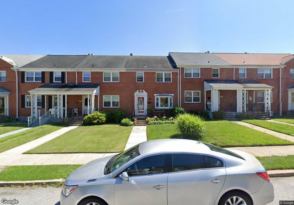
1805 Burnwood Rd Baltimore, MD 21239
Perring Loch NeighborhoodEstimated Value: $212,794 - $235,000
--
Bed
2
Baths
1,280
Sq Ft
$175/Sq Ft
Est. Value
About This Home
This home is located at 1805 Burnwood Rd, Baltimore, MD 21239 and is currently estimated at $223,897, approximately $174 per square foot. 1805 Burnwood Rd is a home located in Baltimore City with nearby schools including Northwood Elementary School, Booker T. Washington Middle School, and Paul Laurence Dunbar Community High School.
Ownership History
Date
Name
Owned For
Owner Type
Purchase Details
Closed on
Aug 12, 2003
Sold by
Business America Llc
Bought by
Jones Hyman Vanessa J
Current Estimated Value
Purchase Details
Closed on
Jun 27, 2003
Sold by
Secretary Of Housing & Urban
Bought by
Business America Llc
Purchase Details
Closed on
Dec 18, 2002
Sold by
Saunders Robert
Bought by
Secretary Of Housing & Urban and Development , The
Purchase Details
Closed on
Jun 3, 1998
Sold by
Gunterman Georgia M
Bought by
Saunders Robert and Saunders Helen
Create a Home Valuation Report for This Property
The Home Valuation Report is an in-depth analysis detailing your home's value as well as a comparison with similar homes in the area
Home Values in the Area
Average Home Value in this Area
Purchase History
| Date | Buyer | Sale Price | Title Company |
|---|---|---|---|
| Jones Hyman Vanessa J | $96,000 | -- | |
| Business America Llc | $59,000 | -- | |
| Secretary Of Housing & Urban | $75,000 | -- | |
| Saunders Robert | $69,000 | -- |
Source: Public Records
Tax History Compared to Growth
Tax History
| Year | Tax Paid | Tax Assessment Tax Assessment Total Assessment is a certain percentage of the fair market value that is determined by local assessors to be the total taxable value of land and additions on the property. | Land | Improvement |
|---|---|---|---|---|
| 2025 | $3,069 | $155,200 | -- | -- |
| 2024 | $3,069 | $142,400 | $36,000 | $106,400 |
| 2023 | $2,983 | $139,100 | $0 | $0 |
| 2022 | $2,910 | $135,800 | $0 | $0 |
| 2021 | $3,127 | $132,500 | $36,000 | $96,500 |
| 2020 | $2,844 | $132,100 | $0 | $0 |
| 2019 | $2,821 | $131,700 | $0 | $0 |
| 2018 | $2,860 | $131,300 | $36,000 | $95,300 |
| 2017 | $2,816 | $130,267 | $0 | $0 |
| 2016 | $2,443 | $129,233 | $0 | $0 |
| 2015 | $2,443 | $128,200 | $0 | $0 |
| 2014 | $2,443 | $128,200 | $0 | $0 |
Source: Public Records
Map
Nearby Homes
- 1814 Winford Rd
- 1907 Burnwood Rd
- 1800 Burnwood Rd
- 1706 Heathfield Rd
- 1809 Hillenwood Rd
- 1648 Ingram Rd
- 1932 Hillenwood Rd
- 1812 Ingram Rd
- 1613 Winford Rd
- 5102 Hillen Rd
- 1717 Hartsdale Rd
- 5515 Hillen Rd
- 1530 Burnwood Rd
- 1513 Northbourne Rd
- 4919 Herring Run Dr
- 1811 Ramblewood Rd
- 2323 Ivy Ave
- 1633 Pentwood Rd
- 2326 Ivy Ave
- 5755 Maplehill Rd
- 1807 Burnwood Rd
- 1803 Burnwood Rd
- 1809 Burnwood Rd
- 1801 Burnwood Rd
- 1811 Burnwood Rd
- 1713 Burnwood Rd
- 1813 Burnwood Rd
- 1711 Burnwood Rd
- 1901 Burnwood Rd
- 1709 Burnwood Rd
- 1802 Winford Rd
- 1804 Winford Rd
- 1800 Winford Rd
- 1806 Winford Rd
- 1903 Burnwood Rd
- 1712 Winford Rd
- 1707 Burnwood Rd
- 1810 Winford Rd
- 1710 Winford Rd
- 1812 Winford Rd