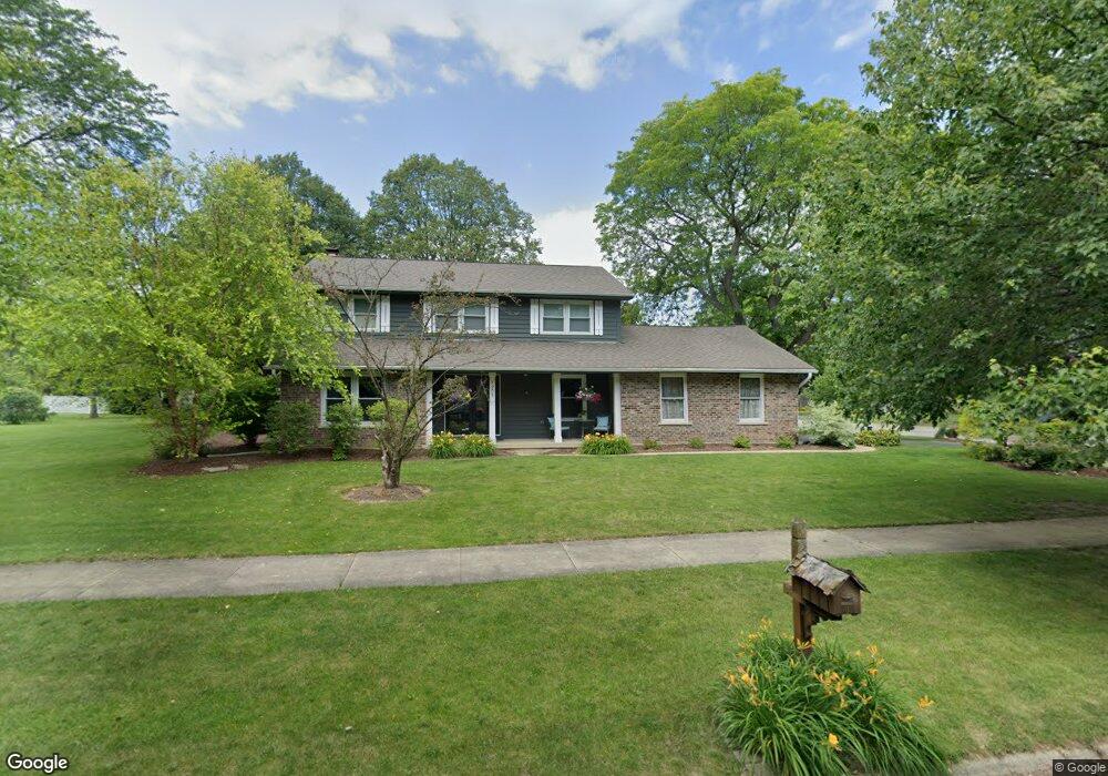
1805 Deerpath Ct Naperville, IL 60565
Signal Point NeighborhoodEstimated Value: $545,000 - $616,000
Studio
1
Bath
2,014
Sq Ft
$289/Sq Ft
Est. Value
About This Home
This home is located at 1805 Deerpath Ct, Naperville, IL 60565 and is currently estimated at $582,438, approximately $289 per square foot. 1805 Deerpath Ct is a home located in DuPage County with nearby schools including Scott Elementary School, Madison Jr High School, and Naperville Central High School.
Ownership History
Date
Name
Owned For
Owner Type
Purchase Details
Closed on
Feb 16, 1998
Sold by
Naas Walter E and Naas Cynthia M
Bought by
Dale Daniel B and Dale Janine E
Current Estimated Value
Home Financials for this Owner
Home Financials are based on the most recent Mortgage that was taken out on this home.
Original Mortgage
$162,000
Interest Rate
6.95%
Create a Home Valuation Report for This Property
The Home Valuation Report is an in-depth analysis detailing your home's value as well as a comparison with similar homes in the area
Home Values in the Area
Average Home Value in this Area
Purchase History
| Date | Buyer | Sale Price | Title Company |
|---|---|---|---|
| Dale Daniel B | $205,000 | -- |
Source: Public Records
Mortgage History
| Date | Status | Borrower | Loan Amount |
|---|---|---|---|
| Closed | Dale Daniel B | $162,000 |
Source: Public Records
Tax History
| Year | Tax Paid | Tax Assessment Tax Assessment Total Assessment is a certain percentage of the fair market value that is determined by local assessors to be the total taxable value of land and additions on the property. | Land | Improvement |
|---|---|---|---|---|
| 2024 | $9,223 | $158,548 | $69,566 | $88,982 |
| 2023 | $8,883 | $144,700 | $63,490 | $81,210 |
| 2022 | $8,498 | $137,300 | $60,240 | $77,060 |
| 2021 | $8,186 | $132,110 | $57,960 | $74,150 |
| 2020 | $8,011 | $129,740 | $56,920 | $72,820 |
| 2019 | $7,775 | $124,130 | $54,460 | $69,670 |
| 2018 | $7,778 | $124,130 | $54,460 | $69,670 |
| 2017 | $7,619 | $119,940 | $52,620 | $67,320 |
| 2016 | $7,466 | $115,610 | $50,720 | $64,890 |
| 2015 | $7,415 | $108,870 | $47,760 | $61,110 |
| 2014 | $7,458 | $106,200 | $45,700 | $60,500 |
| 2013 | $7,347 | $106,460 | $45,810 | $60,650 |
Source: Public Records
Map
Nearby Homes
- 621 Bourbon Ct
- 475 Bourbon Ln
- 1715 Amelia Ct
- 1612 Indian Trail Dr
- 1123 Mill Race Ln
- 517 Sheffield Rd
- 1217 River Oak Dr
- 425 Carriage Hill Rd
- 1712 Coach Dr
- 264 E Bailey Rd Unit C
- 1406 River Oak Dr
- 228 E Bailey Rd Unit F
- 144 E Bailey Rd Unit D
- 138 E Bailey Rd Unit M
- 1546 Treeline Ct Unit 405
- 510 Harlowe Ln Unit 2001C
- 124 E Bailey Rd Unit E
- 307 Leeds Ct
- 805 Potomac Ave
- 321 Carriage Hill Rd
- 810 River Oak Dr
- 1809 Deerpath Ct
- 1808 Deerpath Ct
- 906 River Oak Dr
- 1802 Cliffside Ct
- 1769 Deerpath Ct
- 1813 Deerpath Ct
- 811 River Oak Dr
- 1810 Deerpath Ct Unit 3
- 1806 Cliffside Ct
- 1774 Cliffside Ct
- 1814 Deerpath Ct
- 1817 Deerpath Ct
- 1810 Cliffside Ct
- 903 River Oak Dr
- 1814 Cliffside Ct
- 1765 Deerpath Ct
- 1807 Fairoak Rd
- 1818 Deerpath Ct
- 1811 Fairoak Rd
Your Personal Tour Guide
Ask me questions while you tour the home.