Estimated Value: $296,984 - $329,000
3
Beds
2
Baths
1,921
Sq Ft
$164/Sq Ft
Est. Value
About This Home
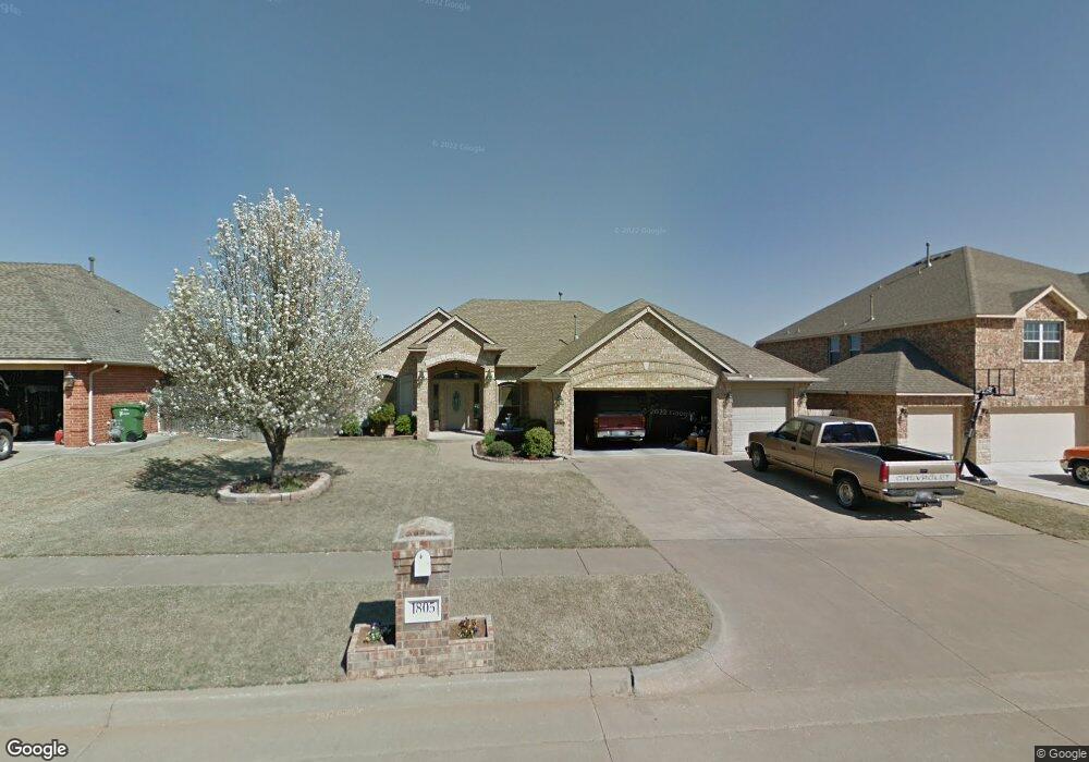
This home is located at 1805 Derail St, Yukon, OK 73099 and is currently estimated at $314,746, approximately $163 per square foot. 1805 Derail St is a home located in Canadian County with nearby schools including Banner School and St. John Nepomuk Catholic School.
Ownership History
Date
Name
Owned For
Owner Type
Purchase Details
Closed on
Jun 15, 2018
Sold by
Montgomery Homes Inc
Bought by
Pearce Alan Dale and Pearce Terrie Ann
Current Estimated Value
Purchase Details
Closed on
Oct 22, 2010
Sold by
Watkins Charles M and Watkins Jeanette L
Bought by
Watkins Charles M and Watkins Jeanette L
Purchase Details
Closed on
May 15, 2007
Sold by
Bradbury Homes Inc
Bought by
Watkins Charles M
Home Financials for this Owner
Home Financials are based on the most recent Mortgage that was taken out on this home.
Original Mortgage
$204,984
Interest Rate
6.16%
Mortgage Type
New Conventional
Create a Home Valuation Report for This Property
The Home Valuation Report is an in-depth analysis detailing your home's value as well as a comparison with similar homes in the area
Home Values in the Area
Average Home Value in this Area
Purchase History
| Date | Buyer | Sale Price | Title Company |
|---|---|---|---|
| Pearce Alan Dale | $290,000 | Old Republic Title | |
| Watkins Charles M | -- | None Available | |
| Watkins Charles M | $153,750 | None Available |
Source: Public Records
Mortgage History
| Date | Status | Borrower | Loan Amount |
|---|---|---|---|
| Previous Owner | Watkins Charles M | $204,984 |
Source: Public Records
Tax History Compared to Growth
Tax History
| Year | Tax Paid | Tax Assessment Tax Assessment Total Assessment is a certain percentage of the fair market value that is determined by local assessors to be the total taxable value of land and additions on the property. | Land | Improvement |
|---|---|---|---|---|
| 2024 | $2,066 | $27,964 | $5,280 | $22,684 |
| 2023 | $2,066 | $27,150 | $5,280 | $21,870 |
| 2022 | $2,032 | $26,359 | $5,280 | $21,079 |
| 2021 | $2,011 | $25,896 | $5,280 | $20,616 |
| 2020 | $1,986 | $25,793 | $5,280 | $20,513 |
| 2019 | $1,944 | $25,042 | $5,280 | $19,762 |
| 2018 | $1,918 | $24,313 | $5,280 | $19,033 |
| 2017 | $2,128 | $26,581 | $4,961 | $21,620 |
| 2016 | $2,022 | $26,580 | $4,625 | $21,955 |
| 2015 | $1,870 | $25,055 | $3,847 | $21,208 |
| 2014 | $1,870 | $24,326 | $3,794 | $20,532 |
Source: Public Records
Map
Nearby Homes
- 409 Frisco Ridge Rd
- 632 Signalman
- 1913 Tinder St
- 613 Side Track Rd
- 0 U S Route 66
- 417 Garth Brooks Blvd
- 1016 Maple Ave
- 611 Garth Brooks Blvd
- 1101 W Main St
- 9116 Anaum Ln
- 1004 Cedar Ave
- 624 Frisco Ridge Rd
- 11325 SW 34th Terrace
- 600 S 8th St
- 705 Yukon Ave
- 601 S 8th St
- 740 Kingston Dr
- 744 Kingston Dr
- 621 Yukon Ave
- 616 Kingston Dr
- 1801 Derail St
- 1809 Derail St
- 1800 Caboose St
- 1804 Caboose St
- 1813 Derail St
- 1808 Caboose St
- 1804 Derail St
- 1808 Derail St
- 1800 Derail St
- 1817 Derail St
- 513 Branch Line Rd
- 509 Branch Line Rd
- 1812 Caboose St
- 517 Branch Line Rd
- 1816 Derail St
- 505 Branch Line Rd
- 601 Branch Line Rd
- 1805 Flagman St
- 1809 Flagman St
- 1801 Caboose St