Estimated Value: $139,000 - $191,000
4
Beds
1
Bath
1,128
Sq Ft
$136/Sq Ft
Est. Value
About This Home
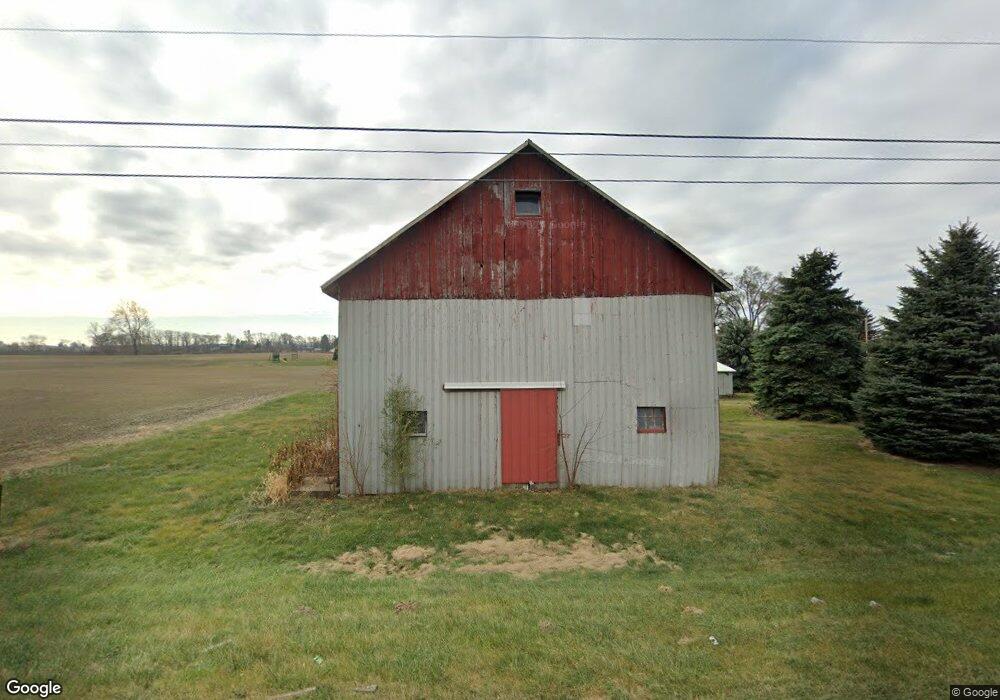
This home is located at 1805 E Mcpherson Hwy, Clyde, OH 43410 and is currently estimated at $153,044, approximately $135 per square foot. 1805 E Mcpherson Hwy is a home located in Sandusky County with nearby schools including Clyde High School, St Mary's Catholic School, and Harvest Temple Christian Academy.
Ownership History
Date
Name
Owned For
Owner Type
Purchase Details
Closed on
May 19, 2023
Sold by
Emmitt Conner Family Trust
Bought by
Conner Garret G
Current Estimated Value
Purchase Details
Closed on
May 17, 2022
Sold by
Conner Emmett G
Bought by
Emmett Conner Family Trust
Purchase Details
Closed on
Aug 16, 2004
Sold by
Conner Emmett G and Conner Vicki
Bought by
Conner Emmett G
Purchase Details
Closed on
Mar 25, 1999
Sold by
Hall Clayton
Bought by
Connors Emmett G
Create a Home Valuation Report for This Property
The Home Valuation Report is an in-depth analysis detailing your home's value as well as a comparison with similar homes in the area
Purchase History
| Date | Buyer | Sale Price | Title Company |
|---|---|---|---|
| Conner Garret G | -- | None Listed On Document | |
| Emmett Conner Family Trust | -- | None Listed On Document | |
| Conner Emmett G | -- | -- | |
| Connors Emmett G | $68,000 | -- |
Source: Public Records
Tax History
| Year | Tax Paid | Tax Assessment Tax Assessment Total Assessment is a certain percentage of the fair market value that is determined by local assessors to be the total taxable value of land and additions on the property. | Land | Improvement |
|---|---|---|---|---|
| 2025 | $1,594 | $114,700 | $41,200 | $73,500 |
| 2024 | $1,594 | $40,150 | $14,420 | $25,730 |
| 2023 | $1,561 | $30,880 | $11,100 | $19,780 |
| 2022 | $1,295 | $30,880 | $11,100 | $19,780 |
| 2021 | $1,308 | $30,880 | $11,100 | $19,780 |
| 2020 | $1,140 | $25,980 | $10,680 | $15,300 |
| 2019 | $1,127 | $25,980 | $10,680 | $15,300 |
| 2018 | $1,126 | $25,980 | $10,680 | $15,300 |
| 2017 | $1,154 | $25,980 | $10,680 | $15,300 |
| 2016 | $1,137 | $25,980 | $10,680 | $15,300 |
| 2015 | $1,123 | $25,980 | $10,680 | $15,300 |
| 2014 | $1,273 | $27,940 | $10,820 | $17,120 |
| 2013 | $1,244 | $27,940 | $10,820 | $17,120 |
Source: Public Records
Map
Nearby Homes
- 1727 E Mcpherson Hwy
- 5255 County Road 177
- 0 Durnwald Dr
- CR 260 89.6 acres Durnwald Dr
- 0 County Road 175
- 625 Ames St
- 174 Centennial Dr
- 162 Centennial Dr
- 136 Centennial Dr
- 0 Auxiliary Dr
- 1 Progress Dr
- 103 Progress Dr
- 1420 County Road 302 Unit 14
- 4688 County Road 177
- 502 S Main St
- 0 W Mcpherson Hwy
- 119 Warnecke Dr
- 152 Meadow Ln
- 209 Fair St
- 135 Mechanic St
- 1740 County Road 270
- 1744 County Road 270
- 1744 Cr 270
- 1756 County Road 270
- 1756 Cr 270
- 1766 County Road 270
- 1766 Cr 270
- 1778 County Road 270
- 1875 E Mcpherson Hwy
- 1727 E Sr-20
- 1790 County Road 270
- 1919 Sr 20
- 1948 E Mcpherson Hwy
- 1857 County Road 270
- 1858 County Road 270
- 1907 County Road 270
- 1614 E Mcpherson Hwy
- 1923 County Road 270
- 1901 County Road 270
- 1926 County Road 270
Your Personal Tour Guide
Ask me questions while you tour the home.