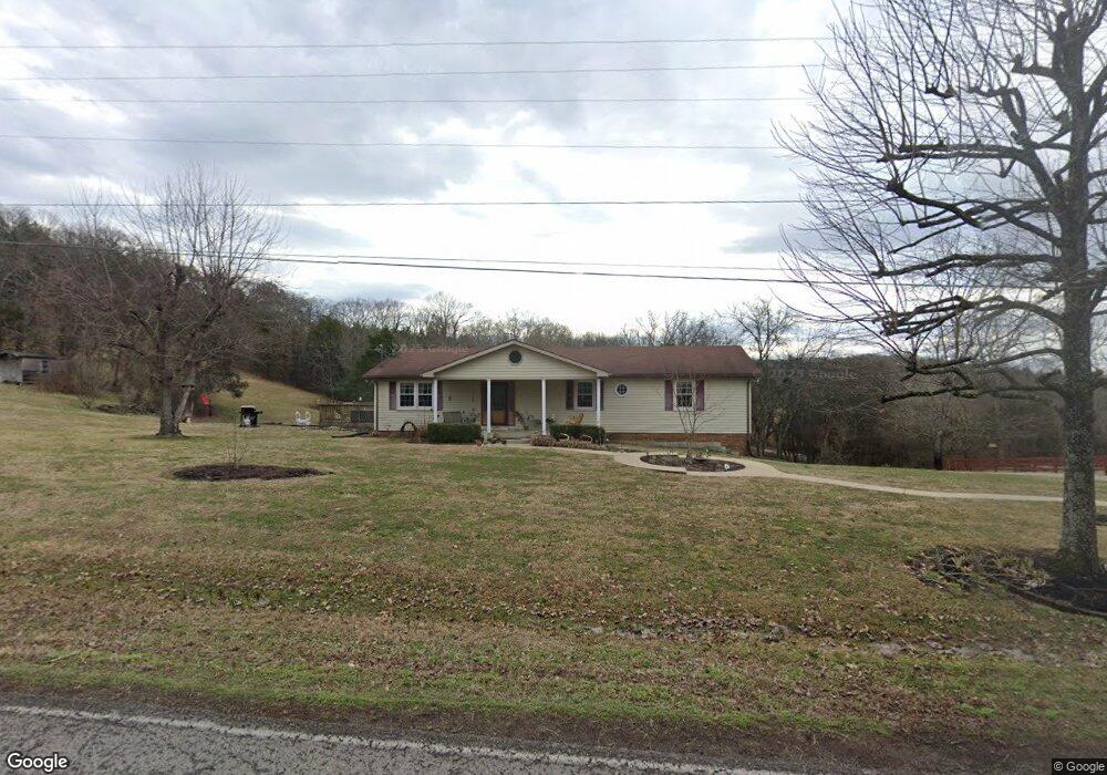
1805 Liberty Ln Gallatin, TN 37066
Estimated Value: $409,113 - $490,000
--
Bed
3
Baths
1,680
Sq Ft
$260/Sq Ft
Est. Value
About This Home
This home is located at 1805 Liberty Ln, Gallatin, TN 37066 and is currently estimated at $437,278, approximately $260 per square foot. 1805 Liberty Ln is a home located in Sumner County with nearby schools including Station Camp High School.
Ownership History
Date
Name
Owned For
Owner Type
Purchase Details
Closed on
Aug 31, 2009
Sold by
Gregory John M
Bought by
Gregory Deborah A
Current Estimated Value
Purchase Details
Closed on
Mar 26, 1998
Sold by
Hastings Winifred and Hastings Aileen
Bought by
Gregory John M and Gregory Deborah
Home Financials for this Owner
Home Financials are based on the most recent Mortgage that was taken out on this home.
Original Mortgage
$72,800
Interest Rate
6.95%
Mortgage Type
Purchase Money Mortgage
Purchase Details
Closed on
Oct 15, 1997
Sold by
Estelle Hastings and Estelle Minnie Estelle
Bought by
Hastings Winifred and Williams Juanita Hastings
Create a Home Valuation Report for This Property
The Home Valuation Report is an in-depth analysis detailing your home's value as well as a comparison with similar homes in the area
Home Values in the Area
Average Home Value in this Area
Purchase History
| Date | Buyer | Sale Price | Title Company |
|---|---|---|---|
| Gregory Deborah A | -- | None Available | |
| Gregory John M | $91,000 | Bankers Title & Escrow Corp | |
| Hastings Winifred | -- | -- |
Source: Public Records
Mortgage History
| Date | Status | Borrower | Loan Amount |
|---|---|---|---|
| Closed | Gregory John M | $72,800 |
Source: Public Records
Tax History Compared to Growth
Tax History
| Year | Tax Paid | Tax Assessment Tax Assessment Total Assessment is a certain percentage of the fair market value that is determined by local assessors to be the total taxable value of land and additions on the property. | Land | Improvement |
|---|---|---|---|---|
| 2024 | $1,337 | $94,075 | $26,900 | $67,175 |
| 2023 | $1,371 | $60,875 | $19,950 | $40,925 |
| 2022 | $1,377 | $60,875 | $19,950 | $40,925 |
| 2021 | $1,377 | $60,875 | $19,950 | $40,925 |
| 2020 | $1,377 | $60,875 | $19,950 | $40,925 |
| 2019 | $1,377 | $0 | $0 | $0 |
| 2018 | $968 | $0 | $0 | $0 |
| 2017 | $968 | $0 | $0 | $0 |
| 2016 | $968 | $0 | $0 | $0 |
| 2015 | -- | $0 | $0 | $0 |
| 2014 | -- | $0 | $0 | $0 |
Source: Public Records
Map
Nearby Homes
- 1935 Liberty Ln
- 249 Cavalcade Loop
- 2039 Liberty Ln
- 402 Upper Station Camp Crk Rd
- 360 Turfway Park
- 315 Gulfstream Dr
- 137 Cavalcade Loop
- 172 Cavalcade Loop
- 319 Cloverbrook Way
- 101 Santa Rosa Dr
- 166 Jennings Rd
- 337 Carellton Dr
- 149 Upper Station Camp Crk Rd
- 2045 Liberty Ln
- 308 Cheval Dr
- 427 Deveron Dr
- 1019 Lacebark Ln
- 2436 Long Hollow Pike
- 1033 Merrick Rd
- 162 Vantrease Rd
- 1809 Liberty Ln
- 1810 Liberty Ln
- 1811 Liberty Ln
- 1833 Liberty Ln
- 1816 Liberty Ln
- 1813 Liberty Ln
- 1824 Liberty Ln
- 1785 Liberty Ln
- 1841 Liberty Ln
- 1828 Liberty Ln
- 1780 Liberty Ln
- 1090 Liberty Point
- 1838 Liberty Ln
- 1844 Liberty Ln
- 1855 Liberty Ln
- 1080 Liberty Point
- 1789 Liberty Ln
- 1775 Liberty Ln
- 1858 Liberty Ln
- 1055 Liberty Point