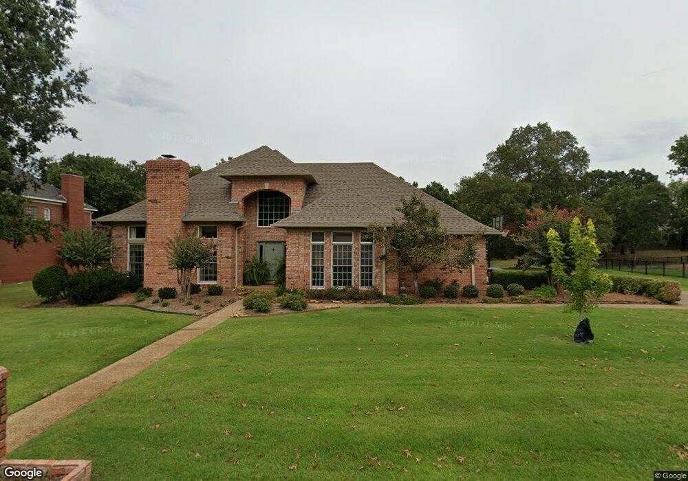
1805 Rannoch Trace Fort Smith, AR 72908
Fianna Hills NeighborhoodEstimated Value: $468,194 - $567,000
--
Bed
4
Baths
3,831
Sq Ft
$138/Sq Ft
Est. Value
About This Home
This home is located at 1805 Rannoch Trace, Fort Smith, AR 72908 and is currently estimated at $529,299, approximately $138 per square foot. 1805 Rannoch Trace is a home located in Sebastian County with nearby schools including Elmer H. Cook Elementary School, Ramsey Junior High School, and Southside High School.
Ownership History
Date
Name
Owned For
Owner Type
Purchase Details
Closed on
Mar 10, 2023
Sold by
Beneux Bryan David and Beneux Nancy Kathleen
Bought by
Beneux Bryan David and Beneux Nancy Kathleen
Current Estimated Value
Purchase Details
Closed on
Oct 21, 2016
Sold by
Cunningham Pau S and Cunningham Victoria L
Bought by
Beneux Bryan David
Home Financials for this Owner
Home Financials are based on the most recent Mortgage that was taken out on this home.
Original Mortgage
$27,492,800
Interest Rate
3.44%
Mortgage Type
New Conventional
Purchase Details
Closed on
Oct 19, 1993
Bought by
Cunningham Paul S and Cunningham Victoria
Purchase Details
Closed on
Feb 8, 1993
Bought by
King R A Construction Inc
Create a Home Valuation Report for This Property
The Home Valuation Report is an in-depth analysis detailing your home's value as well as a comparison with similar homes in the area
Home Values in the Area
Average Home Value in this Area
Purchase History
| Date | Buyer | Sale Price | Title Company |
|---|---|---|---|
| Beneux Bryan David | -- | -- | |
| Beneux Bryan David | $315,000 | None Available | |
| Cunningham Paul S | $275,000 | -- | |
| King R A Construction Inc | $34,000 | -- |
Source: Public Records
Mortgage History
| Date | Status | Borrower | Loan Amount |
|---|---|---|---|
| Previous Owner | Beneux Bryan David | $27,492,800 |
Source: Public Records
Tax History Compared to Growth
Tax History
| Year | Tax Paid | Tax Assessment Tax Assessment Total Assessment is a certain percentage of the fair market value that is determined by local assessors to be the total taxable value of land and additions on the property. | Land | Improvement |
|---|---|---|---|---|
| 2024 | $3,519 | $67,020 | $11,000 | $56,020 |
| 2023 | $3,466 | $67,020 | $11,000 | $56,020 |
| 2022 | $3,516 | $67,020 | $11,000 | $56,020 |
| 2021 | $3,516 | $67,020 | $11,000 | $56,020 |
| 2020 | $3,516 | $67,020 | $11,000 | $56,020 |
| 2019 | $3,514 | $66,990 | $11,000 | $55,990 |
| 2018 | $3,539 | $66,990 | $11,000 | $55,990 |
| 2017 | $3,167 | $0 | $0 | $0 |
| 2016 | $3,517 | $66,990 | $11,000 | $55,990 |
| 2015 | $3,167 | $66,990 | $11,000 | $55,990 |
| 2014 | $3,416 | $71,730 | $11,000 | $60,730 |
Source: Public Records
Map
Nearby Homes
- 1801 Rannoch Trace
- 1708 Rannoch Trace
- 10408 Innsbruck Ct
- 2012 Ramsgate Way
- 2101 Rannoch Trace
- 1801 Fianna Way
- 2300 Brigadoon Dr
- 1326 & 1328 Rabbit Run Rd
- 1808 Bramble Brae St
- 9901 Kingsley Place
- 2309 Skye Rd
- 9708 Jenny Lind Rd
- 9609 Jenny Lind Rd
- 9501 Jenny Lind Rd
- 3005 Chelsea Mead
- 3000 Heather Oaks Way
- 3017 Canongate Way
- 10101 Stephens Ct
- 3209 Royal Scots Way
- 10520 Castleton St
- 1809 Rannoch Trace
- 1808 Rannoch Trace
- 1804 Rannoch Trace
- 1812 Rannoch Trace
- 1815 Rannoch Trace
- 1816 Rannoch Trace
- 1707 Rannoch Trace
- 1808 Innsbruck Ln
- 1812 Innsbruck Ln
- 1904 Ramsgate Way
- 1816 Innsbruck Ln
- 10403 Rannoch Ct
- 1908 Ramsgate Way
- 1901 Rannoch Trace
- 1900 Rannoch Trace
- 1701 Rannoch Trace
- 2000 Ramsgate Way
- 1815 Innsbruck Ln
- 1905 Ramsgate Way
- 1800 Innsbruck Ln