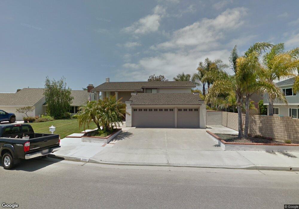
18051 Heathpoint Ln Huntington Beach, CA 92647
Estimated Value: $1,516,184 - $1,727,000
4
Beds
3
Baths
2,114
Sq Ft
$777/Sq Ft
Est. Value
About This Home
This home is located at 18051 Heathpoint Ln, Huntington Beach, CA 92647 and is currently estimated at $1,642,796, approximately $777 per square foot. 18051 Heathpoint Ln is a home located in Orange County with nearby schools including Hope View Elementary School, Mesa View Middle School, and Ocean View High.
Ownership History
Date
Name
Owned For
Owner Type
Purchase Details
Closed on
May 28, 2025
Sold by
Diane Kiku Mcclarin Tr and Diane L Odonnell Tr
Bought by
Diane Kiku Mcclarin Trust and Diane L Odonnell Trust
Current Estimated Value
Purchase Details
Closed on
Apr 25, 2011
Sold by
Mcclarin Diane Kiku
Bought by
Mcclarin Diane Kiku and The Diane Kiku Mcclarin Tr
Purchase Details
Closed on
Apr 8, 2008
Sold by
Odonnell Diane L and Mcclarin Diane Kiku
Bought by
Mcclarin Diane Kiku and Diane Kiku Mcclarin Trust
Home Financials for this Owner
Home Financials are based on the most recent Mortgage that was taken out on this home.
Original Mortgage
$251,000
Interest Rate
6.22%
Mortgage Type
New Conventional
Purchase Details
Closed on
May 12, 2003
Sold by
Mcclarin Diane Kiku and Odonnell Diane L
Bought by
Mcclarin Diane Kiku and Odonnell Diane L
Create a Home Valuation Report for This Property
The Home Valuation Report is an in-depth analysis detailing your home's value as well as a comparison with similar homes in the area
Home Values in the Area
Average Home Value in this Area
Purchase History
| Date | Buyer | Sale Price | Title Company |
|---|---|---|---|
| Diane Kiku Mcclarin Trust | -- | None Listed On Document | |
| Mcclarin Diane Kiku | -- | None Available | |
| Mcclarin Diane Kiku | -- | Accommodation | |
| Odonnell Diane L | -- | None Available | |
| Mcclarin Diane Kiku | -- | -- |
Source: Public Records
Mortgage History
| Date | Status | Borrower | Loan Amount |
|---|---|---|---|
| Previous Owner | Odonnell Diane L | $251,000 |
Source: Public Records
Tax History Compared to Growth
Tax History
| Year | Tax Paid | Tax Assessment Tax Assessment Total Assessment is a certain percentage of the fair market value that is determined by local assessors to be the total taxable value of land and additions on the property. | Land | Improvement |
|---|---|---|---|---|
| 2025 | $3,181 | $266,878 | $112,919 | $153,959 |
| 2024 | $3,181 | $261,646 | $110,705 | $150,941 |
| 2023 | $3,105 | $256,516 | $108,534 | $147,982 |
| 2022 | $3,054 | $251,487 | $106,406 | $145,081 |
| 2021 | $2,998 | $246,556 | $104,319 | $142,237 |
| 2020 | $2,964 | $244,028 | $103,249 | $140,779 |
| 2019 | $2,915 | $239,244 | $101,225 | $138,019 |
| 2018 | $2,851 | $234,553 | $99,240 | $135,313 |
| 2017 | $2,804 | $229,954 | $97,294 | $132,660 |
| 2016 | $2,694 | $225,446 | $95,387 | $130,059 |
| 2015 | $2,652 | $222,060 | $93,954 | $128,106 |
| 2014 | $2,598 | $217,711 | $92,114 | $125,597 |
Source: Public Records
Map
Nearby Homes
- 6161 Norbrook Dr
- 6142 Kiser Dr
- 18321 Fieldbury Ln
- 18202 Foss Ln
- 5852 Bellfield Ln
- 5812 Raphael Dr
- 5732 Grimsby Dr
- 6561 Horseshoe Ln
- 17982 Whitford Ln
- 6416 Setting Sun Dr
- 6852 Jardines Dr
- 17372 Forbes Ln
- 6051 Summerdale Dr
- 6266 Jasmine Dr
- 18976 Rockinghorse Ln
- 17071 Pinehurst Ln
- 17061 Pinehurst Ln
- 6600 Warner Ave Unit 119
- 6600 Warner Ave Unit 50
- 6600 Warner Ave
- 18061 Heathpoint Ln
- 6272 Newbury Dr
- 6252 Newbury Dr
- 6232 Newbury Dr
- 6222 Newbury Dr
- 18071 Heathpoint Ln
- 6291 Glenfox Dr
- 6292 Newbury Dr
- 6301 Glenfox Dr
- 6282 Glenfox Dr
- 6302 Newbury Dr
- 6271 Newbury Dr
- 6251 Newbury Dr
- 6281 Newbury Dr
- 6292 Glenfox Dr
- 6241 Newbury Dr
- 6231 Newbury Dr
- 6311 Glenfox Dr
- 6221 Newbury Dr
- 18112 Vestry Cir