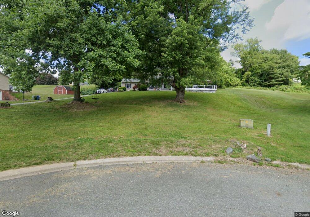
1806 Belvue Dr Forest Hill, MD 21050
Estimated Value: $520,000 - $535,000
4
Beds
3
Baths
2,468
Sq Ft
$214/Sq Ft
Est. Value
About This Home
This home is located at 1806 Belvue Dr, Forest Hill, MD 21050 and is currently estimated at $529,051, approximately $214 per square foot. 1806 Belvue Dr is a home located in Harford County with nearby schools including Forest Lakes Elementary School, Fallston Middle School, and Fallston High School.
Ownership History
Date
Name
Owned For
Owner Type
Purchase Details
Closed on
Apr 2, 2021
Sold by
Brown Wayne T and Markland Brown Diane
Bought by
Sigai Scott and Sigai Randi
Current Estimated Value
Home Financials for this Owner
Home Financials are based on the most recent Mortgage that was taken out on this home.
Original Mortgage
$375,250
Outstanding Balance
$338,259
Interest Rate
2.9%
Mortgage Type
New Conventional
Estimated Equity
$190,792
Purchase Details
Closed on
Jan 28, 2000
Sold by
Hopkins Irvin Roderick
Bought by
Brown Wayne T and Diane Markland
Purchase Details
Closed on
May 2, 1990
Sold by
Boschert Kenneth J
Bought by
Hopkins Irvin Roderick
Home Financials for this Owner
Home Financials are based on the most recent Mortgage that was taken out on this home.
Original Mortgage
$83,000
Interest Rate
10.56%
Purchase Details
Closed on
Nov 10, 1988
Sold by
Forney Paul E
Bought by
Boschert Kenneth J
Create a Home Valuation Report for This Property
The Home Valuation Report is an in-depth analysis detailing your home's value as well as a comparison with similar homes in the area
Home Values in the Area
Average Home Value in this Area
Purchase History
| Date | Buyer | Sale Price | Title Company |
|---|---|---|---|
| Sigai Scott | $395,000 | Sage Title Group Llc | |
| Brown Wayne T | $205,000 | -- | |
| Hopkins Irvin Roderick | $163,000 | -- | |
| Boschert Kenneth J | $43,900 | -- |
Source: Public Records
Mortgage History
| Date | Status | Borrower | Loan Amount |
|---|---|---|---|
| Open | Sigai Scott | $375,250 | |
| Previous Owner | Hopkins Irvin Roderick | $83,000 | |
| Closed | Brown Wayne T | -- |
Source: Public Records
Tax History Compared to Growth
Tax History
| Year | Tax Paid | Tax Assessment Tax Assessment Total Assessment is a certain percentage of the fair market value that is determined by local assessors to be the total taxable value of land and additions on the property. | Land | Improvement |
|---|---|---|---|---|
| 2025 | $4,230 | $395,000 | $108,600 | $286,400 |
| 2024 | $4,230 | $382,567 | $0 | $0 |
| 2023 | $4,094 | $370,133 | $0 | $0 |
| 2022 | $3,959 | $357,700 | $108,600 | $249,100 |
| 2021 | $8,090 | $357,133 | $0 | $0 |
| 2020 | $4,175 | $356,567 | $0 | $0 |
| 2019 | $4,168 | $356,000 | $141,700 | $214,300 |
| 2018 | $4,059 | $351,767 | $0 | $0 |
| 2017 | $3,986 | $356,000 | $0 | $0 |
| 2016 | -- | $343,300 | $0 | $0 |
| 2015 | $3,758 | $337,533 | $0 | $0 |
| 2014 | $3,758 | $331,767 | $0 | $0 |
Source: Public Records
Map
Nearby Homes
- 1702 Lasalle Rd
- 1701 Ingleside Rd
- 1605 Kiersten Ct
- 600 Rock Spring Church Rd
- 1775 Pleasantville Rd
- 1738 Shanwick Rd
- 1205 Bear Hollow Ct
- 916 Delray Dr
- 1991 Gulfstream Ct
- 308 Rock Spring Church Rd
- 1932 Pleasantville Rd
- 2401 Scotlon Ct
- 2011 Fallsgrove Way
- 1615 Samantha Dr
- 105 Sunshine Ct Unit G
- 535 Westwell Ln
- 1605 Samantha Dr
- 1217 Grafton Shop Rd
- 1817 Rock Spring Rd
- 1713 Landmark Dr Unit 1L