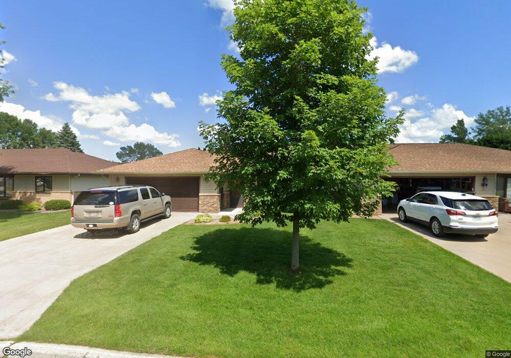
1806 Michael Place Unit 2 Albert Lea, MN 56007
Estimated Value: $255,000 - $259,000
3
Beds
2
Baths
1,514
Sq Ft
$170/Sq Ft
Est. Value
About This Home
This home is located at 1806 Michael Place Unit 2, Albert Lea, MN 56007 and is currently estimated at $257,528, approximately $170 per square foot. 1806 Michael Place Unit 2 is a home located in Freeborn County with nearby schools including Lakeview Elementary School, Southwest Middle School, and Albert Lea Senior High School.
Ownership History
Date
Name
Owned For
Owner Type
Purchase Details
Closed on
Dec 15, 2021
Sold by
Weber Donna M
Bought by
Hansen Nancy L and Hansen Ronald L
Current Estimated Value
Home Financials for this Owner
Home Financials are based on the most recent Mortgage that was taken out on this home.
Original Mortgage
$99,499
Outstanding Balance
$91,488
Interest Rate
3.09%
Mortgage Type
New Conventional
Estimated Equity
$166,040
Purchase Details
Closed on
Feb 22, 2013
Sold by
Vanfossen Brenda C and Vanfossen David L
Bought by
Weber William A and Weber Donna M
Create a Home Valuation Report for This Property
The Home Valuation Report is an in-depth analysis detailing your home's value as well as a comparison with similar homes in the area
Home Values in the Area
Average Home Value in this Area
Purchase History
| Date | Buyer | Sale Price | Title Company |
|---|---|---|---|
| Hansen Nancy L | $199,000 | River Valley Title | |
| Weber William A | -- | -- |
Source: Public Records
Mortgage History
| Date | Status | Borrower | Loan Amount |
|---|---|---|---|
| Open | Hansen Nancy L | $99,499 |
Source: Public Records
Tax History Compared to Growth
Tax History
| Year | Tax Paid | Tax Assessment Tax Assessment Total Assessment is a certain percentage of the fair market value that is determined by local assessors to be the total taxable value of land and additions on the property. | Land | Improvement |
|---|---|---|---|---|
| 2025 | $2,700 | $222,600 | $16,800 | $205,800 |
| 2024 | $2,752 | $196,200 | $16,800 | $179,400 |
| 2023 | $2,668 | $196,500 | $16,800 | $179,700 |
| 2022 | $2,498 | $191,700 | $16,800 | $174,900 |
| 2021 | $2,336 | $159,000 | $16,800 | $142,200 |
| 2020 | $2,360 | $151,000 | $16,800 | $134,200 |
| 2019 | $2,114 | $139,300 | $16,800 | $122,500 |
| 2018 | $2,054 | $0 | $0 | $0 |
| 2016 | $1,960 | $0 | $0 | $0 |
| 2015 | $1,896 | $0 | $0 | $0 |
| 2014 | $2,096 | $0 | $0 | $0 |
| 2012 | $2,490 | $0 | $0 | $0 |
Source: Public Records
Map
Nearby Homes
- 1850 Lakewood Ave Unit 4
- 1626 Keystone Dr
- 313 Glenn Rd
- 319 Glenn Rd
- 314 Garden Rd
- 209 Burr Oak Dr
- 705 Glenview Dr
- 314 Burr Oak Dr
- 120 Ridge Rd
- 210 North Ln
- 210 Lee Place
- 212 Lee Place
- 1932 Wilby Rd
- 613 & 615 Giles Place
- 618 & 620 Giles Place
- 2161 Highland Ave
- 605 E Hawthorne St
- 902 Clausen Ave
- 1105 Crestview Rd
- 711 Clausen Ave
- 1800 Michael Place Unit 1
- 1808 Michael Place Unit 1
- 1812 Michael Place Unit 2
- 1807 Lakewood Ave
- 1805 Lakewood Ave
- 1809 Lakewood Ave
- 1813 Lakewood Ave
- 1803 Lakewood Ave
- 302 Bancroft Dr
- 1807 Michael Place
- 1818 Michael Place Unit 1
- 1819 Lakewood Ave Unit 1
- 1811 Michael Place
- 207 Bancroft Dr
- 205 Bancroft Dr
- 301 Bancroft Dr
- 1823 Lakewood Ave
- 1822 Michael Place Unit 2
- 201 Bancroft Dr
- 1815 Michael Place