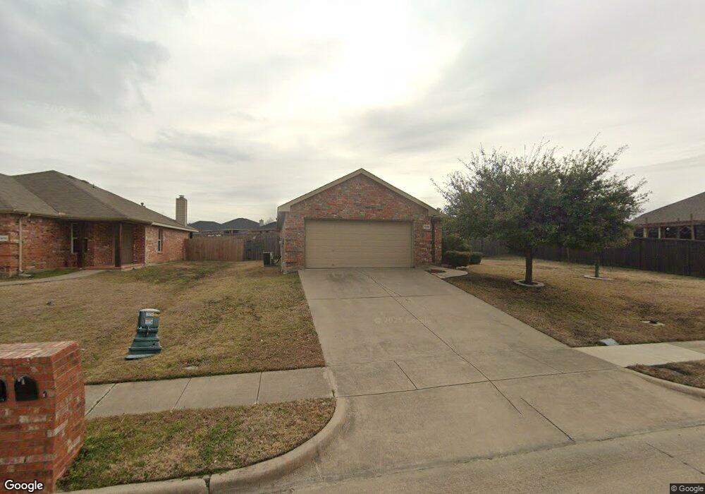
1806 Millbrook Dr Midlothian, TX 76065
Estimated Value: $290,051 - $303,000
3
Beds
2
Baths
1,348
Sq Ft
$220/Sq Ft
Est. Value
About This Home
This home is located at 1806 Millbrook Dr, Midlothian, TX 76065 and is currently estimated at $296,526, approximately $219 per square foot. 1806 Millbrook Dr is a home located in Ellis County with nearby schools including J A Vitovsky Elementary School and Walnut Grove Middle School.
Ownership History
Date
Name
Owned For
Owner Type
Purchase Details
Closed on
May 16, 2013
Sold by
Evans William C and Evans Ashley N
Bought by
Fojtik Leonard
Current Estimated Value
Home Financials for this Owner
Home Financials are based on the most recent Mortgage that was taken out on this home.
Original Mortgage
$97,200
Outstanding Balance
$68,784
Interest Rate
3.45%
Mortgage Type
New Conventional
Estimated Equity
$227,742
Purchase Details
Closed on
May 17, 2006
Sold by
F & R Management Lp
Bought by
Evans William C and Evans Ashley N
Home Financials for this Owner
Home Financials are based on the most recent Mortgage that was taken out on this home.
Original Mortgage
$12,032
Interest Rate
6.58%
Mortgage Type
New Conventional
Create a Home Valuation Report for This Property
The Home Valuation Report is an in-depth analysis detailing your home's value as well as a comparison with similar homes in the area
Home Values in the Area
Average Home Value in this Area
Purchase History
| Date | Buyer | Sale Price | Title Company |
|---|---|---|---|
| Fojtik Leonard | -- | None Available | |
| Evans William C | -- | None Available |
Source: Public Records
Mortgage History
| Date | Status | Borrower | Loan Amount |
|---|---|---|---|
| Open | Fojtik Leonard | $97,200 | |
| Previous Owner | Evans William C | $12,032 |
Source: Public Records
Tax History
| Year | Tax Paid | Tax Assessment Tax Assessment Total Assessment is a certain percentage of the fair market value that is determined by local assessors to be the total taxable value of land and additions on the property. | Land | Improvement |
|---|---|---|---|---|
| 2025 | $897 | $277,572 | $90,000 | $187,572 |
| 2024 | $897 | $268,183 | -- | -- |
| 2023 | $897 | $243,803 | $0 | $0 |
| 2022 | $4,966 | $221,639 | $0 | $0 |
| 2021 | $4,768 | $201,490 | $45,000 | $156,490 |
| 2020 | $4,900 | $194,800 | $45,000 | $149,800 |
| 2019 | $4,642 | $177,720 | $0 | $0 |
| 2017 | $3,899 | $147,950 | $25,000 | $122,950 |
| 2016 | $3,545 | $133,780 | $20,000 | $113,780 |
Source: Public Records
Map
Nearby Homes
- 1410 Embercrest Dr
- 1305 Misty Meadow Dr
- 1214 Misty Meadow Dr
- TBD 1 acre Overlook Dr
- 807 Crockett St
- 606 Overlook Dr
- 0 U S Highway 67
- 620 N 6th St
- 902 W Avenue D
- 1834 Rough Ridge Trail
- 4418 Timberdrift St
- 900 W Avenue F
- 000 N 6th St
- 4434 Verbena St
- 215 S 1st St
- 120 N 5th St
- 809 Deleon Dr
- 1015 Magdalena Way
- 316 S 5th St
- 107 Sewell Ave
- 1325 Yukon Dr
- 1333 Yukon Dr
- 1321 Yukon Dr
- 1814 Millbrook Dr
- 1306 Platte Ct
- 1805 Millbrook Dr
- 1801 Millbrook Dr
- 1317 Yukon Dr
- 1809 Millbrook Dr
- 1813 Millbrook Dr
- 1313 Yukon Dr
- 1330 Yukon Dr
- 1326 Yukon Dr
- 1302 Platte Ct
- 1334 Yukon Dr
- 1322 Yukon Dr
- 1901 Millbrook Dr
- 1318 Yukon Dr
- 1721 Millbrook Dr
- 1309 Platte Ct
Your Personal Tour Guide
Ask me questions while you tour the home.