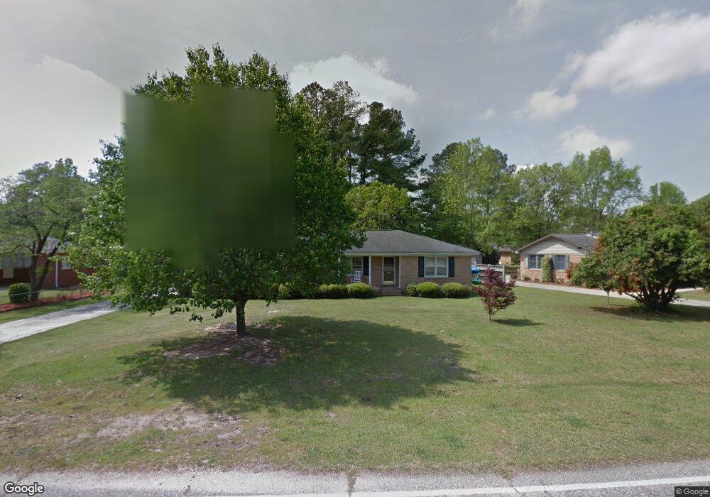
1806 W Sandhurst Dr Florence, SC 29505
Estimated Value: $208,983 - $226,000
3
Beds
2
Baths
1,583
Sq Ft
$138/Sq Ft
Est. Value
About This Home
This home is located at 1806 W Sandhurst Dr, Florence, SC 29505 and is currently estimated at $217,996, approximately $137 per square foot. 1806 W Sandhurst Dr is a home located in Florence County with nearby schools including McLaurin Elementary School, Southside Middle School, and South Florence High School.
Ownership History
Date
Name
Owned For
Owner Type
Purchase Details
Closed on
Feb 13, 2009
Sold by
Clements Terry L
Bought by
Clements Terry L and Clements Kelly C
Current Estimated Value
Home Financials for this Owner
Home Financials are based on the most recent Mortgage that was taken out on this home.
Original Mortgage
$149,280
Interest Rate
5.08%
Mortgage Type
FHA
Purchase Details
Closed on
Feb 4, 2009
Sold by
Clements Kelly C
Bought by
Clements Terry L
Home Financials for this Owner
Home Financials are based on the most recent Mortgage that was taken out on this home.
Original Mortgage
$149,280
Interest Rate
5.08%
Mortgage Type
FHA
Create a Home Valuation Report for This Property
The Home Valuation Report is an in-depth analysis detailing your home's value as well as a comparison with similar homes in the area
Purchase History
| Date | Buyer | Sale Price | Title Company |
|---|---|---|---|
| Clements Terry L | -- | -- | |
| Clements Terry L | -- | -- |
Source: Public Records
Mortgage History
| Date | Status | Borrower | Loan Amount |
|---|---|---|---|
| Closed | Clements Terry L | $149,280 |
Source: Public Records
Tax History
| Year | Tax Paid | Tax Assessment Tax Assessment Total Assessment is a certain percentage of the fair market value that is determined by local assessors to be the total taxable value of land and additions on the property. | Land | Improvement |
|---|---|---|---|---|
| 2024 | $553 | $6,267 | $1,000 | $5,267 |
| 2023 | $500 | $4,689 | $1,000 | $3,689 |
| 2022 | $579 | $4,689 | $1,000 | $3,689 |
| 2021 | $614 | $4,690 | $0 | $0 |
| 2020 | $564 | $4,690 | $0 | $0 |
| 2019 | $527 | $4,689 | $1,000 | $3,689 |
| 2018 | $494 | $4,690 | $0 | $0 |
| 2017 | $468 | $4,690 | $0 | $0 |
| 2016 | $428 | $4,690 | $0 | $0 |
| 2015 | $447 | $4,690 | $0 | $0 |
| 2014 | $386 | $4,689 | $1,000 | $3,689 |
Source: Public Records
Map
Nearby Homes
- 1768 Marsh Ave
- 1807 Nottingham Dr
- 1830 Marsh Ave
- 1815 Hampton Dr
- 1905 Marsh Ave
- 1770 Woods Dr
- 1804 Woods Dr
- 1162 Pinckney Ave
- 1779 S Saint Anthony Ave
- 1714 2nd Loop Rd
- 1914 Brigadoone Ln
- 1062 Clarendon Ave
- 2113 Sanderling Dr
- 1521 2nd Loop Rd
- 1220 Courtland Ave
- 2141 Elderberry Dr
- 1335 S Lazar Place
- 1110 3rd Loop Rd
- 1880 S Walter Dr
- 1126 3rd Loop Rd
- 1810 W Sandhurst Dr
- 1801 Marsh Ave
- 1807 Marsh Ave
- 1816 W Sandhurst Dr
- 1806 Devonshire Dr
- 1807 W Sandhurst Dr
- 1811 W Sandhurst Dr
- 1811 Marsh Ave
- 1815 Sandhust Dr
- 1815 W Sandhurst Dr
- 1810 Devonshire Dr
- 1763 Marsh Ave
- 1800 Marsh Ave
- 1819 W Sandhurst Dr
- 1815 Marsh Ave
- 1806 Marsh Ave
- 1822 W Sandhurst Dr
- 1318 Clarendon Ave
- 1801 Kent Cir
- 1801 Kent Cir
Your Personal Tour Guide
Ask me questions while you tour the home.