Estimated Value: $146,000 - $175,837
3
Beds
1
Bath
925
Sq Ft
$181/Sq Ft
Est. Value
About This Home
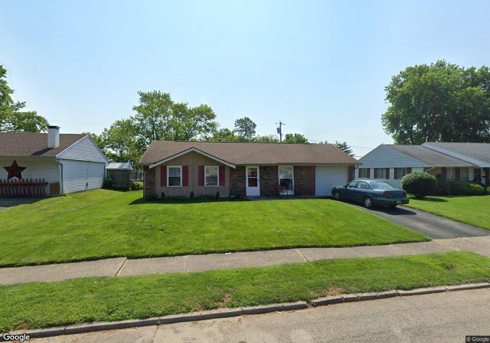
This home is located at 1807 Commonwealth Dr, Xenia, OH 45385 and is currently estimated at $167,209, approximately $180 per square foot. 1807 Commonwealth Dr is a home located in Greene County with nearby schools including Xenia High School, Summit Academy Community School for Alternative Learners - Xenia, and Legacy Christian Academy.
Ownership History
Date
Name
Owned For
Owner Type
Purchase Details
Closed on
Apr 2, 2015
Sold by
Vogelson Madison N
Bought by
Taylor Arthur R and Taylor Bonnie L
Current Estimated Value
Home Financials for this Owner
Home Financials are based on the most recent Mortgage that was taken out on this home.
Original Mortgage
$55,200
Outstanding Balance
$42,479
Interest Rate
3.73%
Mortgage Type
New Conventional
Estimated Equity
$124,730
Purchase Details
Closed on
Sep 9, 2010
Sold by
Hill Ray A and Hill Jamie L
Bought by
Vogelsong Madison N
Home Financials for this Owner
Home Financials are based on the most recent Mortgage that was taken out on this home.
Original Mortgage
$60,700
Interest Rate
4.45%
Mortgage Type
New Conventional
Purchase Details
Closed on
Mar 15, 2006
Sold by
Cline Robin C
Bought by
Hill Bambi H C and Hill Ray A
Home Financials for this Owner
Home Financials are based on the most recent Mortgage that was taken out on this home.
Original Mortgage
$59,400
Interest Rate
5.5%
Mortgage Type
Unknown
Create a Home Valuation Report for This Property
The Home Valuation Report is an in-depth analysis detailing your home's value as well as a comparison with similar homes in the area
Home Values in the Area
Average Home Value in this Area
Purchase History
| Date | Buyer | Sale Price | Title Company |
|---|---|---|---|
| Taylor Arthur R | $69,000 | Home Services Title Llc | |
| Vogelsong Madison N | $63,900 | Attorney | |
| Hill Bambi H C | $69,900 | None Available |
Source: Public Records
Mortgage History
| Date | Status | Borrower | Loan Amount |
|---|---|---|---|
| Open | Taylor Arthur R | $55,200 | |
| Previous Owner | Vogelsong Madison N | $60,700 | |
| Previous Owner | Hill Bambi H C | $59,400 |
Source: Public Records
Tax History Compared to Growth
Tax History
| Year | Tax Paid | Tax Assessment Tax Assessment Total Assessment is a certain percentage of the fair market value that is determined by local assessors to be the total taxable value of land and additions on the property. | Land | Improvement |
|---|---|---|---|---|
| 2024 | $1,710 | $39,960 | $10,270 | $29,690 |
| 2023 | $1,710 | $39,960 | $10,270 | $29,690 |
| 2022 | $1,414 | $28,180 | $6,040 | $22,140 |
| 2021 | $1,433 | $28,180 | $6,040 | $22,140 |
| 2020 | $1,373 | $28,180 | $6,040 | $22,140 |
| 2019 | $1,221 | $23,590 | $6,160 | $17,430 |
| 2018 | $1,225 | $23,590 | $6,160 | $17,430 |
| 2017 | $1,128 | $23,590 | $6,160 | $17,430 |
| 2016 | $1,129 | $21,320 | $6,160 | $15,160 |
| 2015 | $1,132 | $21,320 | $6,160 | $15,160 |
| 2014 | $1,084 | $21,320 | $6,160 | $15,160 |
Source: Public Records
Map
Nearby Homes
- 1866 Roxbury Dr
- 1403 Texas Dr
- 1908 Whitt St
- 1778 Arapaho Dr
- 1829 Gayhart Dr
- 1255 Colorado Dr
- 1769 Gayhart Dr
- 1107 Arkansas Dr
- 1618 Navajo Dr
- 1272 Bellbrook Ave
- 1653 Seneca Dr
- 2499 Jenny Marie Dr
- 1208 Bellbrook Ave
- 2540 Jenny Marie Dr
- 2421 Louisiana Dr
- 2257 Maryland Dr
- 2345 Tennessee Dr
- 2540 Cornwall Dr
- 2142 Michigan Dr
- 0 Berkshire Dr Unit 942854
- 1819 Commonwealth Dr
- 1793 Commonwealth Dr
- 1833 Commonwealth Dr
- 1781 Commonwealth Dr
- 1806 Commonwealth Dr
- 1820 Commonwealth Dr
- 1792 Commonwealth Dr
- 1847 Commonwealth Dr
- 1834 Commonwealth Dr
- 1767 Commonwealth Dr
- 1782 Commonwealth Dr
- 1848 Commonwealth Dr
- 1859 Commonwealth Dr
- 1803 Roxbury Dr
- 1815 Roxbury Dr
- 1791 Roxbury Dr
- 1764 Commonwealth Dr
- 1753 Commonwealth Dr
- 1827 Roxbury Dr
- 1779 Roxbury Dr