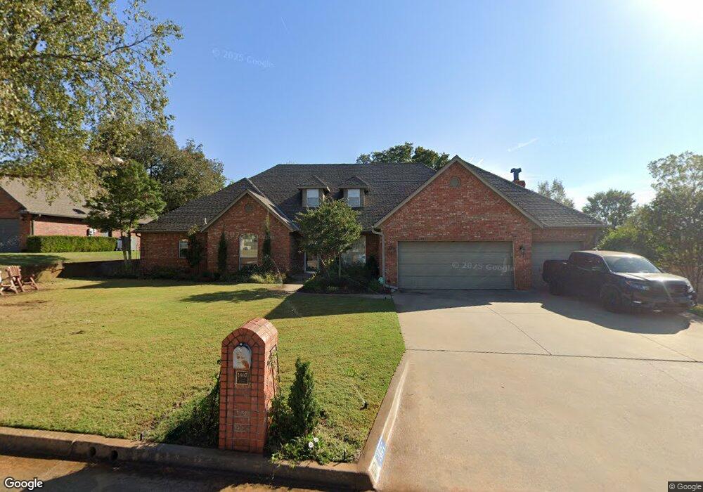
1807 Henson Ct Shawnee, OK 74804
Estimated Value: $403,000 - $470,000
3
Beds
3
Baths
3,019
Sq Ft
$146/Sq Ft
Est. Value
About This Home
This home is located at 1807 Henson Ct, Shawnee, OK 74804 and is currently estimated at $441,520, approximately $146 per square foot. 1807 Henson Ct is a home located in Pottawatomie County.
Ownership History
Date
Name
Owned For
Owner Type
Purchase Details
Closed on
May 25, 2006
Sold by
Garibay Robert P and Garibay Cheryl
Bought by
Nicklas David E and Nicklas Kathleen
Current Estimated Value
Home Financials for this Owner
Home Financials are based on the most recent Mortgage that was taken out on this home.
Original Mortgage
$130,000
Interest Rate
6.5%
Mortgage Type
Purchase Money Mortgage
Purchase Details
Closed on
Aug 5, 2005
Sold by
Brown Greg and Brown Christine
Bought by
Garibay Robert P and Garibay Cheryl
Home Financials for this Owner
Home Financials are based on the most recent Mortgage that was taken out on this home.
Original Mortgage
$260,000
Interest Rate
5.55%
Mortgage Type
New Conventional
Purchase Details
Closed on
Sep 30, 1994
Sold by
Brown Tom and Brown Carole
Bought by
Brown Greg and Brown Christine
Create a Home Valuation Report for This Property
The Home Valuation Report is an in-depth analysis detailing your home's value as well as a comparison with similar homes in the area
Home Values in the Area
Average Home Value in this Area
Purchase History
| Date | Buyer | Sale Price | Title Company |
|---|---|---|---|
| Nicklas David E | $325,000 | None Available | |
| Garibay Robert P | $325,000 | None Available | |
| Brown Greg | -- | -- |
Source: Public Records
Mortgage History
| Date | Status | Borrower | Loan Amount |
|---|---|---|---|
| Closed | Nicklas David E | $130,000 | |
| Previous Owner | Garibay Robert P | $260,000 |
Source: Public Records
Tax History Compared to Growth
Tax History
| Year | Tax Paid | Tax Assessment Tax Assessment Total Assessment is a certain percentage of the fair market value that is determined by local assessors to be the total taxable value of land and additions on the property. | Land | Improvement |
|---|---|---|---|---|
| 2024 | $3,552 | $39,531 | $3,840 | $35,691 |
| 2023 | $3,552 | $38,380 | $3,840 | $34,540 |
| 2022 | $3,485 | $38,380 | $3,840 | $34,540 |
| 2021 | $3,517 | $38,380 | $3,840 | $34,540 |
| 2020 | $3,547 | $38,758 | $3,840 | $34,918 |
| 2019 | $3,656 | $39,490 | $3,840 | $35,650 |
| 2018 | $3,680 | $39,525 | $3,840 | $35,685 |
| 2017 | $3,685 | $39,889 | $3,840 | $36,049 |
| 2016 | $3,804 | $40,719 | $3,813 | $36,906 |
| 2015 | $3,259 | $39,533 | $3,720 | $35,813 |
| 2014 | $3,161 | $38,382 | $3,120 | $35,262 |
Source: Public Records
Map
Nearby Homes
- 1406 E Bradley St
- 1836 N Bryan Ave
- 31 E Oak Hill
- 23 Crown Point
- 9 Dustin Cir
- 1404 Charles Dr
- 17 Beckley St
- 40 Northridge Rd
- 1208 E Rose Dr
- 57 Serenada Ln
- 2 Sequoyah Blvd
- 2024 Lantana Cir
- 1219 E Monroe Dr
- 1301 E Independence St
- 1206 Monroe Dr
- 2 Lancet Cir
- 1210 E Independence St
- 27 N Rice Ave
- 6 Lancet Ct
- 1809 Hunters Ridge Dr
- 1805 Henson Ct
- 1809 Henson Ct
- 1806 Henson Ct
- 1803 Henson Ct
- 1700 E Bradley St
- 1804 Henson Ct
- 1811 Henson Ct
- 1808 Henson Ct
- 1802 Henson Ct
- 1810 Henson Ct
- 1801 Henson Ct
- 1800 Henson Ct
- 1913 Carleton Ln
- 1500 E Bradley St
- 1711 Autumn Ln
- 1705 E Bradley St
- 5006 Chauncey Ln
- 7 Quail Ridge
- 1709 Autumn Ln
- 1710 Autumn Ln